My Store
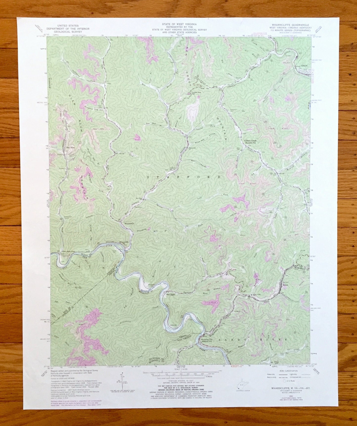
Antique Wharncliffe, West Virginia 1963 US Geological Survey Topographic Map – War Eagle, Wyoming City, Glen Alum, Gilbert, Isaban, WV
Antique Wharncliffe, West Virginia 1963 US Geological Survey Topographic Map – War Eagle, Wyoming City, Glen Alum, Gilbert, Isaban, WV
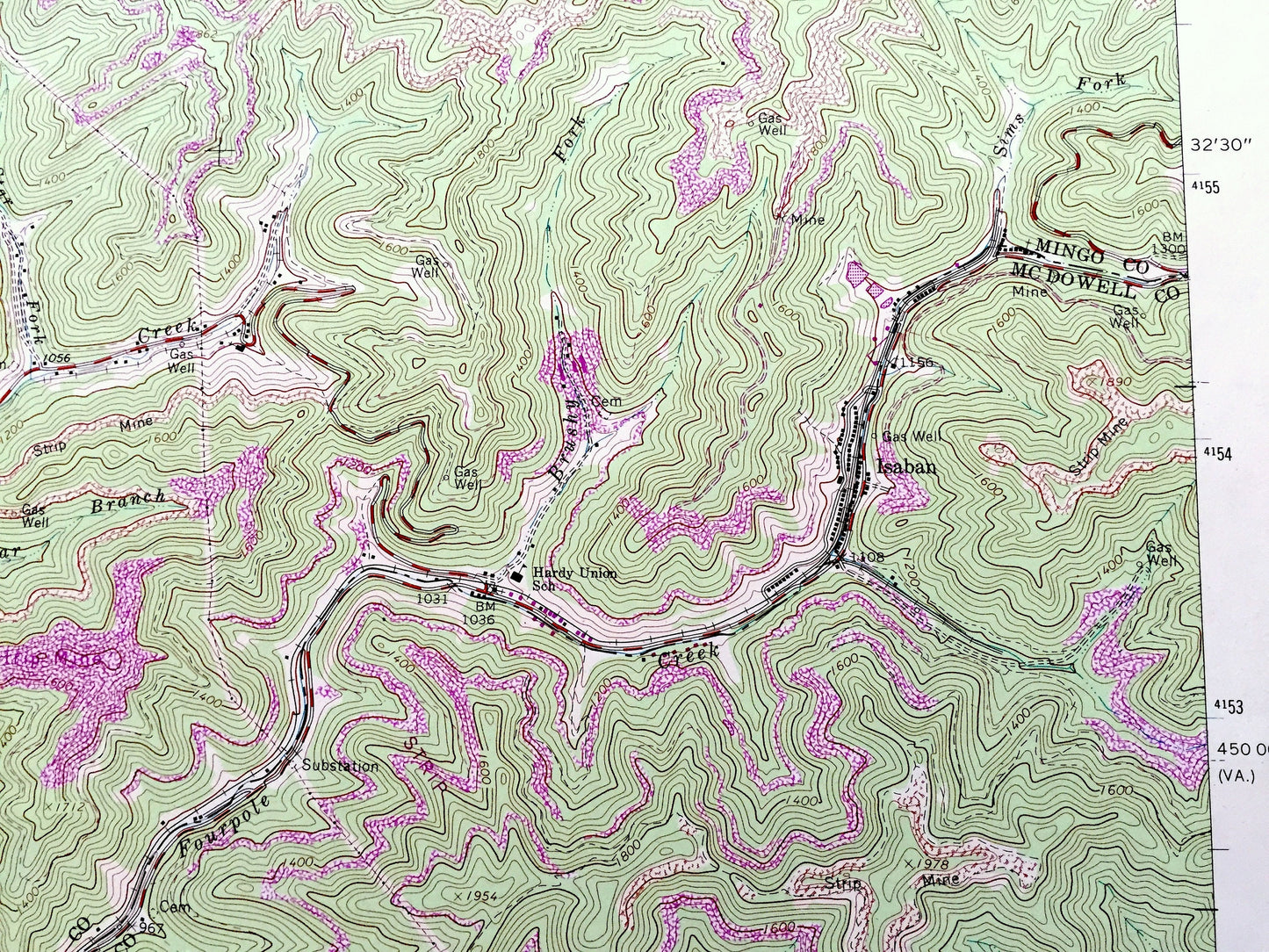
Beautiful, antique map of Wharncliffe, West Virginia and surrounding Virginia and Kentucky and Mingo, McDowell, Magnolia, Pike, and Buchanan County area. This is an authentic 1963 edition, 1979 print from the U.S. Geological Survey and NOT a computer reproduction.
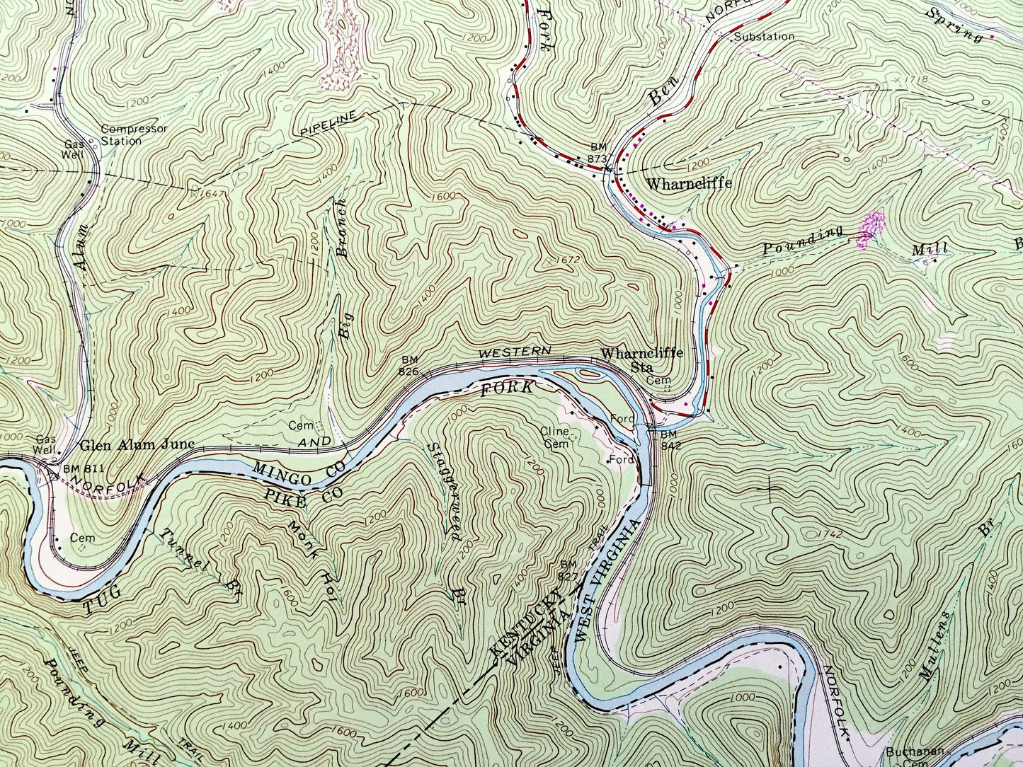
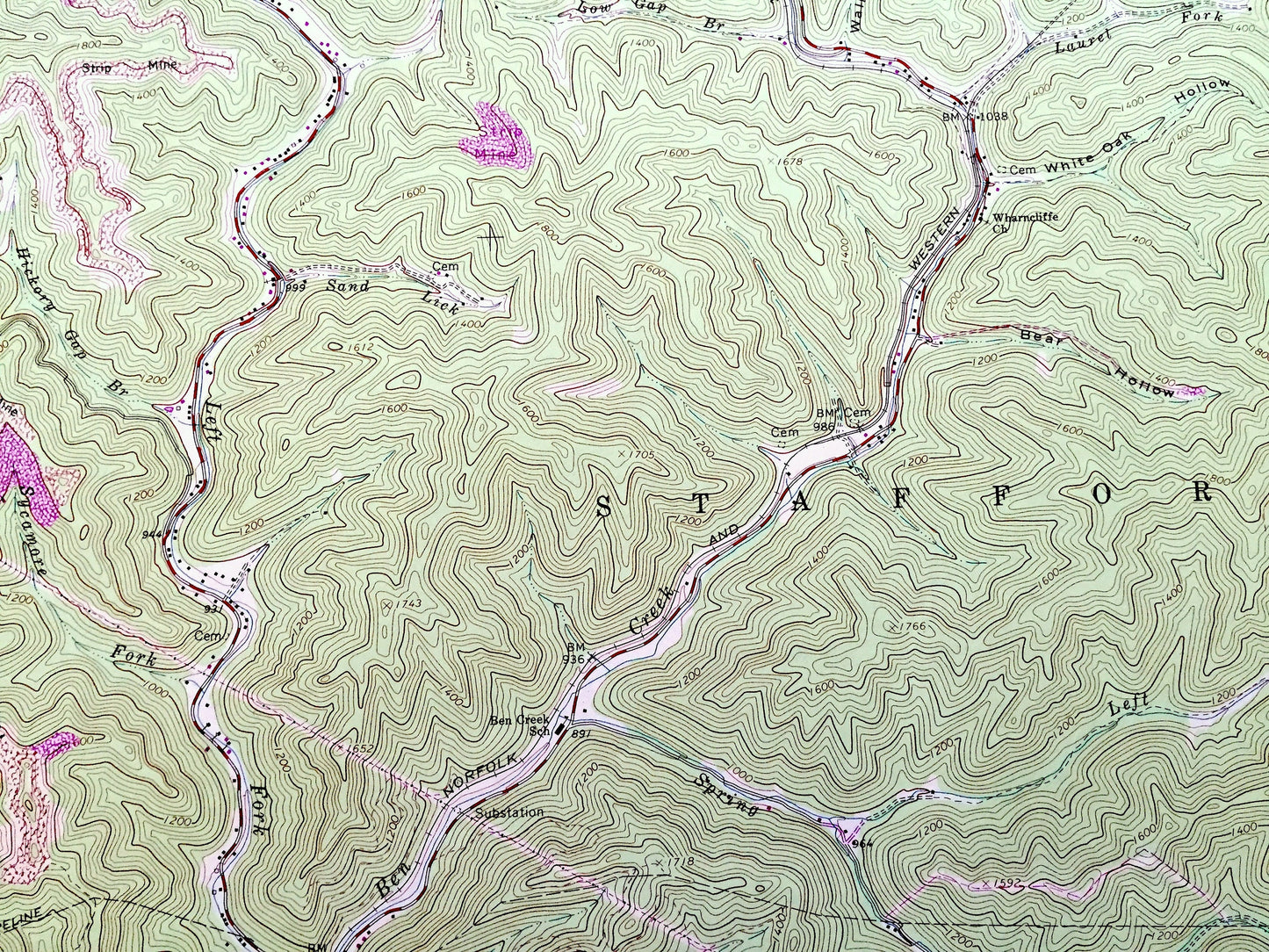
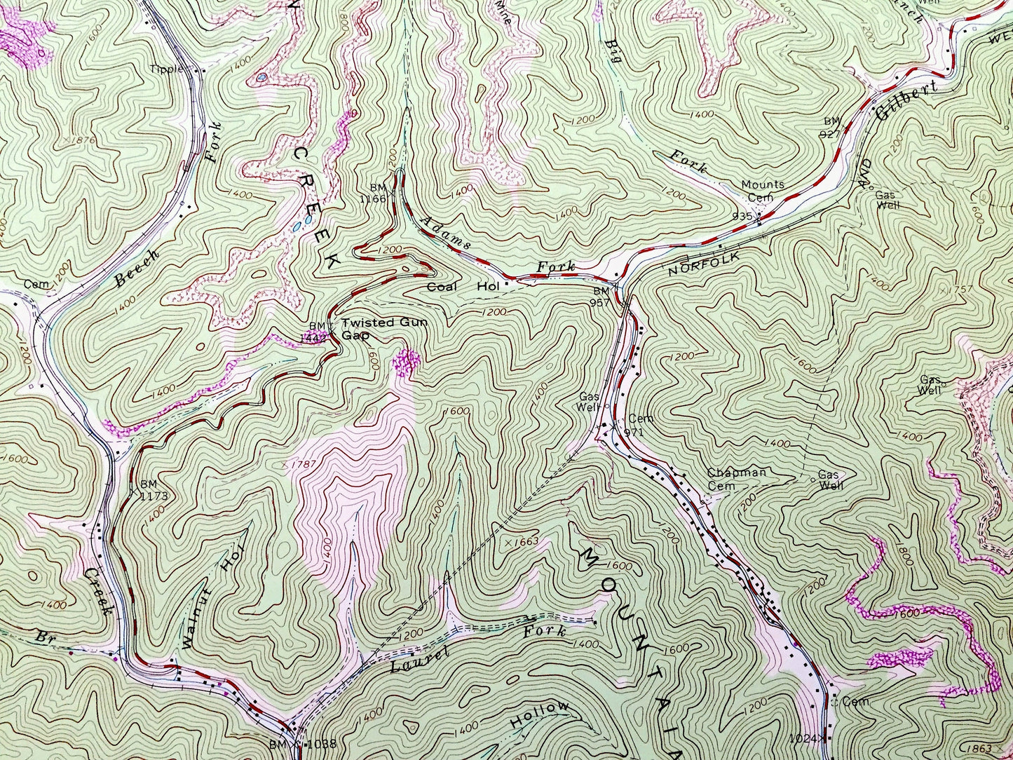
See what West Virginia looked like 60 years ago. Lots of intricate details and geological contours. Map even has little squares for every house that existed at the time. The USGS cartographers were very thorough back then!
Perfect for the historian, map-lover, the curious or just as a conversation starter. Wonderful and rare. Vintage maps such as these make great gifts.
Edition of 1963, printed 1979
Dimensions: 22" width x 27" height
----
Features
Cities & Towns: War Eagle, Wyoming City, Gilbert, Gilbert Creek, Wharncliffe, Sandy River, Stafford, Isaban.
Points of Interest: Mingo County, McDowell County, Magnolia County, Pike County, Buchanan County, Ben Creek Mountain, Tug Fork, Fourpole Creek, Alum Creek, Spring Fork, Glen Alum Mountain, Gilbert Creek, Skillet Creek, Turkey Creek, and lots more hills, mountains, creeks, towns, roads and train tracks.
Condition: Very Good Vintage condition, commensurate with age. This map is in great shape for being over 40 years old. Has some light fold marks, but these will read as vintage character when framed.
----
We will happily adjust shipping price for multiple purchases. Maps are rolled up and shipped in sturdy mailing tubes, never folded.
Couldn't load pickup availability
Share