My Store
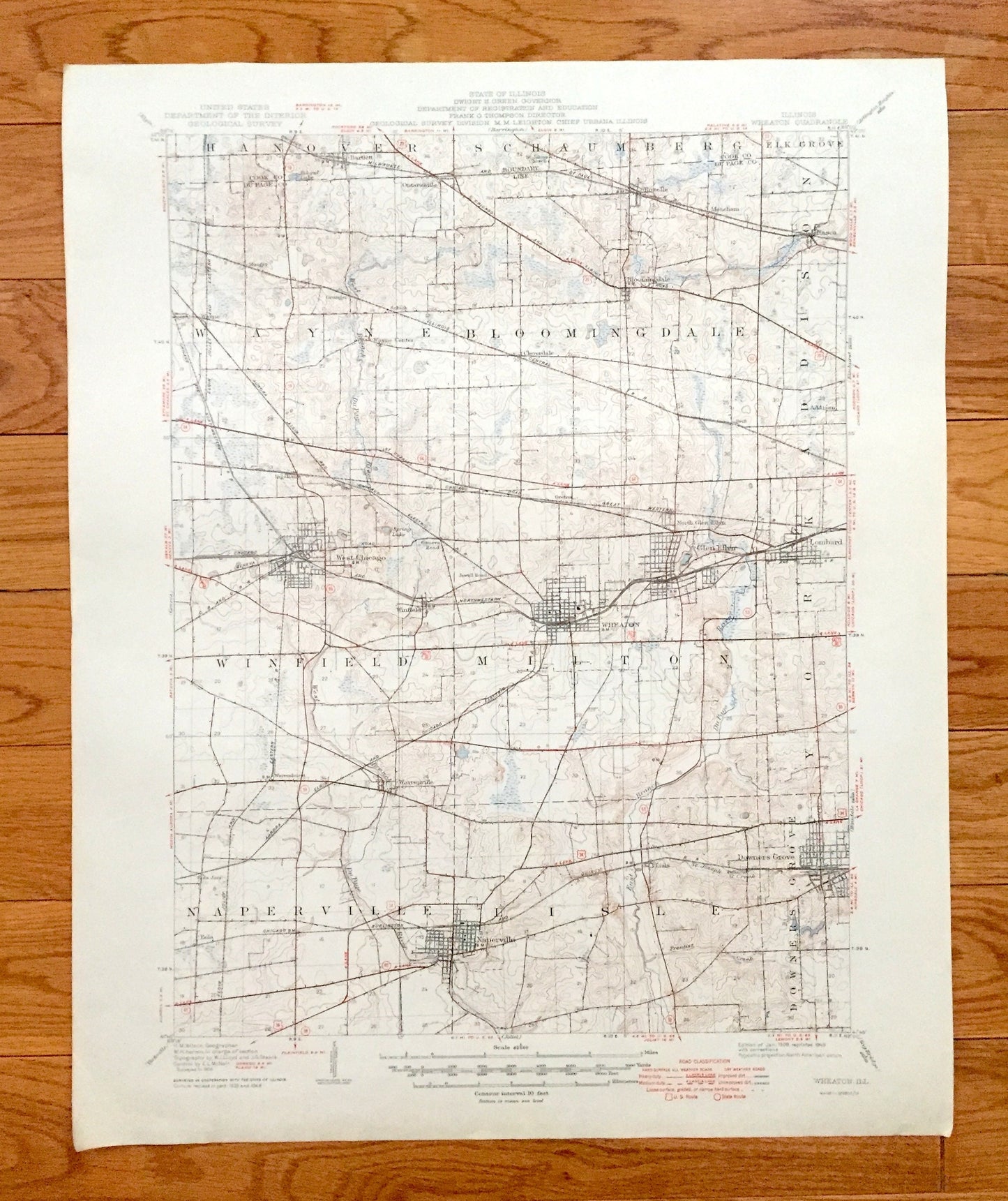
Antique Wheaton, Illinois 1908 US Geological Survey Topographic Map – West Chicago, Glen Ellen, Lombard, Naperville, Downers Grove, Wayne IL
Antique Wheaton, Illinois 1908 US Geological Survey Topographic Map – West Chicago, Glen Ellen, Lombard, Naperville, Downers Grove, Wayne IL
Beautiful, antique map of Wheaton, Illinois and Dupage County area. This is an authentic 1908 edition, 1949 print from the U.S. Geological Survey and NOT a computer reproduction.
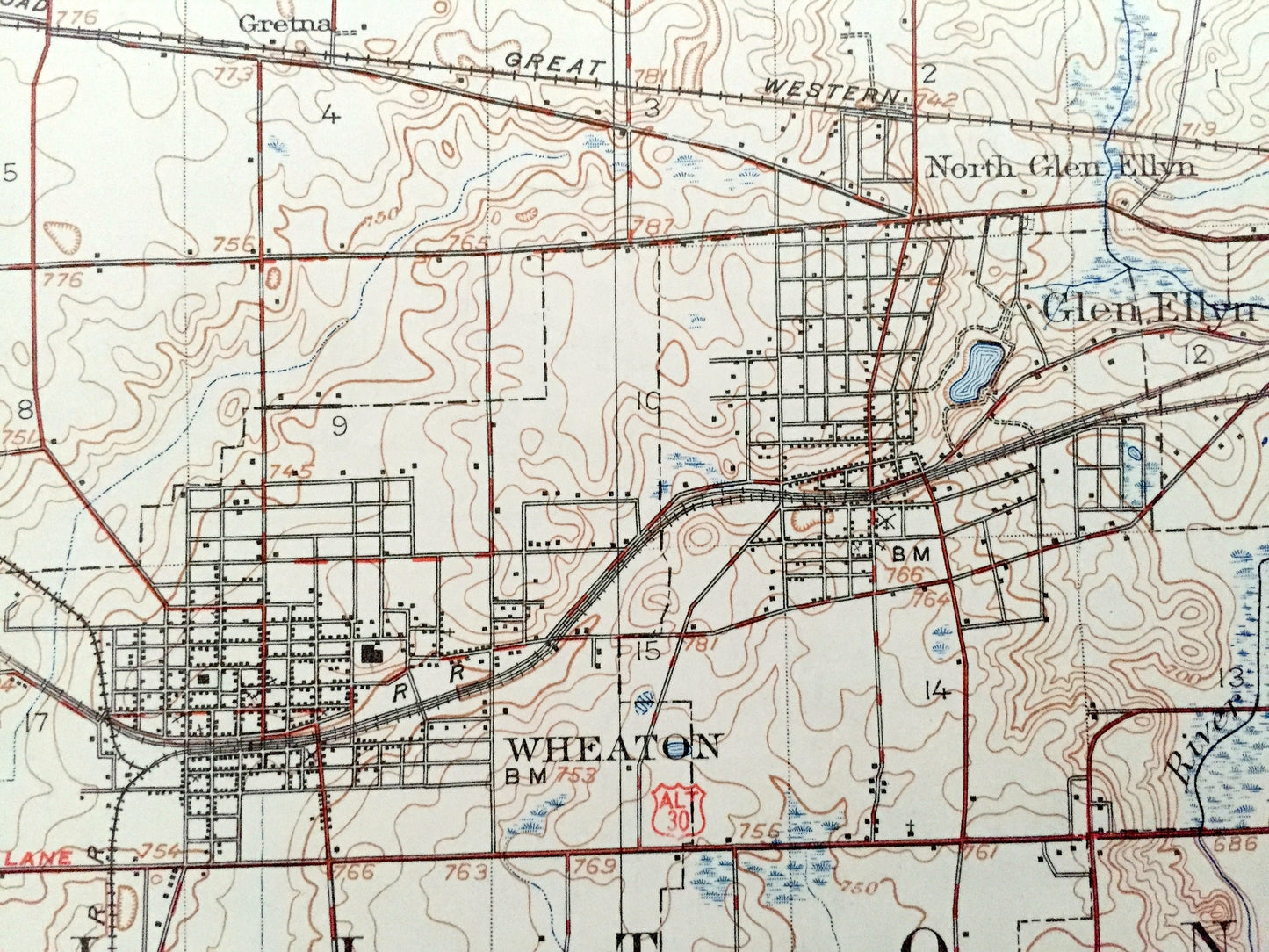
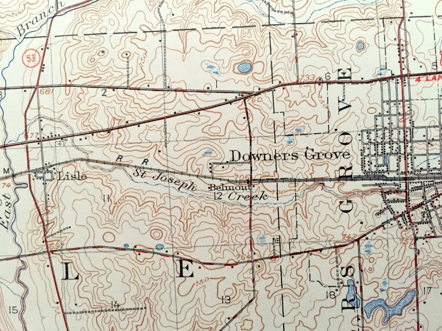
See what Illinois looked like more than 110 years ago. Lots of intricate details and geological contours. Map even has little squares for every house that existed at the time. The cartographers were very thorough back then! On the back is a description of topographic symbols and map guide.
Perfect for the historian, map-lover, the curious or just as a conversation starter. Wonderful and rare. Vintage maps such as these make great gifts.
Edition of 1908, printed 1949
Dimensions: 17" width x 21" height
----
Features
Cities & Towns: Hanover, Shaumberg, Elk Grove, Wayne, Bloomingdale, Addison, Winfield, Milton, York, Naperville, Lisle, Downers Grove, Bartlett, Munger, Granger, Shick, Itasca, Cloverdale, Ingalton, Warrenhurst, Warrenvile, Eola June, Eola, Roselle, Meacham, Swift, Ontarioville, Gretna.
Points of Interest: Dupage River, Chicago Electric Railroad, Aurora Elgin and Chicago Electric Railroad, and lots more hills, brooks, villages, schools, churches, roads and train tracks.
Condition: Very Good condition, commensurate with age. This map is in great shape for being over 70 years old. Has light edge-wear but this will add to vintage character when framed.
----
We will happily adjust shipping price for multiple purchases. Map will be shipped folded to preserve integrity.
Couldn't load pickup availability
Share