My Store
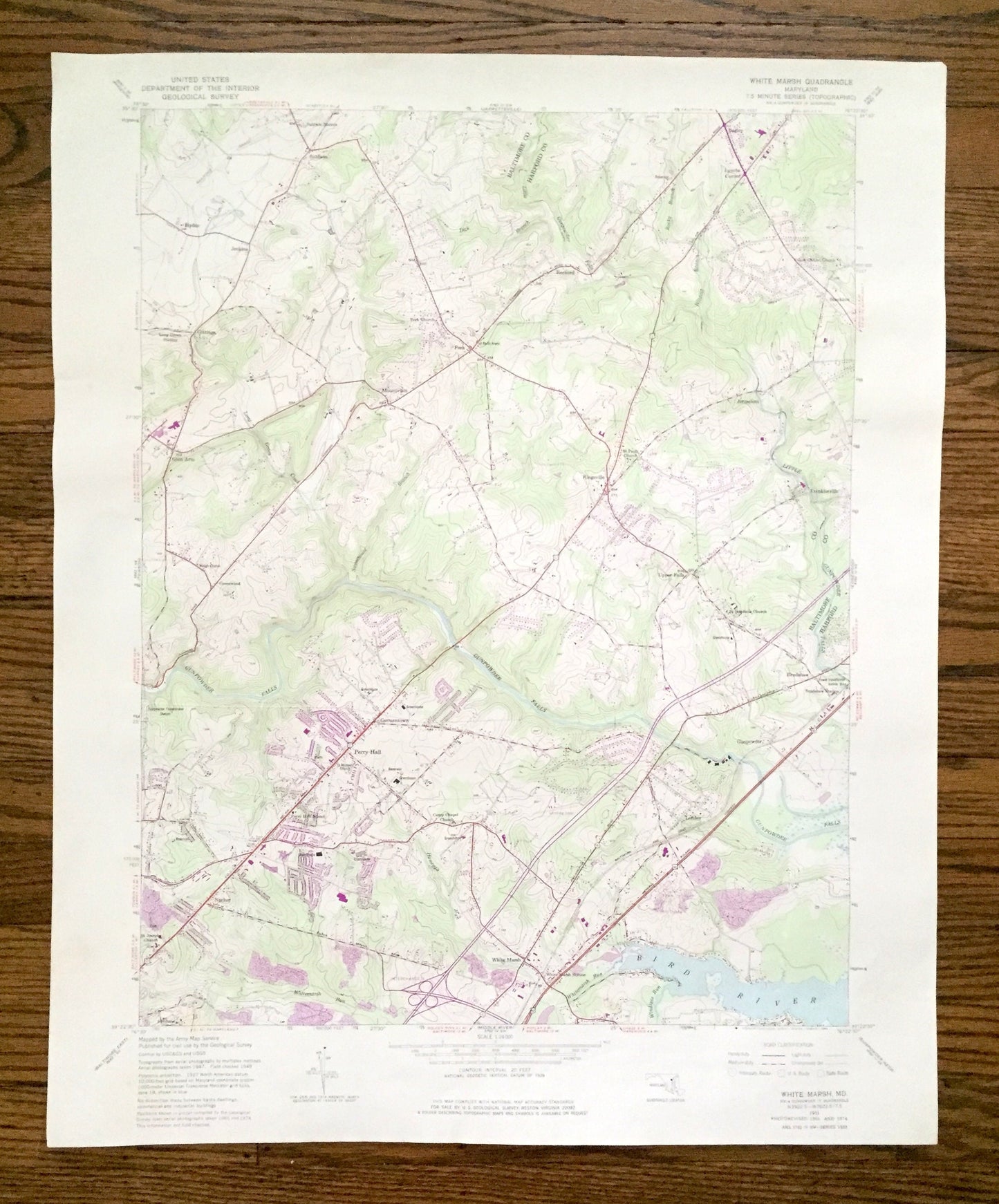
Antique White Marsh, Maryland 1951 US Geological Survey Topographic Map – Baltimore, Harford County, Perry Hall, Gunpowder, Kingsville, MD
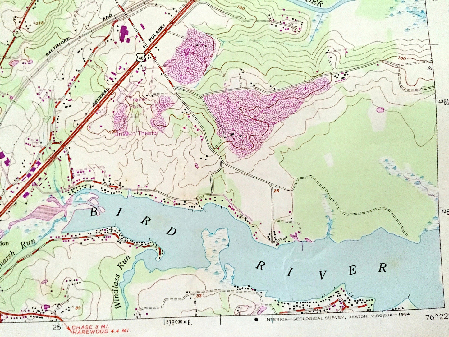
Antique White Marsh, Maryland 1951 US Geological Survey Topographic Map – Baltimore, Harford County, Perry Hall, Gunpowder, Kingsville, MD
Beautiful, antique map of White Marsh, Maryland and surrounding Baltimore County and Harford County areas. This is an authentic 1951 edition, 1984 print from the U.S. Geological Survey and NOT a computer reproduction.
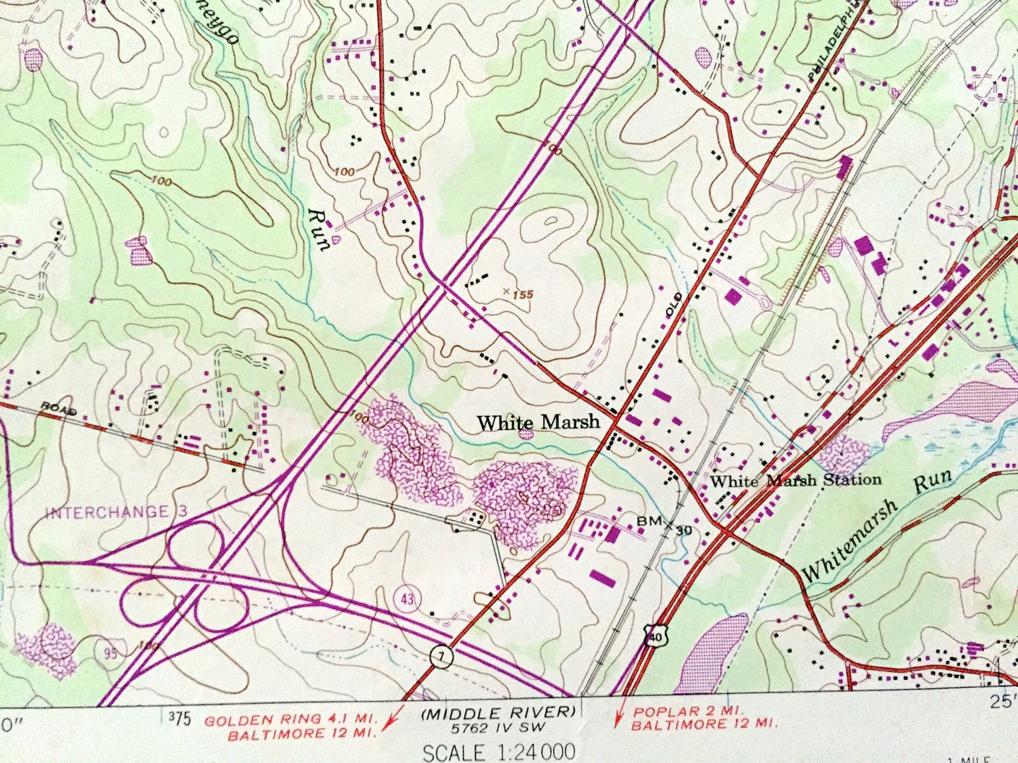
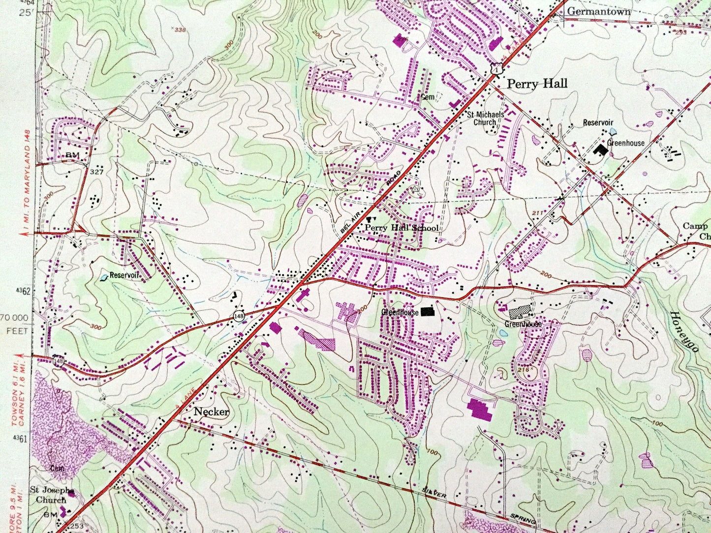
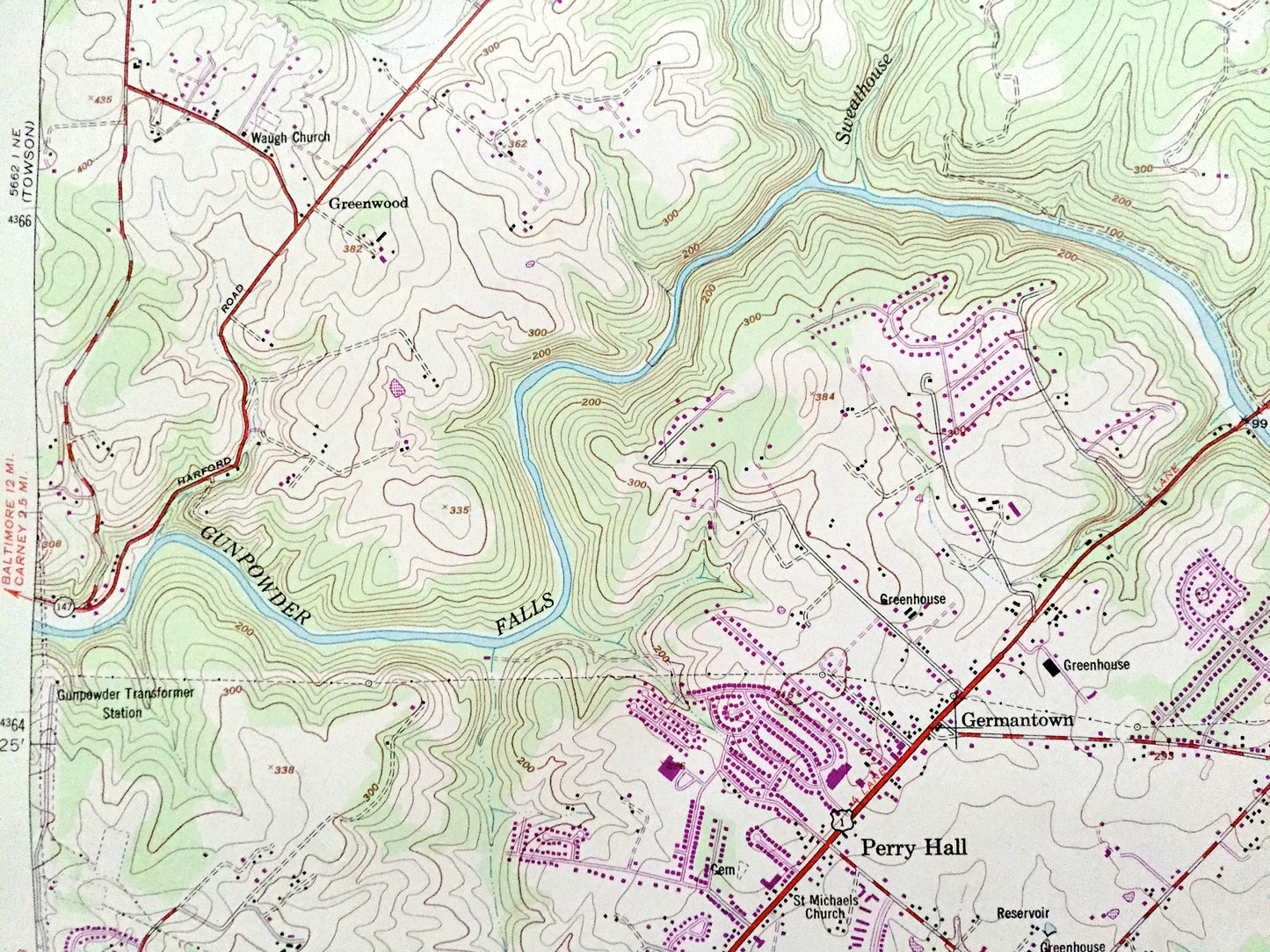
See what Maryland looked like over 70 years ago. Lots of intricate details and geological contours. Map even has little squares for every house that existed at the time. The USGS cartographers were very thorough back then!
Perfect for the historian, map-lover, the curious or just as a conversation starter. Wonderful and rare. Vintage maps such as these make great gifts.
Edition of 1951, printed 1984
Dimensions: 22" width x 27" height
----
Features
Cities & Towns: Baldwin, Bagley, Lynchs Corner, Reckord, Fork, Hyde, Jenkins, Gittings, Mountvista, Glen Arm, Greenwood, Stockton, Jerusalem, Franklinville, Upper Falls, Bradshaw, Germantown, Loreley, Necker.
Points of Interest: Bird River, Gunpowder Falls, Little Gunpowder Falls, Long Green Creek, Whitemarsh Run, Windlass Run, Wildcat Branch, Rocky Branch, greenhouses, reservoirs, and many more hills, streams, ponds, houses, schools, railroads, churches and roads.
Condition: Good Vintage condition, commensurate with age. This map is in great shape for being about 40 years old. Has some edge-wear and toning, but this will read as character when framed.
----
We will happily adjust shipping price for multiple purchases. Maps are rolled up and shipped in sturdy mailing tubes, never folded.
Couldn't load pickup availability
Share