My Store
Antique Whitefield, New Hampshire & Lunenburg, Vermont 1938 US Geological Survey Topographic Map – Lancaster Jefferson Bethlehem Carroll NH
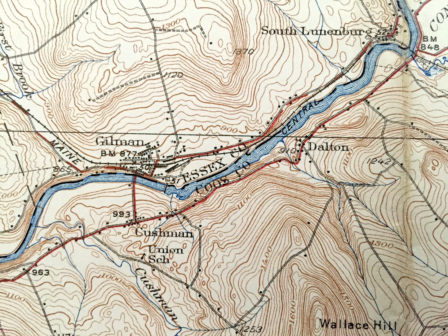
Antique Whitefield, New Hampshire & Lunenburg, Vermont 1938 US Geological Survey Topographic Map – Lancaster Jefferson Bethlehem Carroll NH
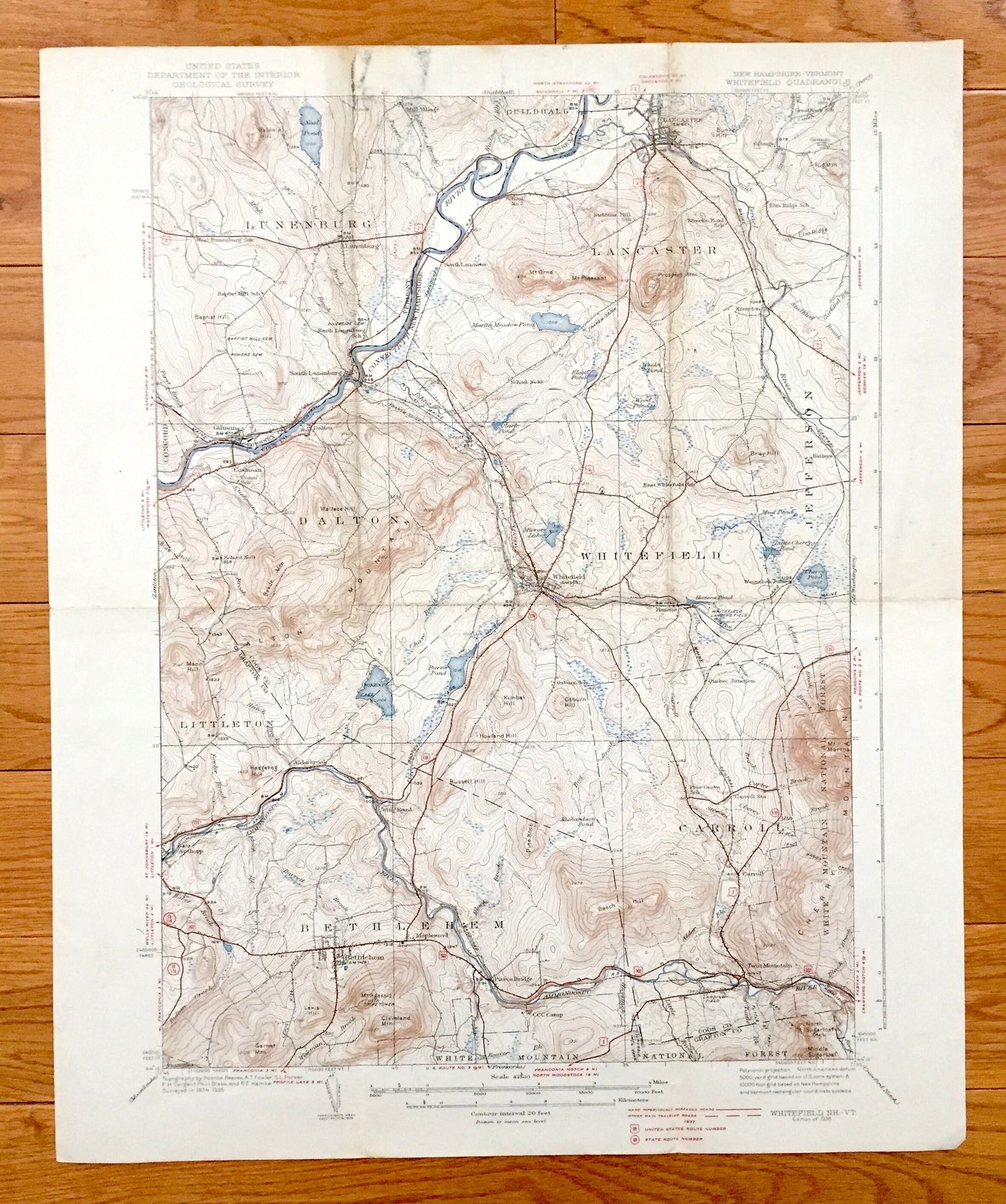
Beautiful, antique map of Lancaster, Whitefield, Dalton, Bethlehem and Carroll, New Hampshire, including Lunenburg, Vermont. This is an authentic 1938 print from the U.S. Geological Survey and NOT a computer reproduction.
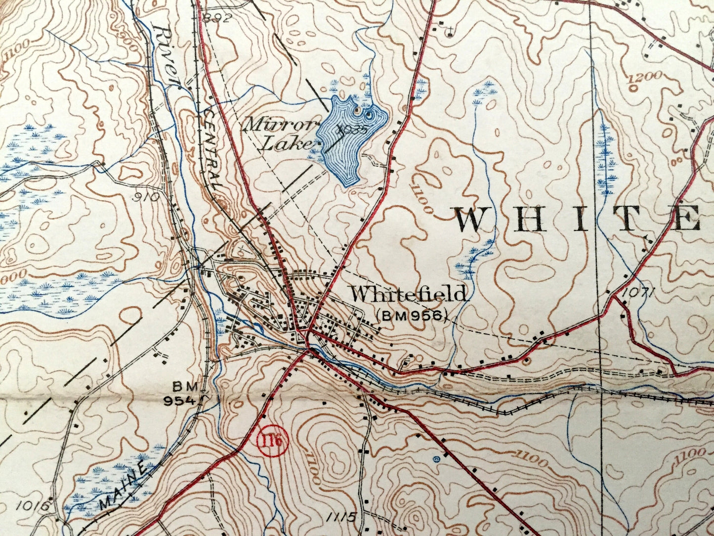
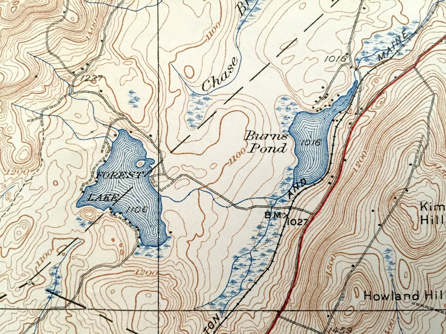
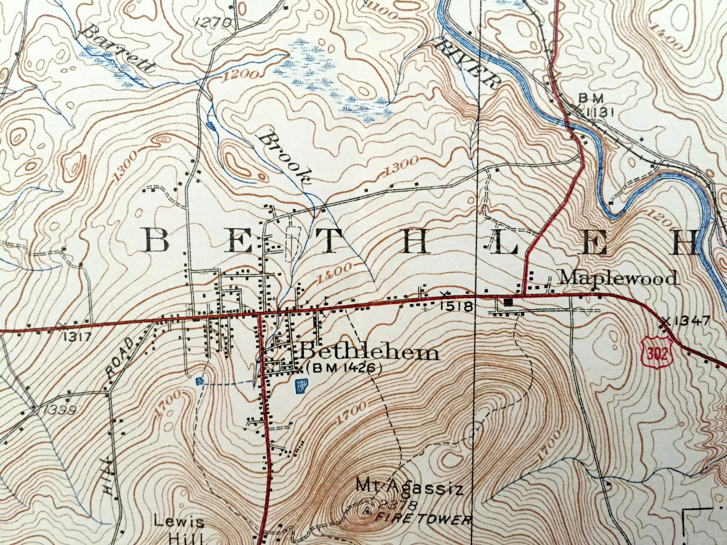
See what Coos and Essex Counties looked like almost 80 years ago. Lots of intricate details and geological contours. Map even has little squares for every house that existed at the time. The USGS cartographers were very thorough back then! On the back is a description of topographic symbols and map guide.
Perfect for the historian, map-lover, the curious or just as a conversation starter. Wonderful and rare. Vintage maps such as these make great gifts.
Edition of 1938, printed 1938
Dimensions: 16 1/2" width x 20" height
----
Features
Cities & Towns: New Hampshire: Lancaster, Elm Ridge, Riverton, Dalton, Cushman, Littleton, Alderbrook, Bethlethm, Maplewood, Pierce Bridge, Apthorp, Carroll, Hazens, Waumbeck June, Whitefield, East Whitefield, Jefferson, Baileys.
Vermont: Lunenburg, South Lunenburg, Guildall, Mill Village.
Points of Interest: Neal Pond, South Lunenburg School, Baptist Hill School, Union School, School No. 9, Dalton Mountain, Ammonoosuc River, Mt. Agassiz Fire Tower, White Mountain national Forest, North Sugarloaf Mountain, Baby Twins Trail, Twin Mountain, Cherry Mountain, Cherry Pond, Whitefield Landing Field, Elm Ridge School, Riverton Road School, Mt. Orne, Martin Meadow Pond, School No. 10, CCC Camp, Forest Lake, Boston & Maine Railroad, and lots more hills, mountains, streams, ponds, houses, schools and roads.
Condition: Good Vintage condition, commensurate with age. This map is in incredible shape for being almost 80 years old. Has some edge-wear and discoloration along the fold lines, but this will add to vintage character when framed.
----
We will happily adjust shipping price for multiple purchases. Maps are rolled up and shipped in sturdy mailing tubes, never folded.
Couldn't load pickup availability
Share