My Store
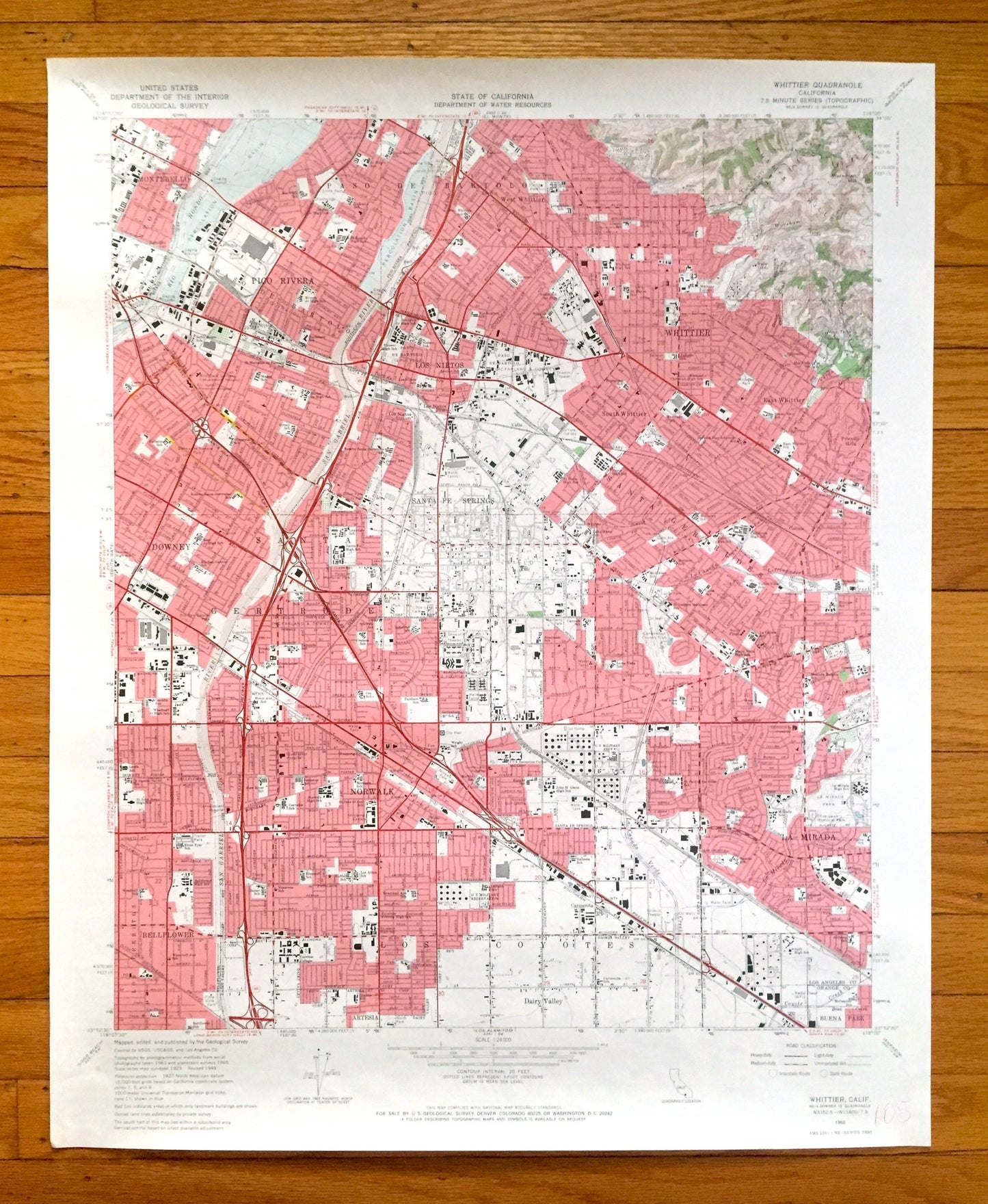
Antique Whittier, California 1965 US Geological Survey Topographic Map – Montebello, Pico Rivera, Mirada, Norwalk, Los Angeles County, CA
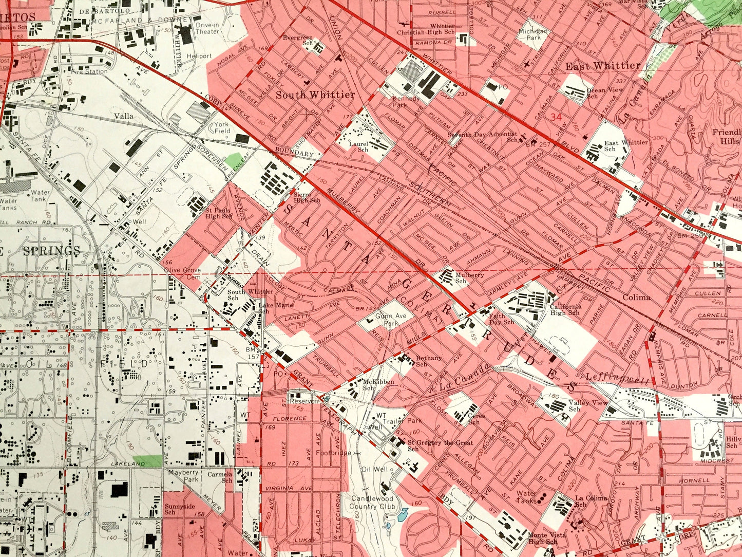
Antique Whittier, California 1965 US Geological Survey Topographic Map – Montebello, Pico Rivera, Mirada, Norwalk, Los Angeles County, CA
Beautiful, antique map of Whittier, California and surrounding Los Angeles County area. This is an authentic 1965 edition, 1967 print from the U.S. Geological Survey and NOT a computer reproduction.
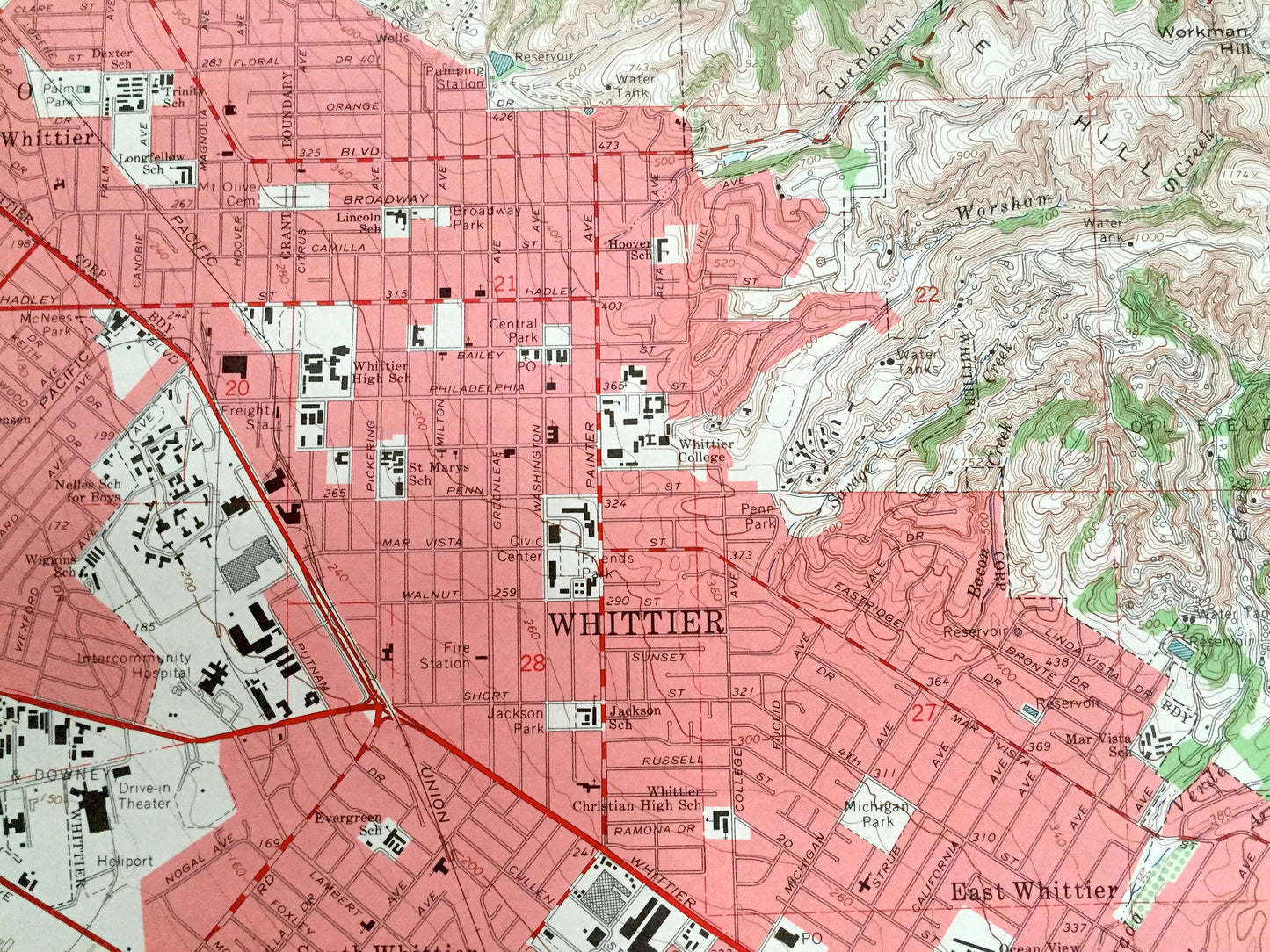
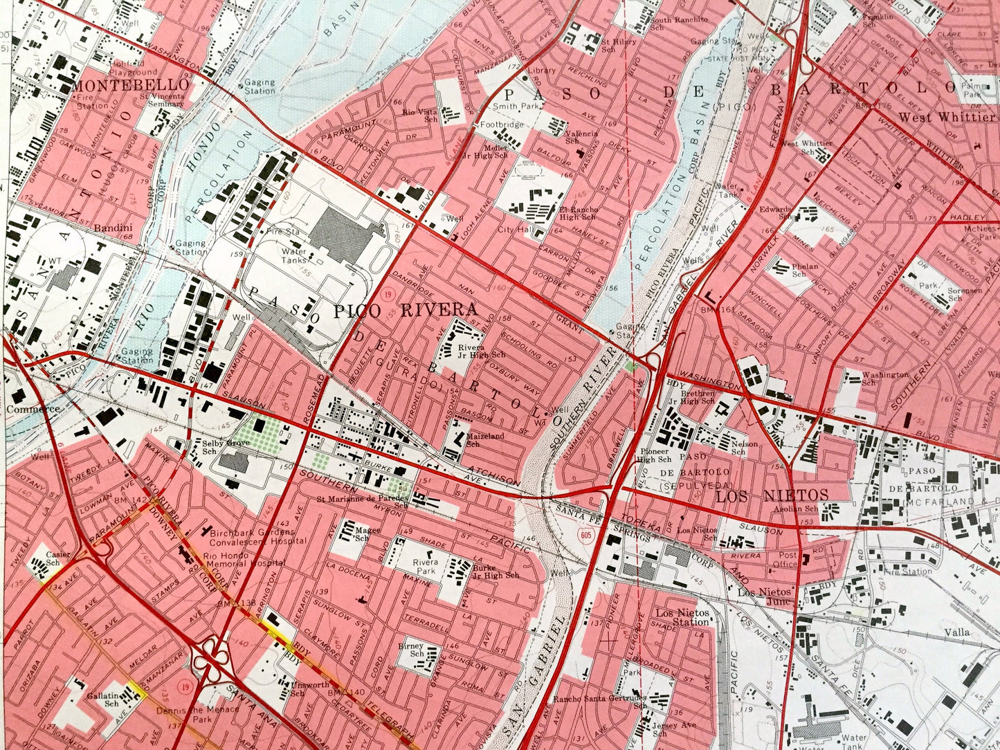
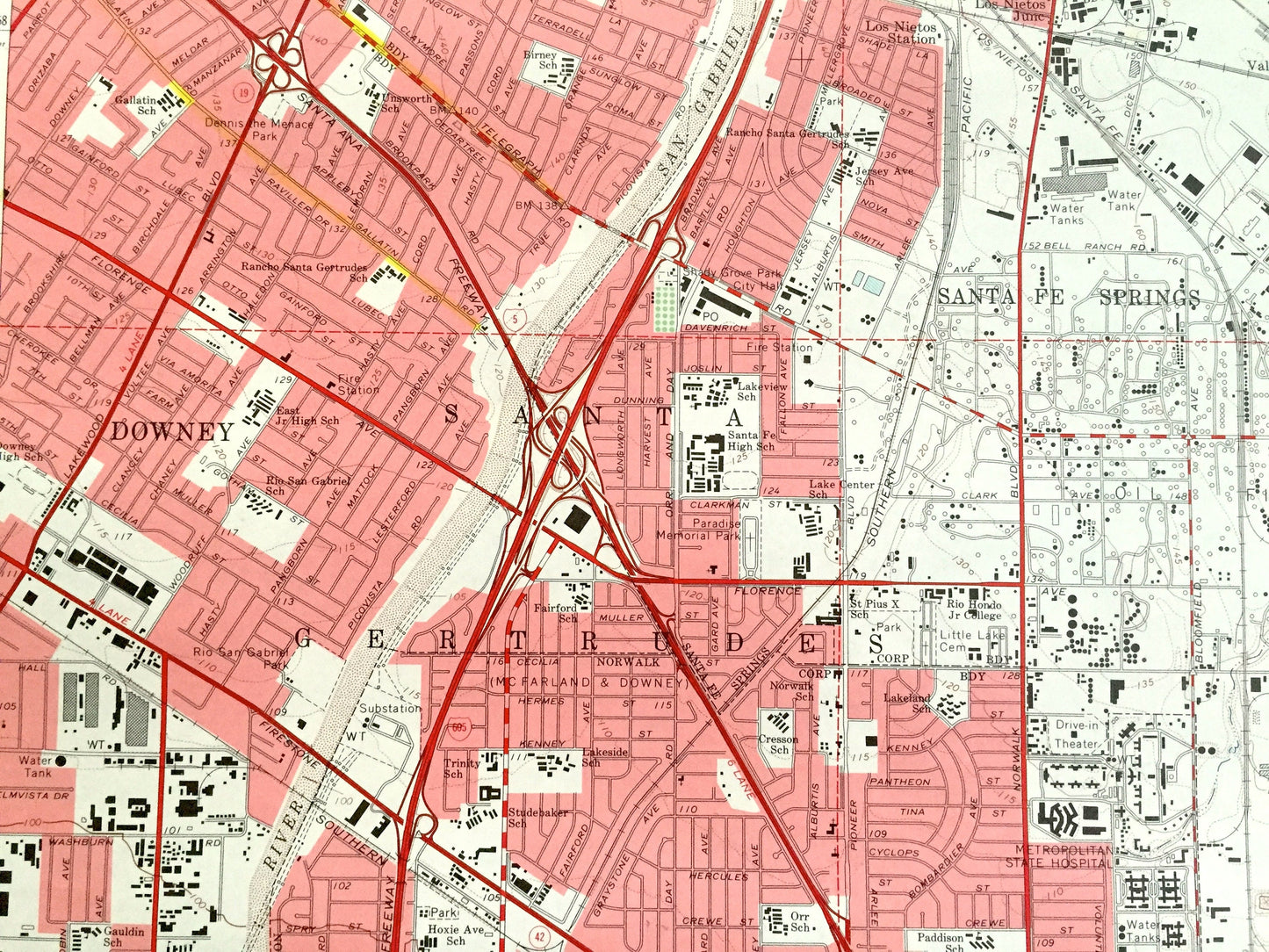
See what California looked like over 55 years ago. Lots of intricate details and geological contours. Map even has little squares for every house that existed at the time. The USGS cartographers were very thorough back then!
Perfect for the historian, map-lover, the curious or just as a conversation starter. Wonderful and rare. Vintage maps such as these make great gifts.
Edition of 1965, printed 1967
Dimensions: 22" width x 27" height
----
Features
Cities, Neighborhoods & Towns: Bellflower, Norwalk, Los Coyotes, Santa Gertrudes, Santa Fe Springs, Downey, La Mirada, Los Nietos, Pico Rivera, Whittier, South Whittier, East Whittier, West Whittier, Gertrudes, Montebello, Cerritos.
Points of Interest: Los Angeles County, San Gabriel River, Atchison Topeka and Santa Fe Railway, Paso de Bartolo, La Mirada Park, Puente Hill, Santa Gertrudes, and many more creeks, streams, small towns, railroads, schools and hospitals.
Condition: Good Vintage condition, commensurate with age. This map is in great shape for being over 55 years old. Has light wear and marker in bottom right corner, but this will add to vintage character when framed.
----
We will happily adjust shipping price for multiple purchases. Maps are rolled up and shipped in sturdy mailing tubes, never folded.
Couldn't load pickup availability
Share