My Store
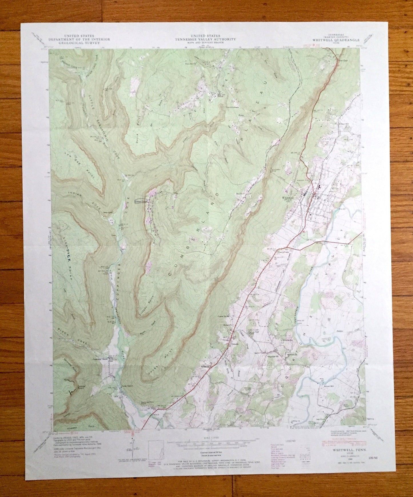
Antique Whitwell, Tennessee 1946 US Geological Survey Topographic Map – Marion County, Red Hill, Mt Olive, Victoria, Ketner Mill, TN
Antique Whitwell, Tennessee 1946 US Geological Survey Topographic Map – Marion County, Red Hill, Mt Olive, Victoria, Ketner Mill, TN
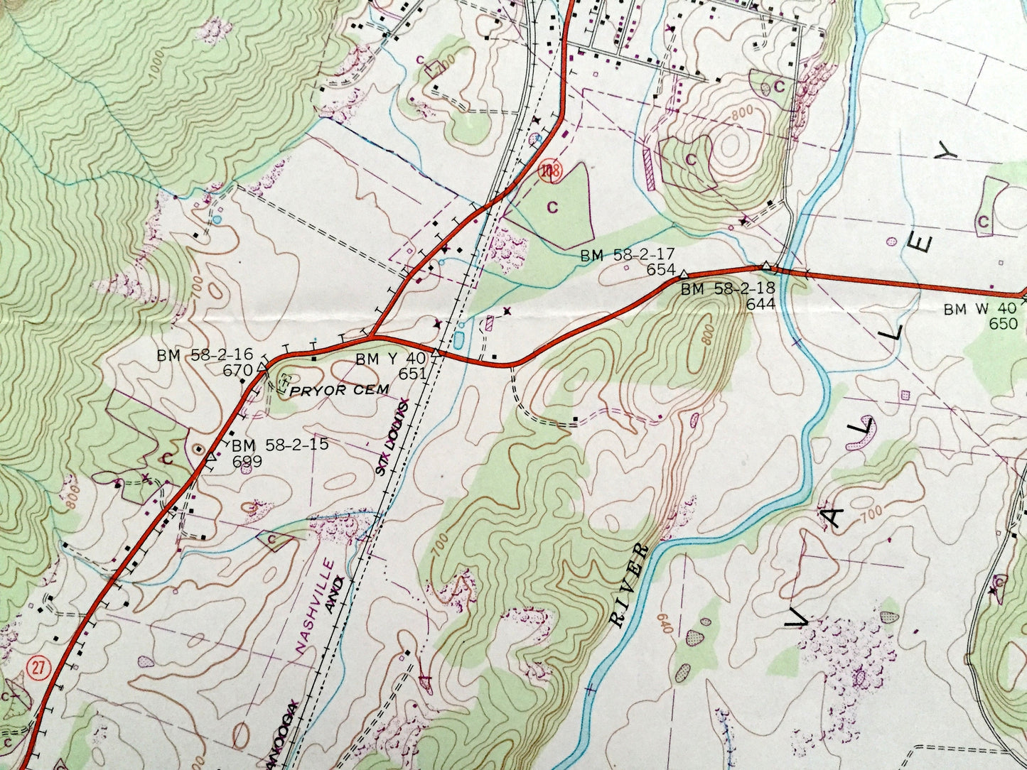
Beautiful, antique map of Whitwell, Tennessee and surrounding Marion County area. This is an authentic 1946 edition, 1973 print from the U.S. Geological Survey and NOT a computer reproduction.
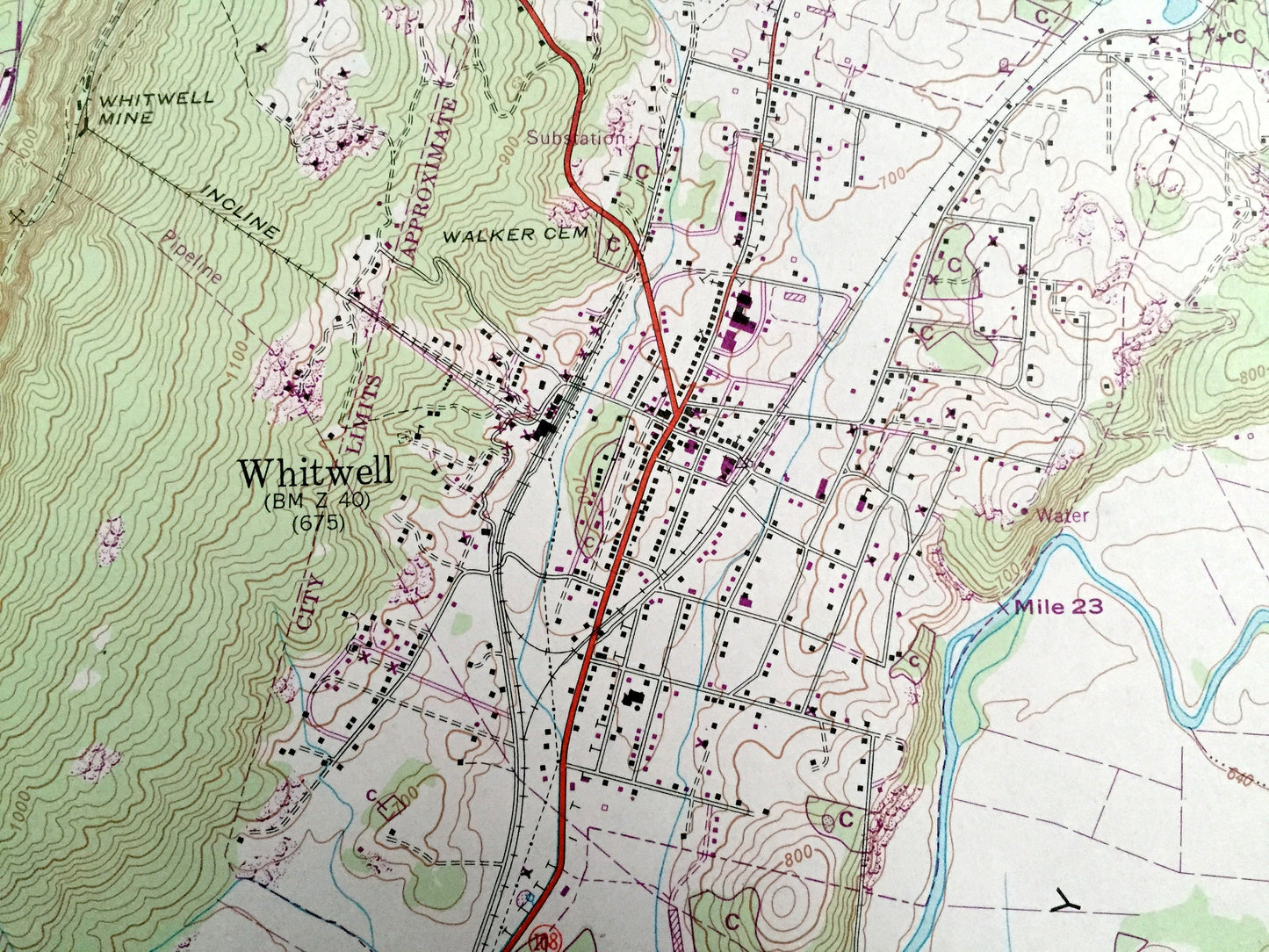
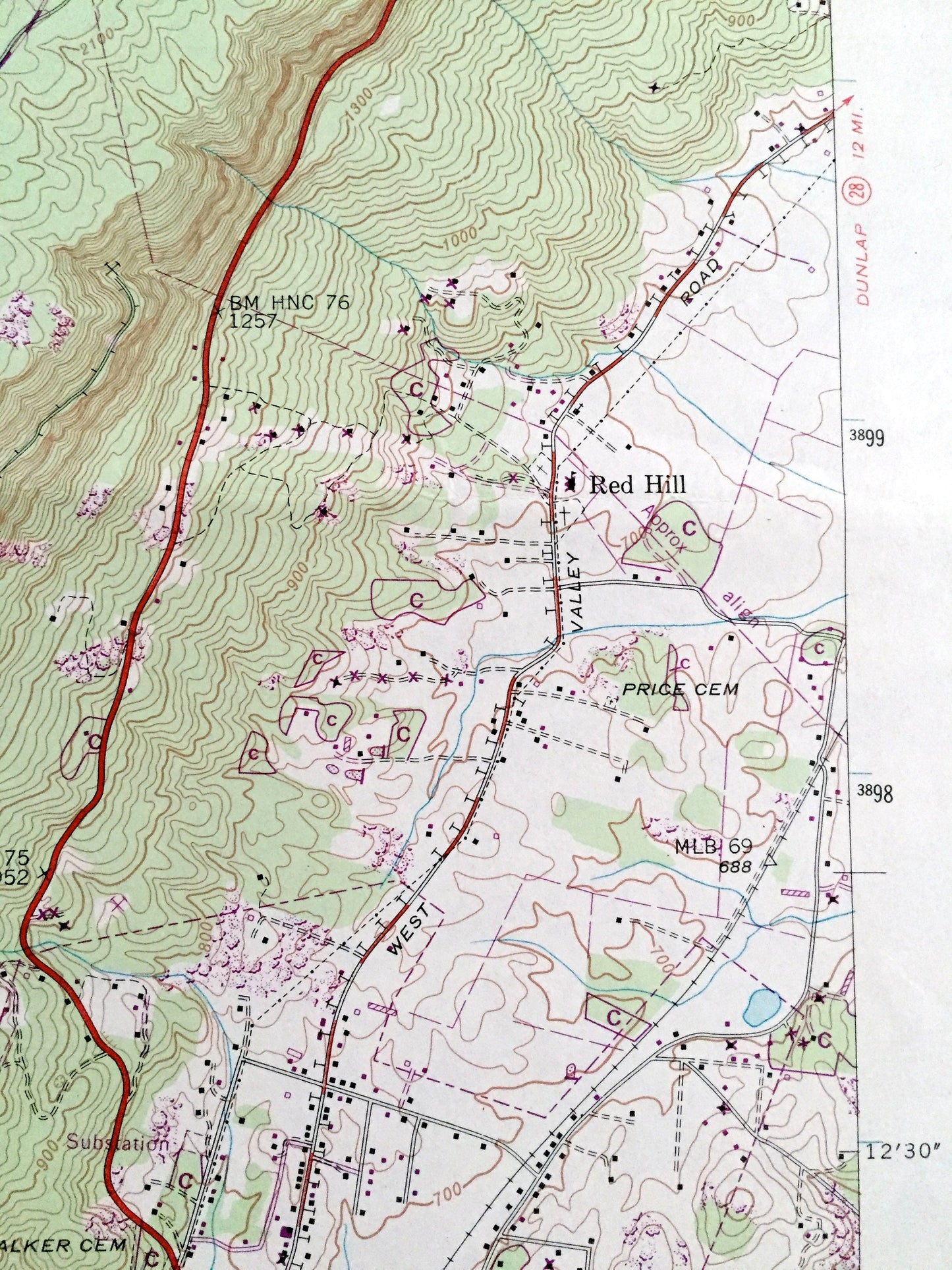
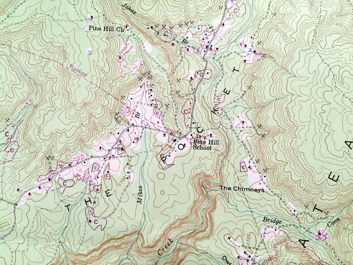
See what Tennessee looked like over 75 years ago. Lots of intricate details and geological contours. Map even has little squares for every house that existed at the time. The USGS cartographers were very thorough back then!
Perfect for the historian, map-lover, the curious or just as a conversation starter. Wonderful and rare. Vintage maps such as these make great gifts.
Edition of 1946, printed 1973
Dimensions: 22" width x 27" height
----
Features
Cities & Towns: Red Hill, Mt Olive, Victoria, Ketner Mill, Oak Grove.
Points of Interest: Camp Glancy, Dancing Fern Cave, Cumberland Plateau, Sequatchie Valley, Dixon Cove, Peter Cave Cove, Bryant Cove, The Pocket, Indian Cove, Jones Point, Sequatchie River, Little Sequatchie River, Pocket Creek, Grays Creek, The Lagoon, and many more hills, streams, ponds, houses, schools, railroads, churches and roads.
Condition: Good Vintage condition, commensurate with age. This map is in great shape for being about 50 years old. Has light edge-wear and folds as-issued, but these will flatten easily and all will read as character when framed.
----
We will happily adjust shipping price for multiple purchases. Maps are rolled up and shipped in sturdy mailing tubes, never folded.
Couldn't load pickup availability
Share