My Store
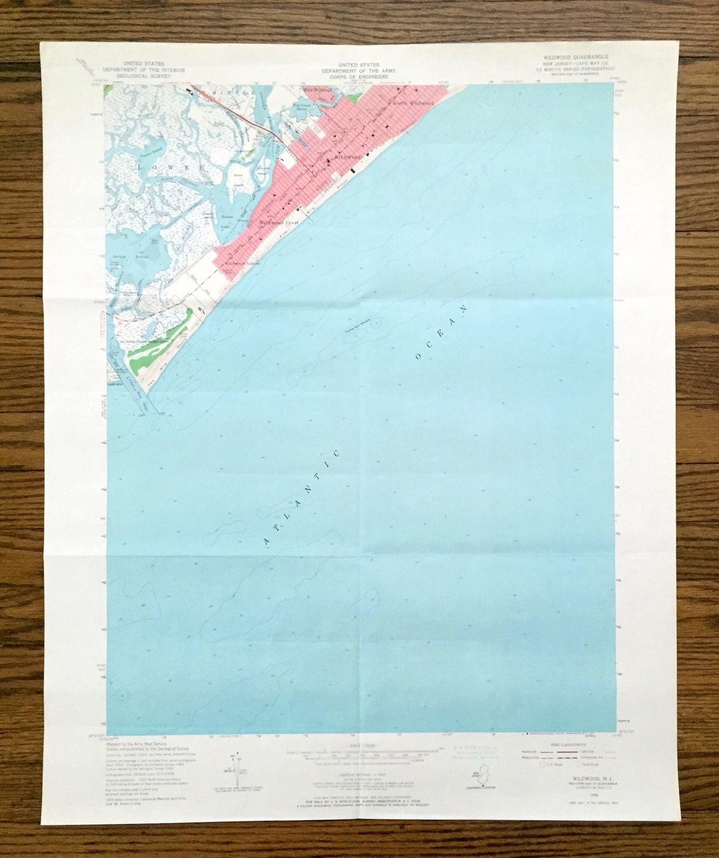
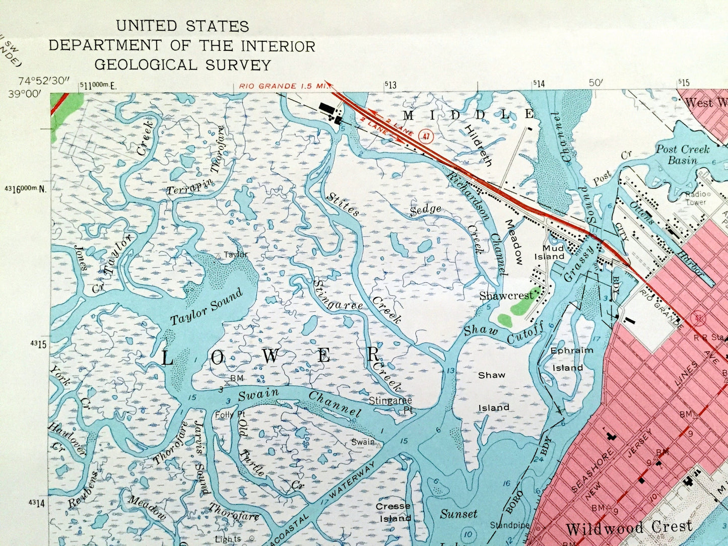
Antique Wildwood, New Jersey 1955 US Geological Survey Topographic Map – Cape May County, Lower Township, Middle, Coast Guard, Shore, NJ
Antique Wildwood, New Jersey 1955 US Geological Survey Topographic Map – Cape May County, Lower Township, Middle, Coast Guard, Shore, NJ
Beautiful, antique map of Wildwood, New Jersey and surrounding Cape May County area. This is an authentic 1955 edition, 1967 print from the U.S. Geological Survey and NOT a computer reproduction.
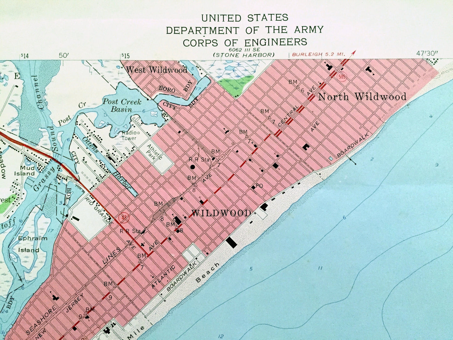
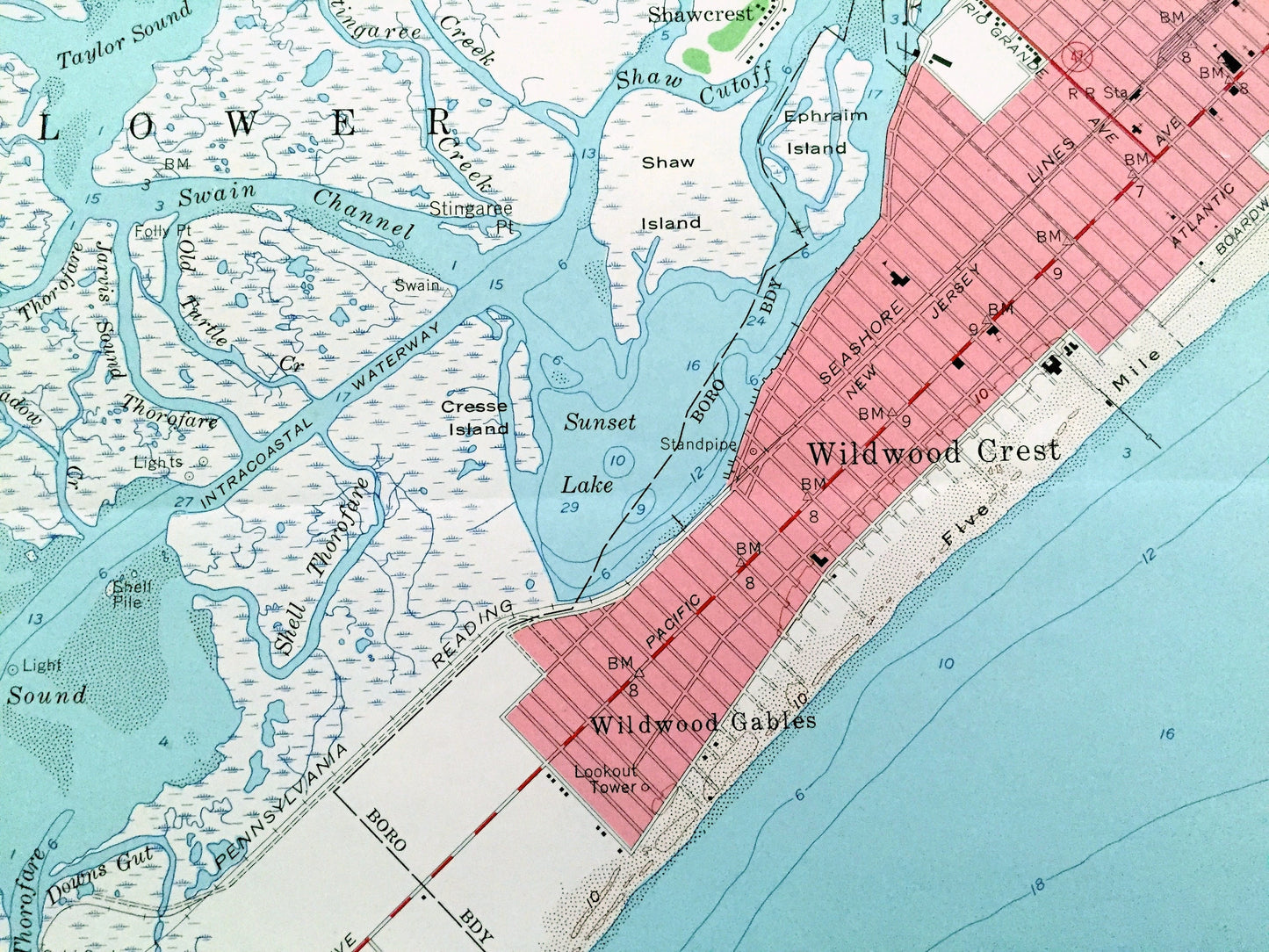
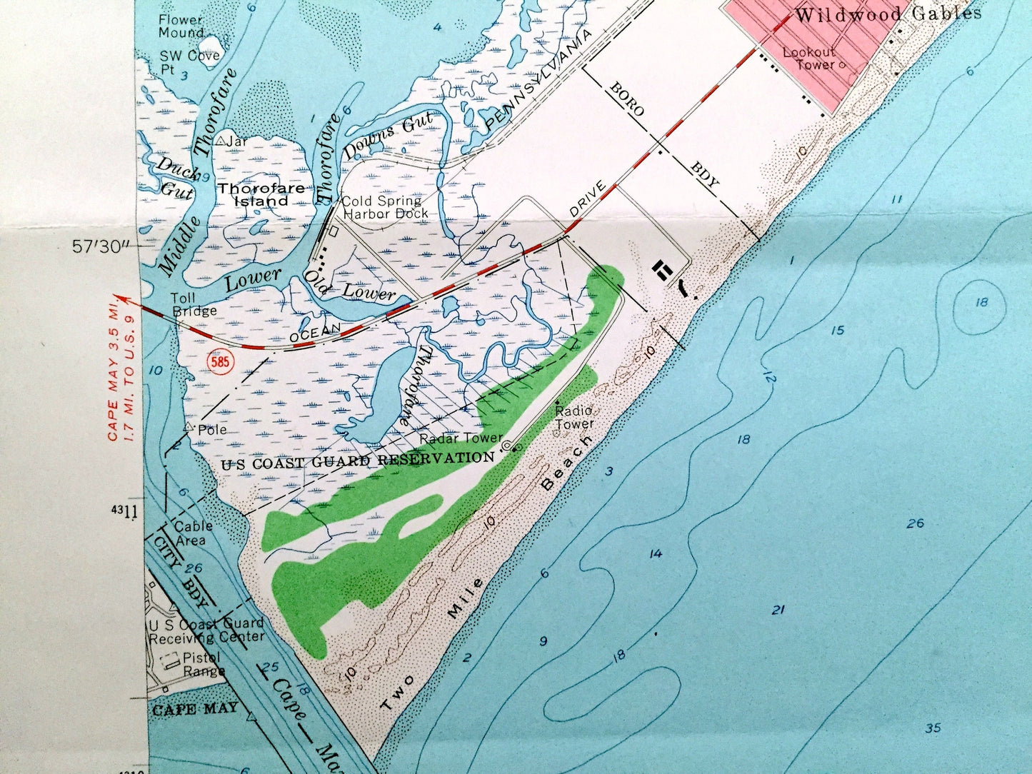
See what New Jersey looked like more than 65 years ago. Lots of intricate details and geological contours. Map even has little squares for every house that existed at the time. The USGS cartographers were very thorough back then!
Perfect for the historian, map-lover, the curious or just as a conversation starter. Wonderful and rare. Vintage maps such as these make great gifts.
Edition of 1955, printed 1967
Dimensions: 22" width x 27" height
----
Features
Cities & Towns: West Wildwood, Wildwood Gables, Shaw Island, Thorofare Island, Cresse Island, Cape May, Ephraim Island, Shawcrest, Hildreth Meadow.
Points of Interest: Two Mile Beach, Five Mile Beach, US Coast Guard Reservation, Cold Spring Harbor Dock, Cape May Inlet, Taylor Sound, Jarvis Sound, Sunset Lake, Post Creek Basin, Sedge Creek, Stites Creek, Intracoastal Waterway, Atlantic Ocean, Shell Thorofare, Terrapin Thorofare, Taylor Creek, and many more roads, houses, beaches, islands, rivers, inlets, marshes, lighthouses and creeks.
Condition: Good Vintage condition, commensurate with age. This map is in great shape for being over 55 years old. Has light wear and folds as-issued, but these will flatten easily and all will read as vintage character when framed.
----
We will happily adjust shipping price for multiple purchases. Maps are rolled up and shipped in sturdy mailing tubes, never folded.
Couldn't load pickup availability
Share