My Store
Antique Wilkeson, Washington 1899 US Geological Survey Topographic Map – Carbonado, Fairfax, Carbon River, Pierce County, Gleason Hill WA
Antique Wilkeson, Washington 1899 US Geological Survey Topographic Map – Carbonado, Fairfax, Carbon River, Pierce County, Gleason Hill WA
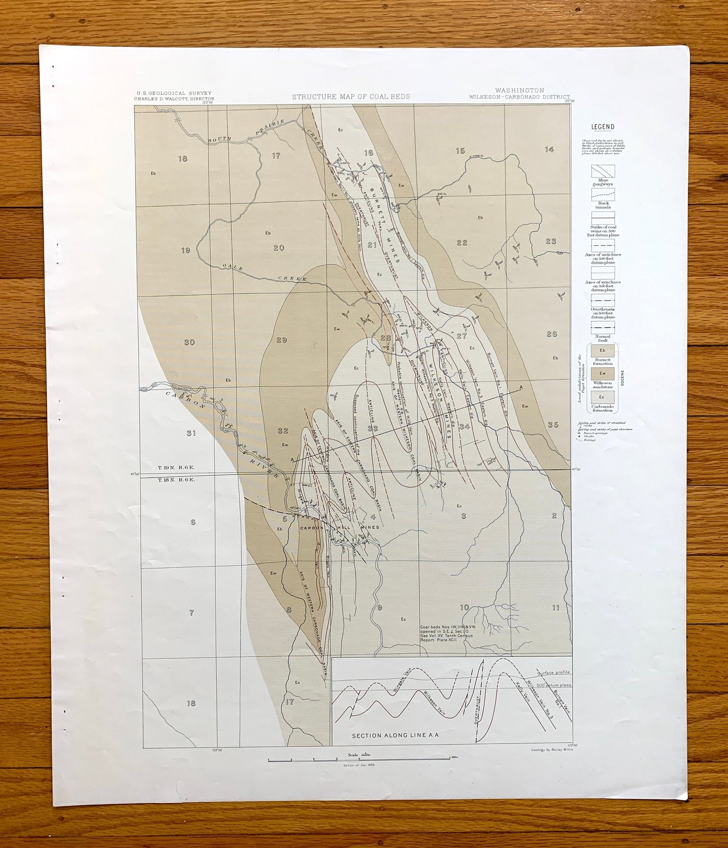
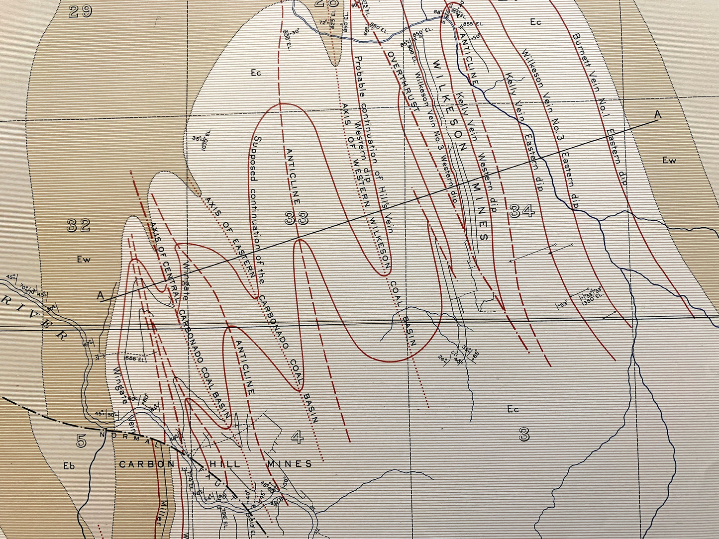
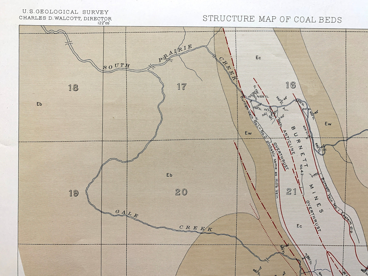
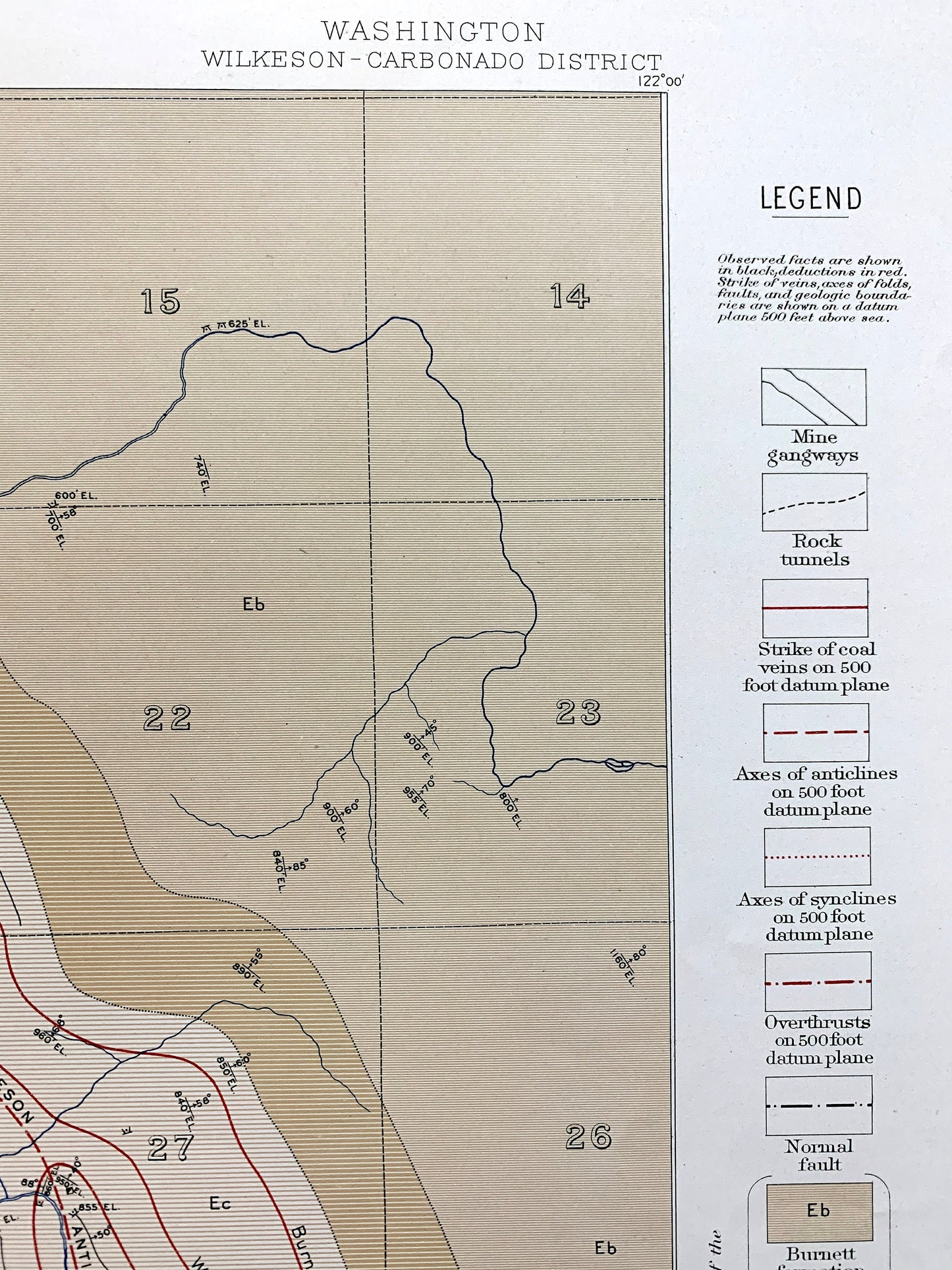
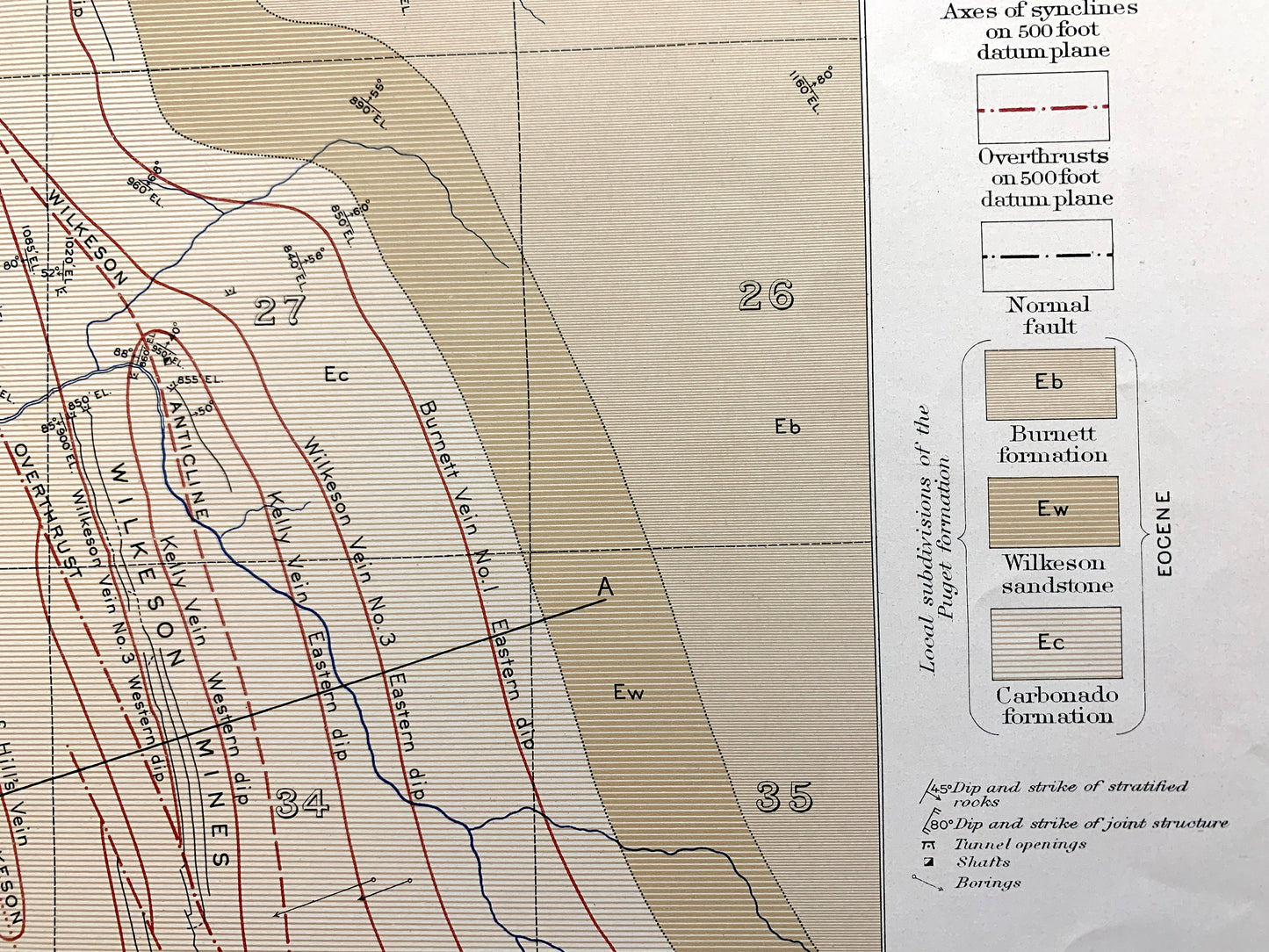
Beautiful, antique, double-sided structure map of coal beds in Wilkeson, Washington and surrounding Pierce County area on the Carbon River. This is an authentic 1899 edition, 1899 print from the U.S. Geological Survey and NOT a computer reproduction. It is from a Geologic Atlas folio. The reverse side has two more structure section maps.
See what Washington State looked like 120 years ago. Lots of intricate details and geological contours. Map even has little squares for every house that existed at the time. The USGS cartographers were very thorough back then! This is one of the rare maps where the topographic symbols and map guide are on the front.
Perfect for the historian, map-lover, the curious or just as a conversation starter. Wonderful and rare. Vintage maps such as these make great gifts.
Edition of 1899 printed 1899
Dimensions: 18 1/2" width x 22" height
----
Features
Cities & Towns: Wilkeson, Carbonado, Fairfax, Upper Fairfax.
Points of Interest: Pierce County, Carbon River, Voight Creek, Wilkeson Creek, Gleason Hill, Wingate Hill, Brooks Hill, Cowling Ridge, Sunset Lake, Fairfax Bridge, Lily Creek, Gale Creek, Waterhole Creek, Northern Pacific Railroad and lots more hills, rivers, creeks, ponds, towns, schools, roads and train tracks.
Condition: Good Vintage condition, commensurate with age. This map is in great shape for being 120 years old. Some edge-wear and staple holes in the margin, all of which will read as vintage character when framed.
----
We will happily adjust shipping price for multiple purchases. Maps are rolled up and shipped in sturdy mailing tubes, never folded.
Couldn't load pickup availability
Share