My Store
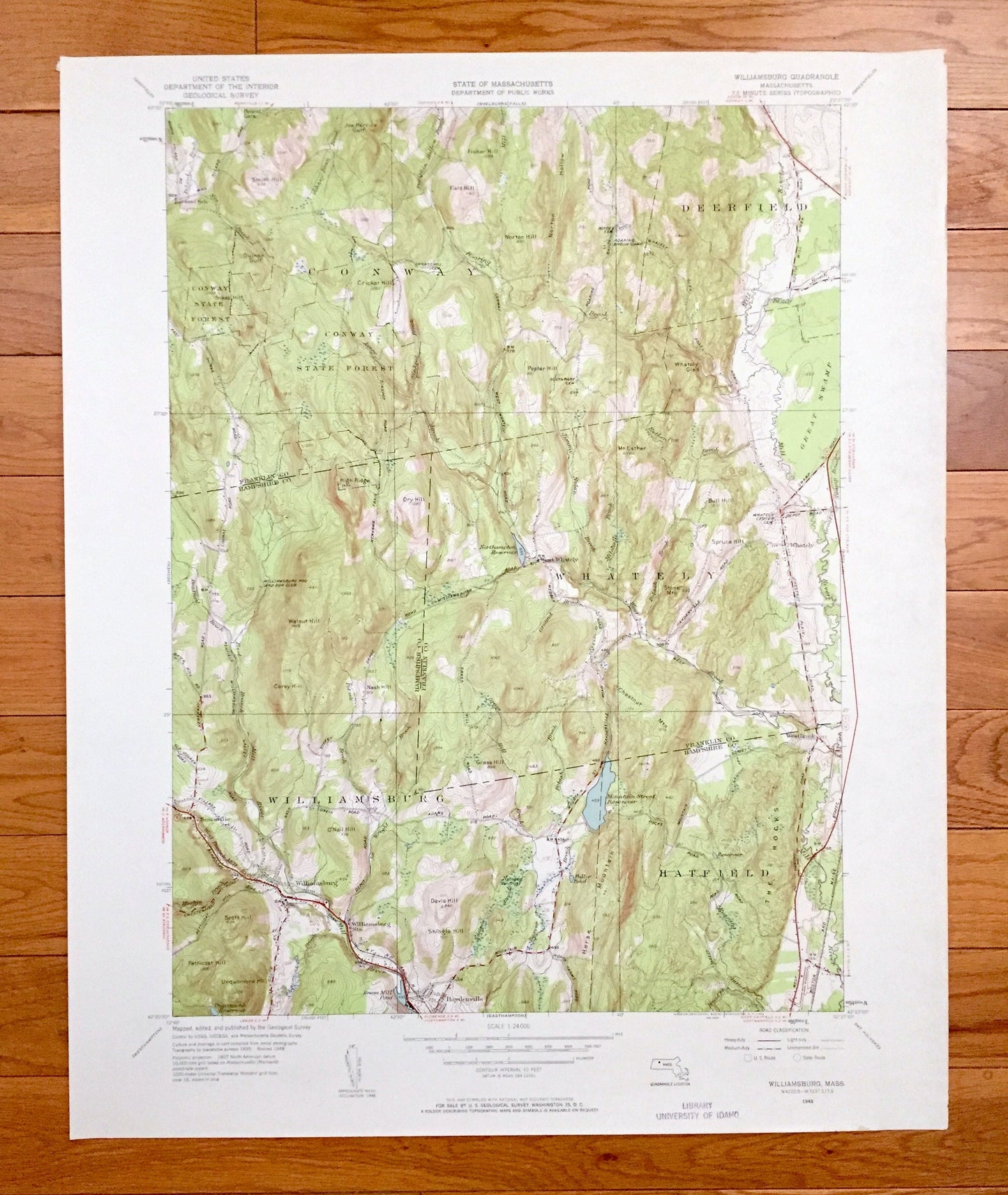
Antique Williamsburg, Massachusetts 1948 US Geological Survey Topographic Map – Hampshire, Franklin County, Conway, Deerfield, Hatfield, MA
Antique Williamsburg, Massachusetts 1948 US Geological Survey Topographic Map – Hampshire, Franklin County, Conway, Deerfield, Hatfield, MA
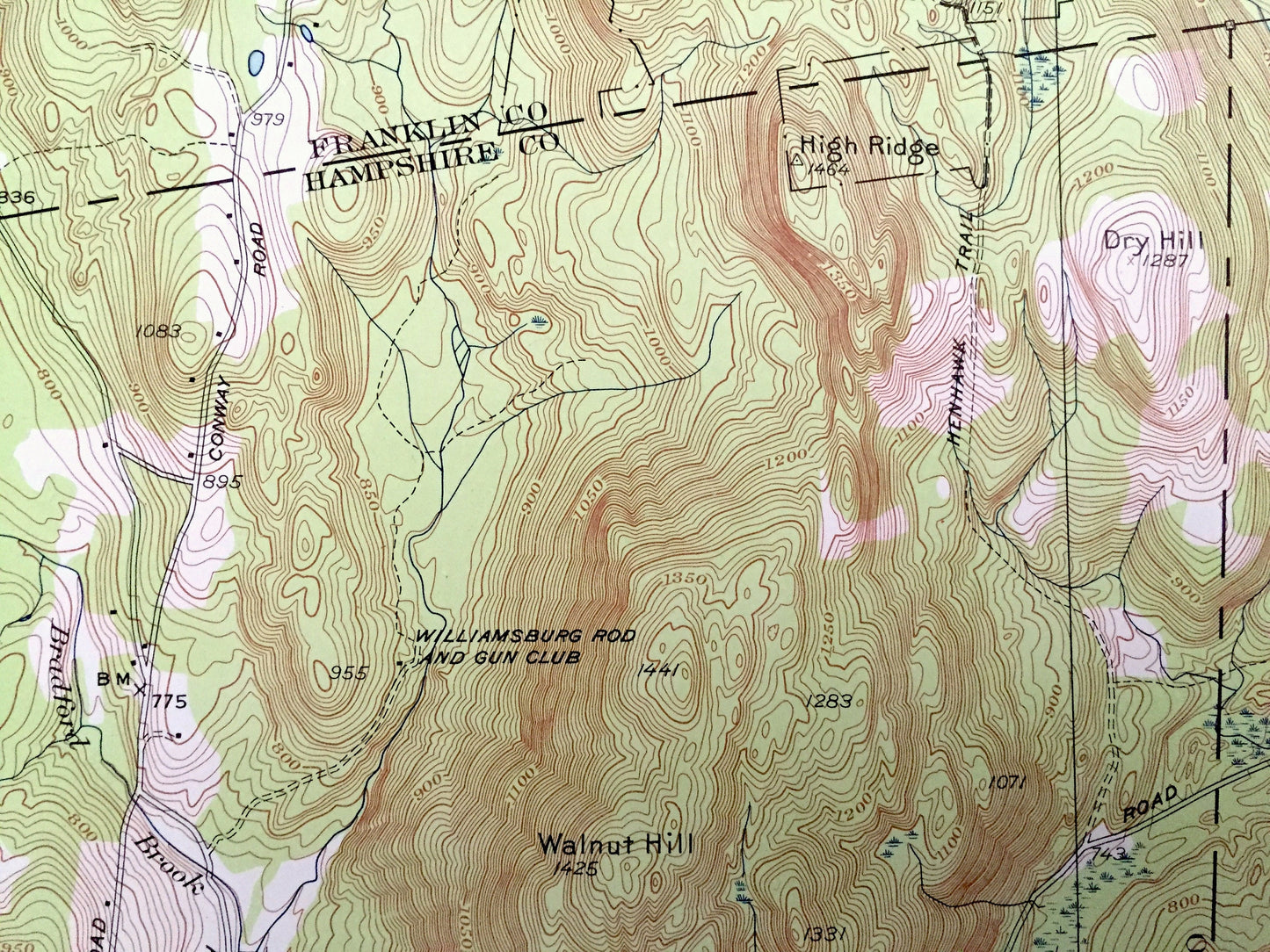
Beautiful, antique map of Williamsburg, Massachusetts and surrounding Hampshire County and Franklin County areas. This is an authentic 1948 edition, 1958 print from the U.S. Geological Survey and NOT a computer reproduction.
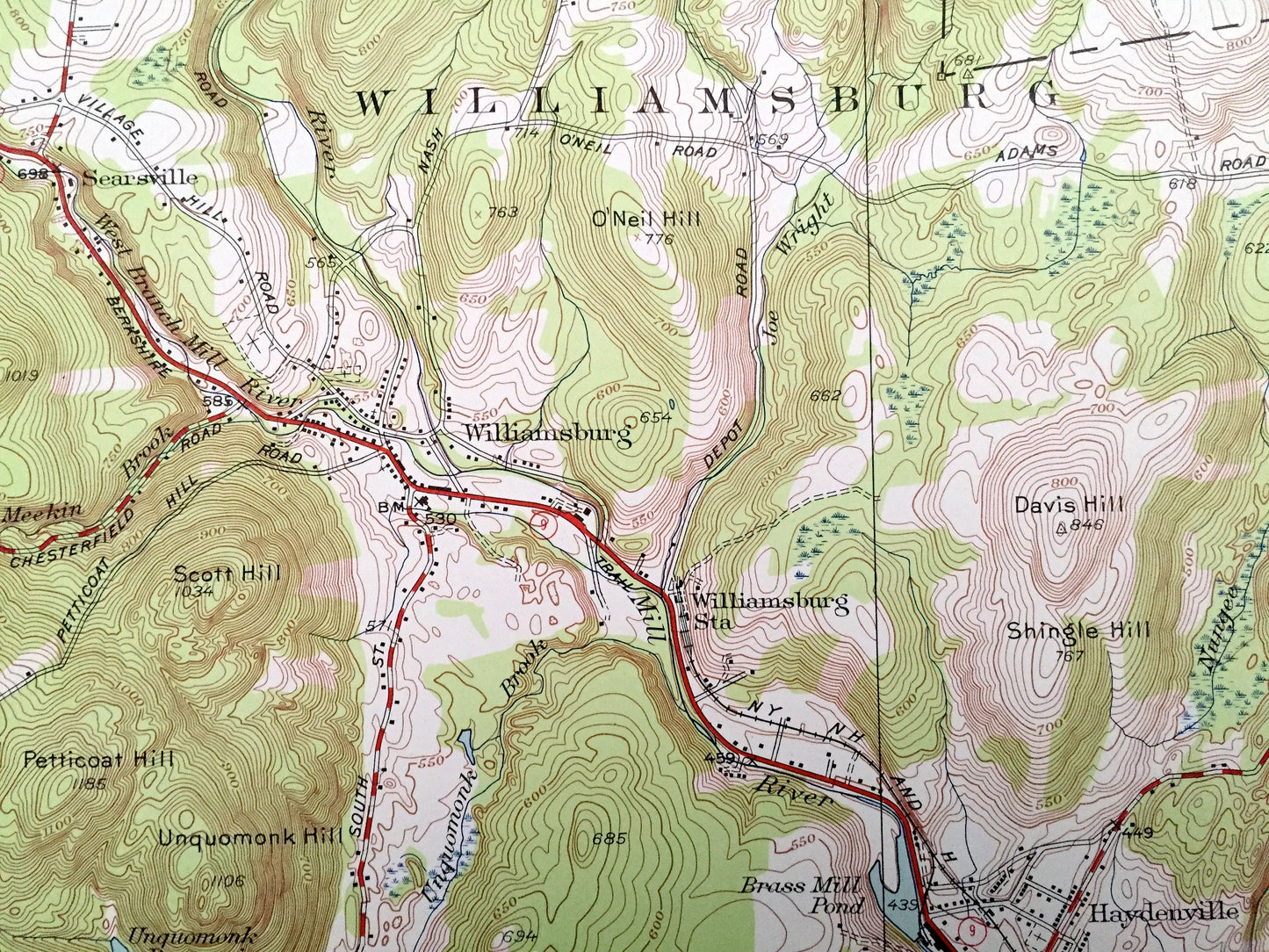
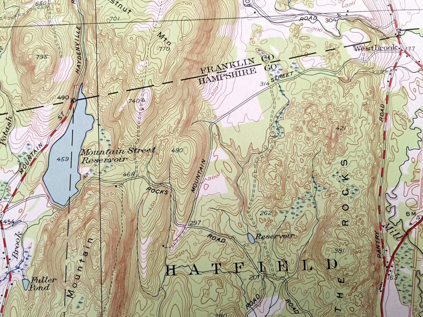
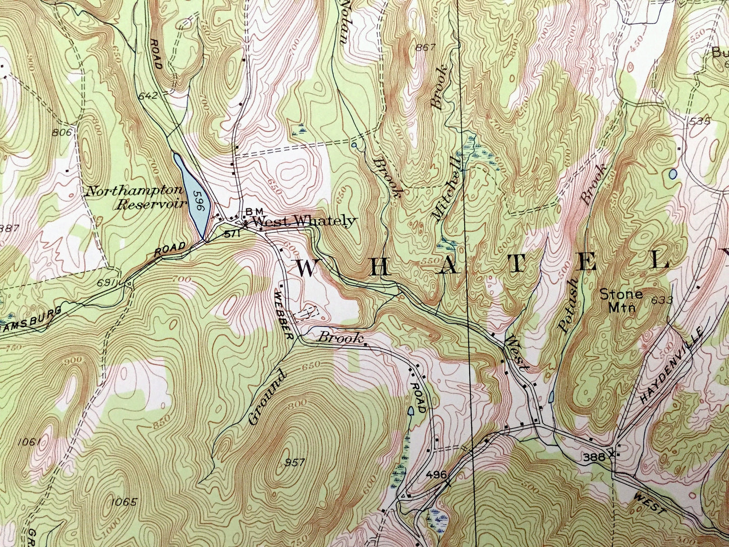
See what Massachusetts looked like over 70 years ago. Lots of intricate details and geological contours. Map even has little squares for every house that existed at the time. The USGS cartographers were very thorough back then!
Perfect for the historian, map-lover, the curious or just as a conversation starter. Wonderful and rare. Vintage maps such as these make great gifts.
Edition of 1948, printed 1958
Dimensions: 22" width x 27" height
----
Features
Cities & Towns: Conway, Deerfield, Whately, Hatfield, Searsville, West Whately, Haydenville, Westbrook.
Points of Interest: Conway State Forest, Williamsburg Rod and Gun Club, Roaring Brook Camp, The Rocks, Smith Hill, Cricket Hill, Fisher Hill, Norton Hill, Whately Glen, Dry Hill, Mt Esther, O’Neil Hill, Grass Hill, Shingle Hill, Northampton Reservoir, Mountain Street Reservoir, Unquomonk Reservoir, Mill River, Roaring Brook, Beaver Brook, Johnny Bean Brook, and many more hills, streams, ponds, houses, schools, railroads, churches and roads.
Condition: Very Good Vintage condition, commensurate with age. This map is in great shape for being over 60 years old. Has subtle edge-wear and spots of discoloration, all of which will read as character when framed.
----
We will happily adjust shipping price for multiple purchases. Maps are rolled up and shipped in sturdy mailing tubes, never folded.
Couldn't load pickup availability
Share