My Store
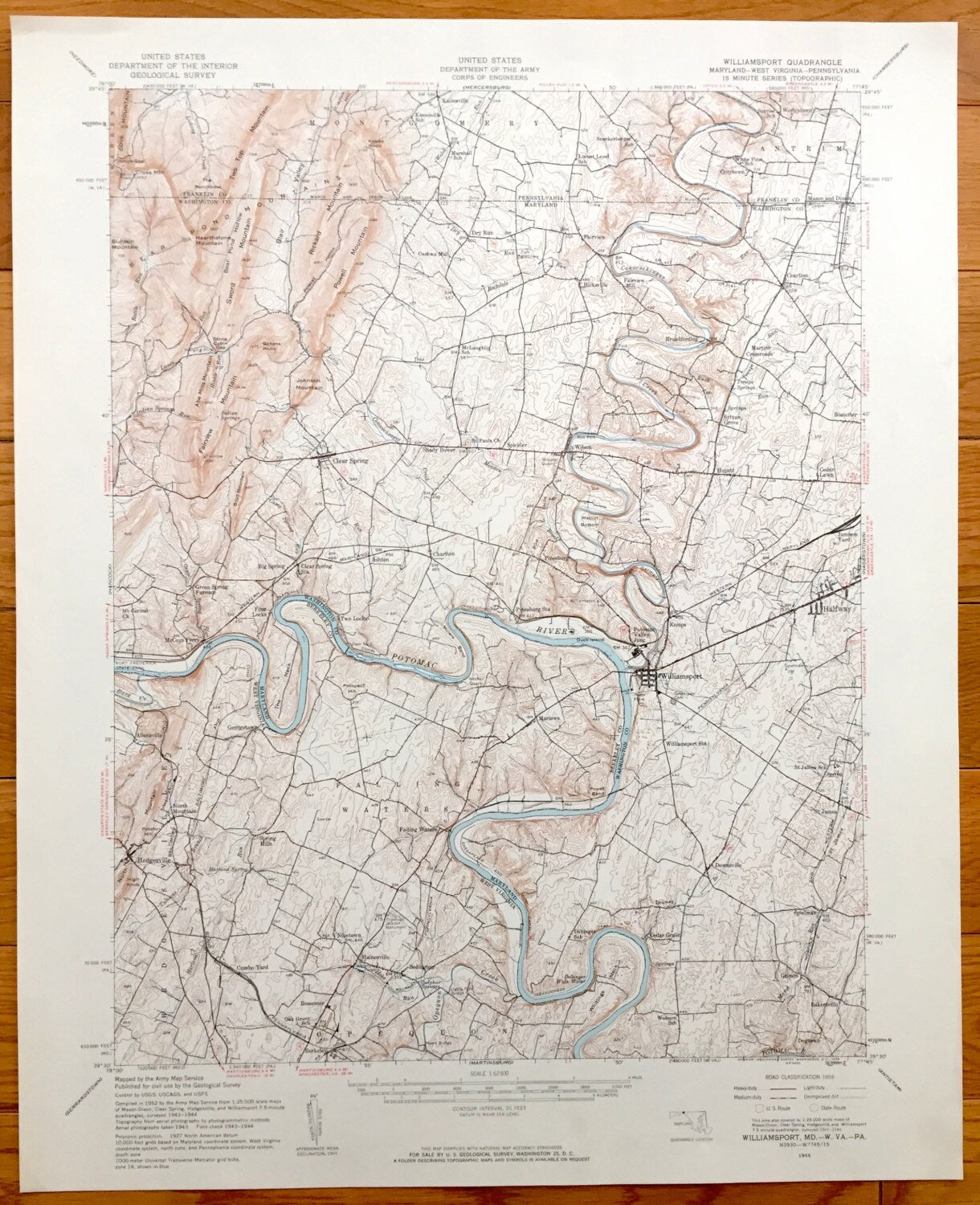
Antique Williamsport, Maryland 1944 US Geological Survey Topographic Map – Halfway, Clear Spring, Hedgesville West Virginia Potomac River MD
Antique Williamsport, Maryland 1944 US Geological Survey Topographic Map – Halfway, Clear Spring, Hedgesville West Virginia Potomac River MD
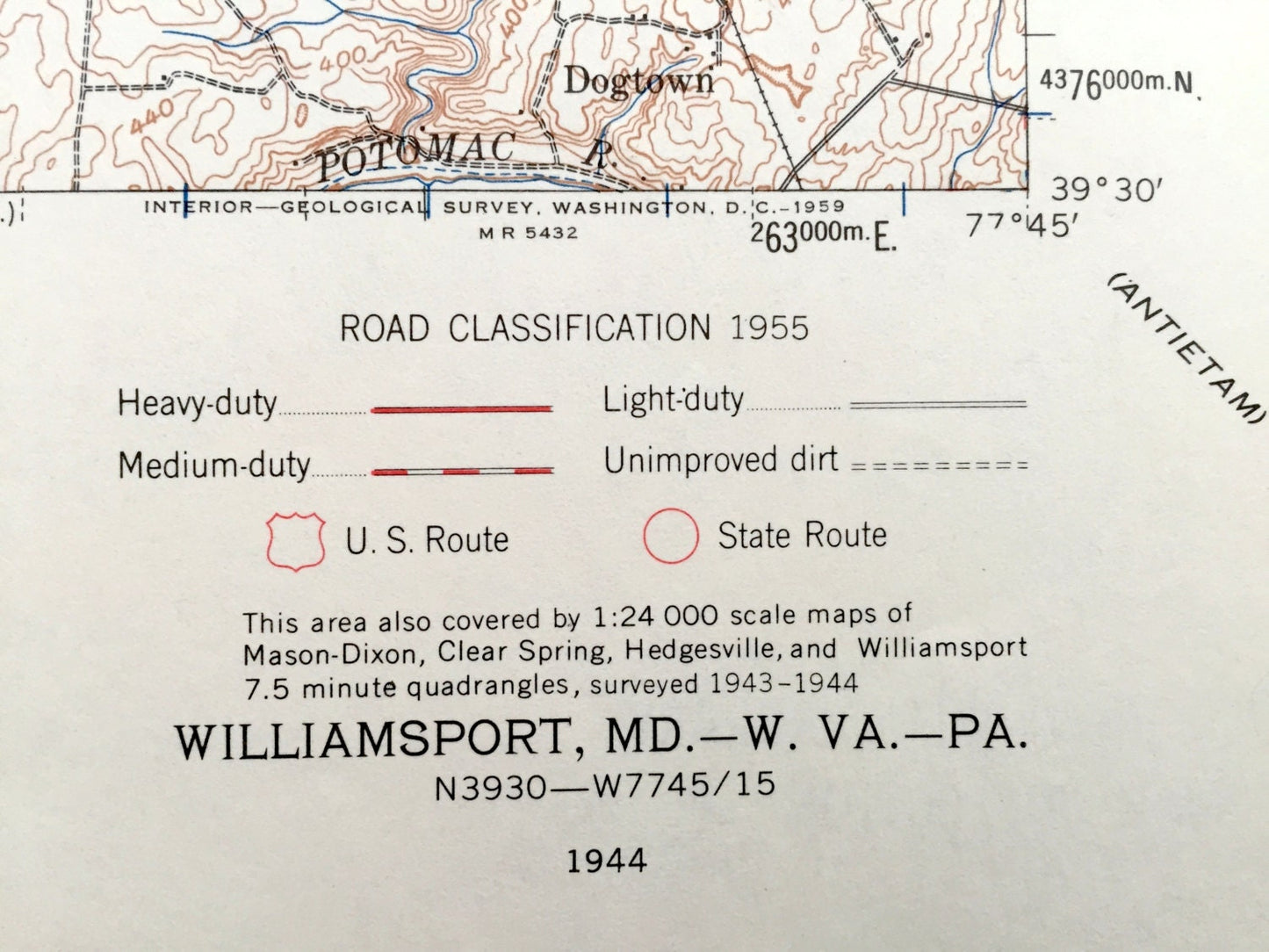
Beautiful, antique map of Williamsport, Maryland and surrounding areas of Washington County, Maryland, Berkeley County, West Virginia and Franklin County, Pennsylvania. This is an authentic 1944 print from the U.S. Geological Survey and NOT a computer reproduction.
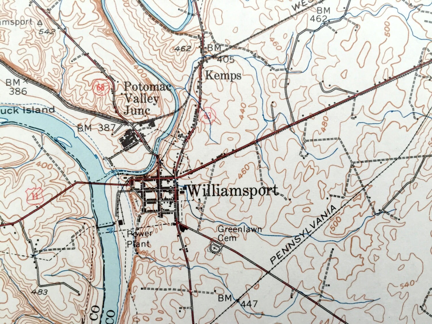
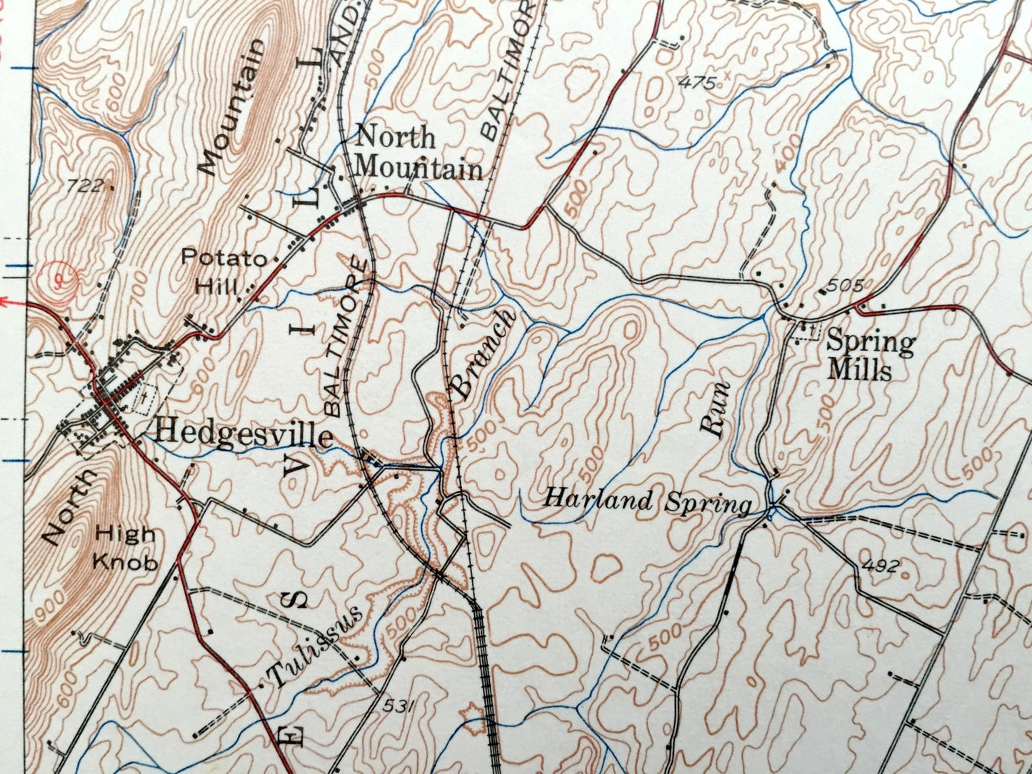
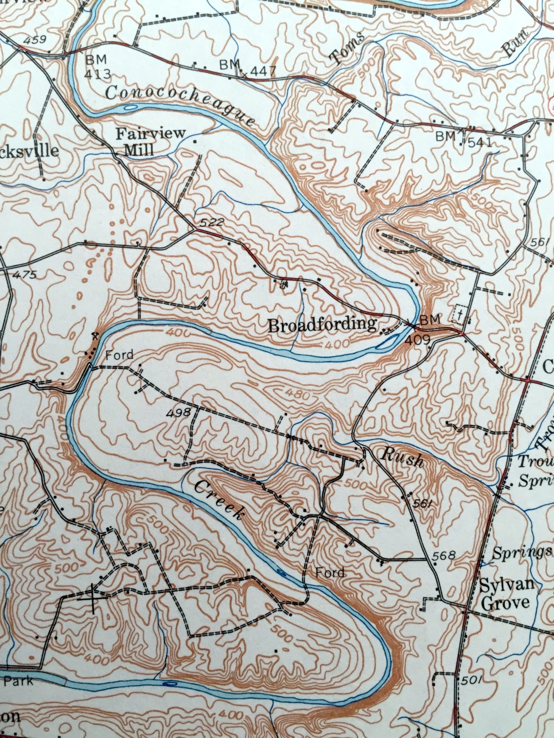
See what Williamsport on the Potomac looked like over 75 years ago. Lots of intricate details and geological contours. Map even has little squares for every house that existed at the time. The USGS cartographers were very thorough back then!
Perfect for the historian, map-lover, the curious or just as a conversation starter. Wonderful and rare. Vintage maps such as these make great gifts.
Edition of 1944, printed 1944
Dimensions: 17" width x 21" height
----
Features
Cities & Towns: MARYLAND: Clear Spring, McCoys Ferry, Big Spring, Four Locks, Dry Run, Spickler, Shady Bower, Charlton, Ashton, Two Locks, Hicksville, Wilson, Broadfording, Fairview, Pinesburg, Potomac Valley Junction, Kemps, Williamsport, Huyett, Sylvan Grove, Martins Crossroads, Cearfoss, Bostetter, Cedar Lawn, Jamison Yard, Halfway, St. James, Cedar Grove, Spielman, Grimes, Bakersville, Dogtown, Downsville
WEST VIRGINIA: Allensville, Georgetown, Marlowe, North Mountain, Hedgesville, Spring Mills, Falling Waters, Cumbo Yard, Nipetown, Hainesville, Bedington, Bessemer, Berkeley.
PENNSYLVANIA: Montgomery, Antrim, Kasiesville, Worleytown, Cozytown.
Points of Interest: Potomac River, Mason-Dixon Line, Conocheague Creek, Bear Pond Mountain, Fairview Mountain, Sword Mountain, Blair Valley, Rickard Mountain, Abe Mills Mountain, Cove Mountain, Boyd Mountain, Bullskin Mountain, North Mountain, Baltimore & Ohio Railroad, Fort Frederick State Park, Stone Cabin Gap, Hanging Rock, Gilhens Knob, Indian Springs, Hearthstone Mountain, Kasies Knob, Potato Hill, Lights Ford Bridge, High Germany, and lots more hills, mountains, creeks, towns, schools, churches and roads.
Condition: Very Good Vintage condition, commensurate with age. This map is in great shape for being over 75 years old. Has light wear but this will add to vintage character when framed.
----
We will happily adjust shipping price for multiple purchases. Maps are rolled up and shipped in sturdy mailing tubes, never folded.
Couldn't load pickup availability
Share