My Store
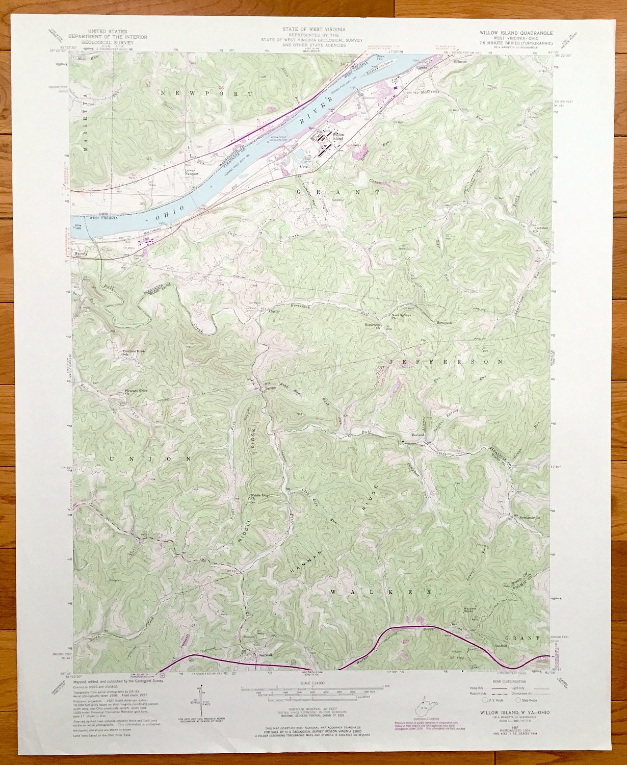
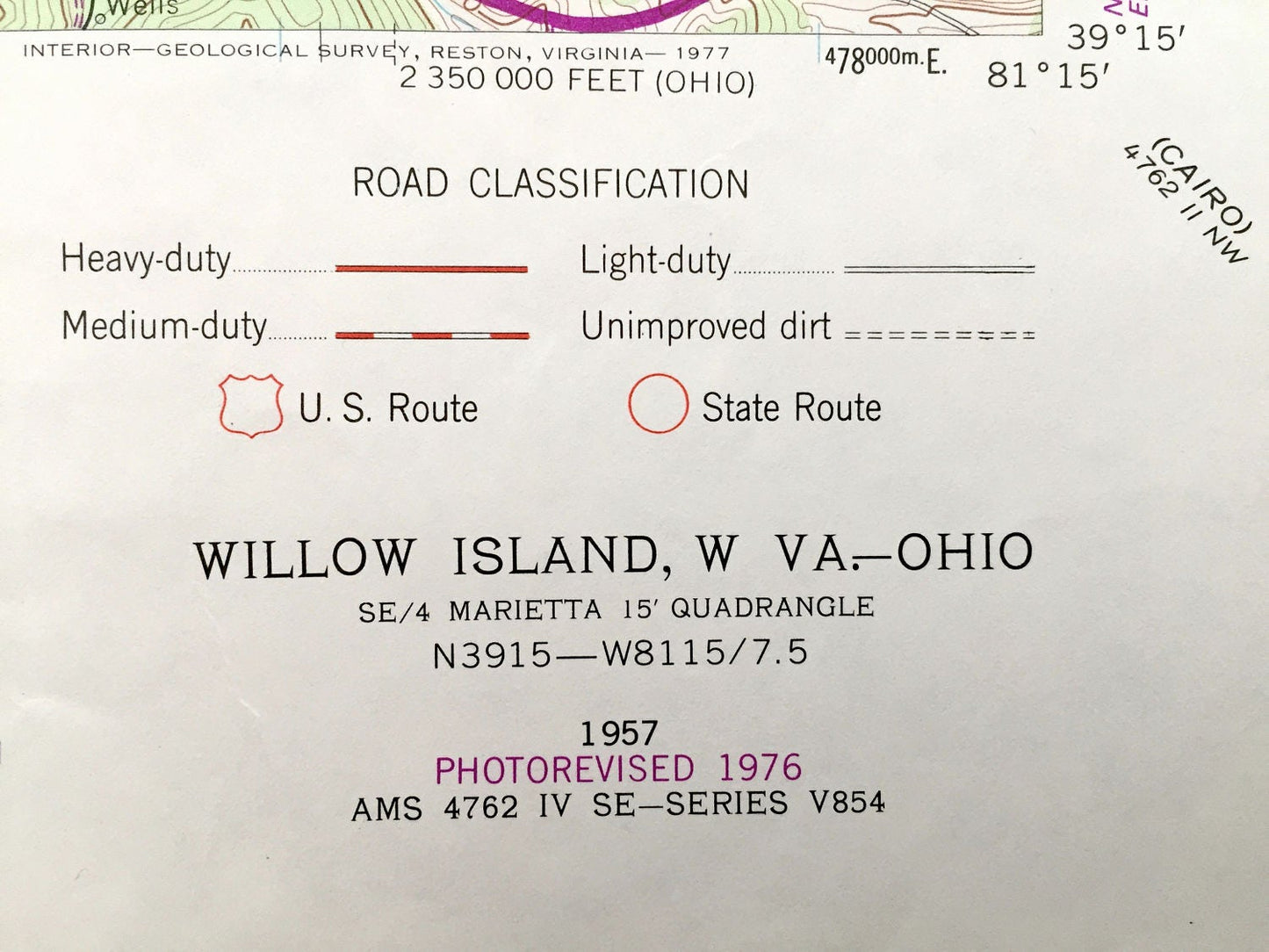
Antique Willow Island, West Virginia & Newport, Ohio 1957 US Geological Survey Topographic Map – Jefferson, Walker, Union, Grant, Marietta
Antique Willow Island, West Virginia & Newport, Ohio 1957 US Geological Survey Topographic Map – Jefferson, Walker, Union, Grant, Marietta
Beautiful, antique map of Grant, Jefferson, Walker, Union, and Willow Island, West Virginia also including Newport, Ohio. This is an authentic 1976 print of 1957 survey data from the U.S. Geological Survey and NOT a computer reproduction.
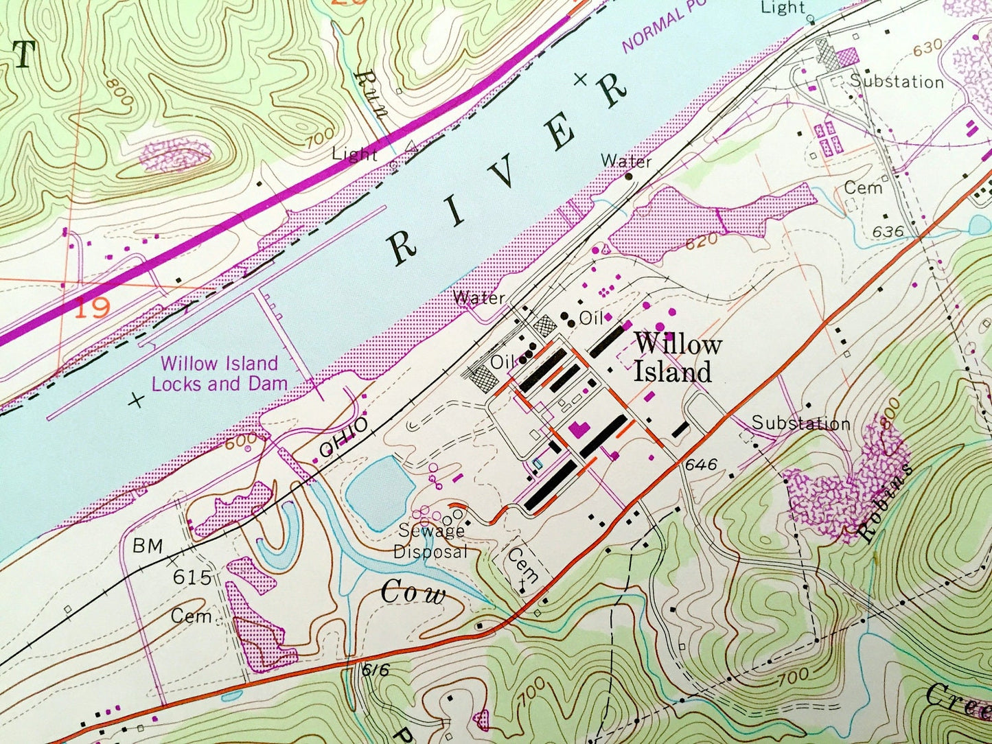
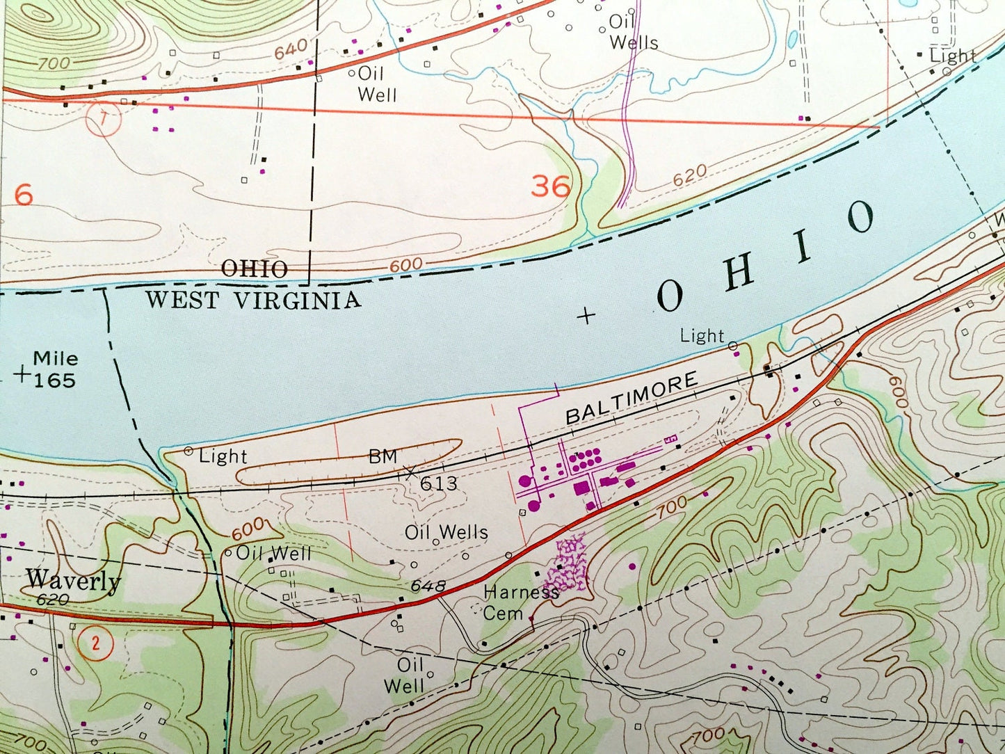
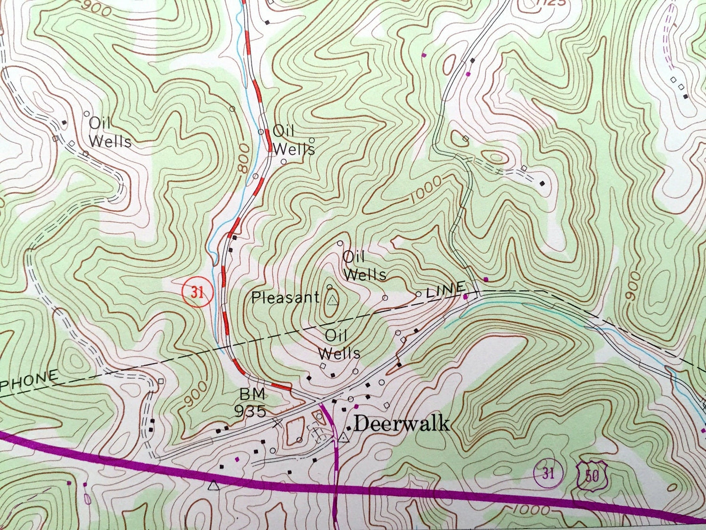
See what Pleasants and Wood Counties of West Virginia and Washington County of Ohio looked like 60 years ago. Lots of intricate details and geological contours. Map even has little squares for every house that existed at the time. The USGS cartographers were very thorough back then!
Perfect for the historian, map-lover, the curious or just as a conversation starter. Wonderful and rare. Vintage maps such as these make great gifts.
Edition of 1957, printed 1976
Dimensions: 22" width x 27" height
----
Features
Cities & Towns: WEST VIRGINIA: Waverly, Union, Walker, Grant, Jefferson, Horseneck, Grant, Willow Island, Eureka, Belmont, Newlandsville, Cluster.
OHIO: Newport, Marietta, Lower Newport.
Points of Interest: Ohio River, Pumpkin Knob School, Pleasant Grove Church, Middle Ridge,Hannan Ridge, Volcano Oil Field, Buzzard Rocks, Sulpher Spring, Horseneck Church, Baltimore and Ohio Railroad, and lots more streams, churches, houses, and roads.
Condition: Very Good condition, commensurate with age. This map is in incredible shape for being almost 45 years old.
----
We will happily adjust shipping price for multiple purchases. Maps are rolled up and shipped in sturdy mailing tubes, never folded.
Couldn't load pickup availability
Share