My Store
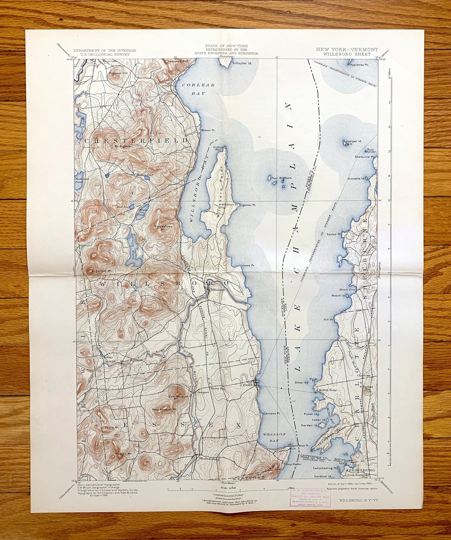
Antique Willsboro, New York 1895 US Geological Survey Topographic Map – Lake Champlain, Adirondacks, Essex, Chittenden Burlington Addison NY
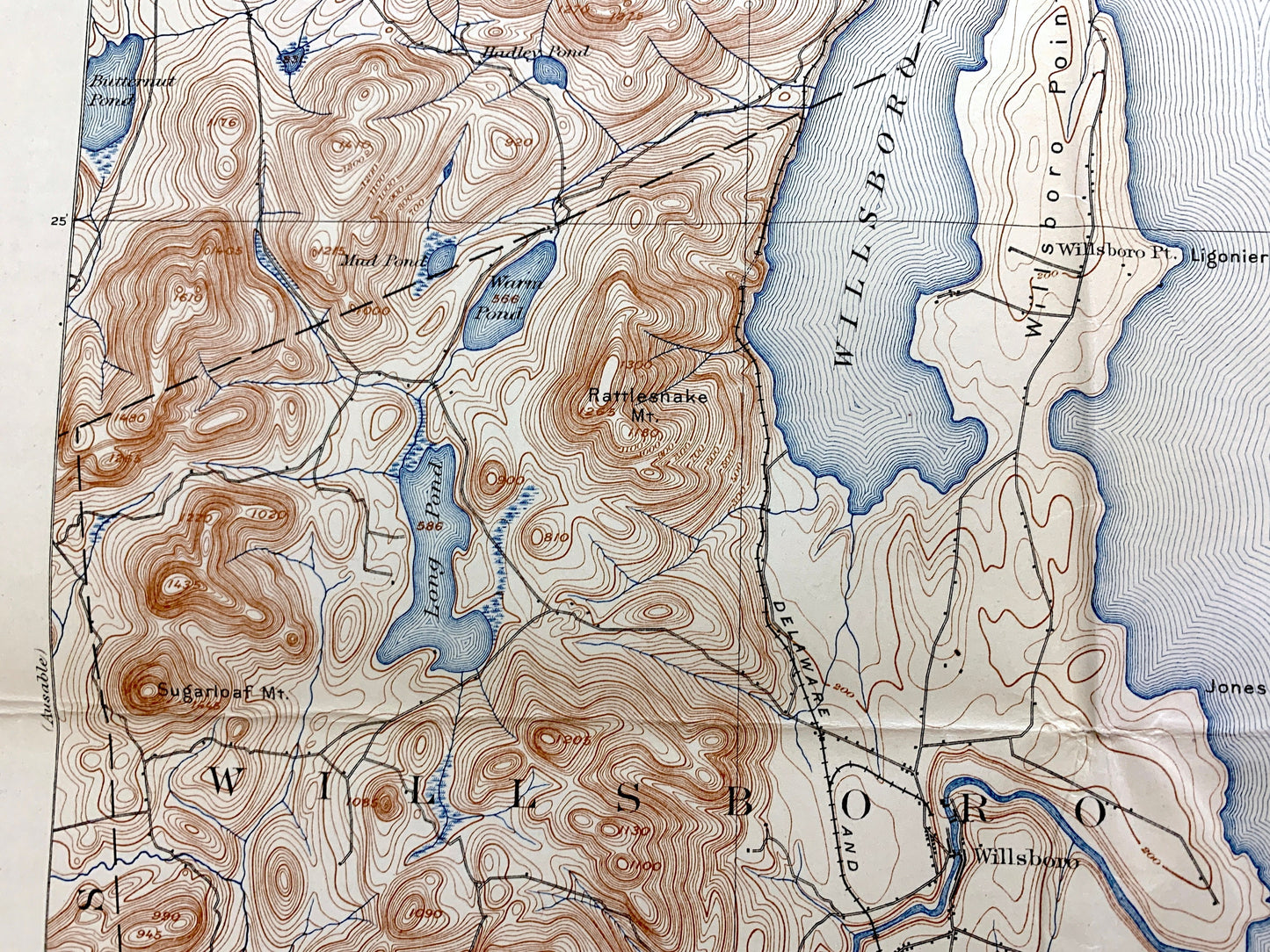
Antique Willsboro, New York 1895 US Geological Survey Topographic Map – Lake Champlain, Adirondacks, Essex, Chittenden Burlington Addison NY
Beautiful, antique map of Willsboro, Vermont on Lake Champlain, including Charlotte and Shelburne, Vermont and Essex County, New York. This is an authentic 1895 edition, 1924 print from the U.S. Geological Survey and NOT a computer reproduction.
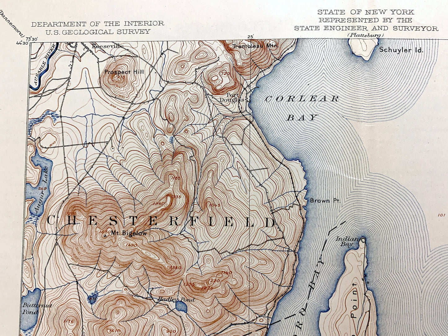
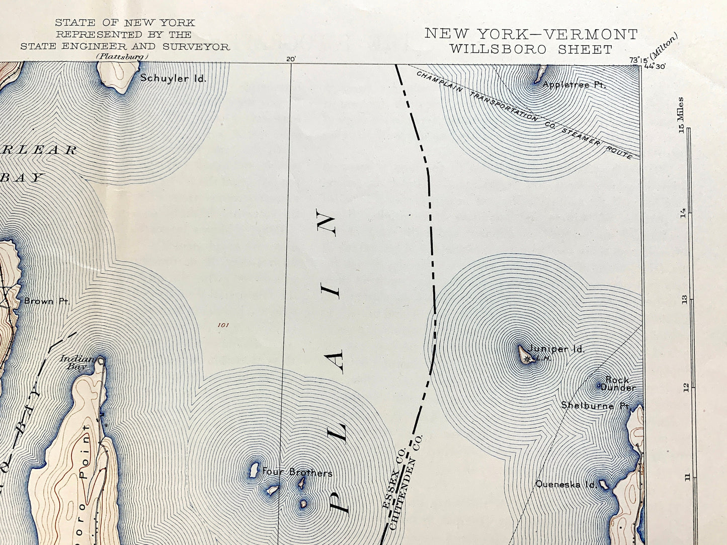
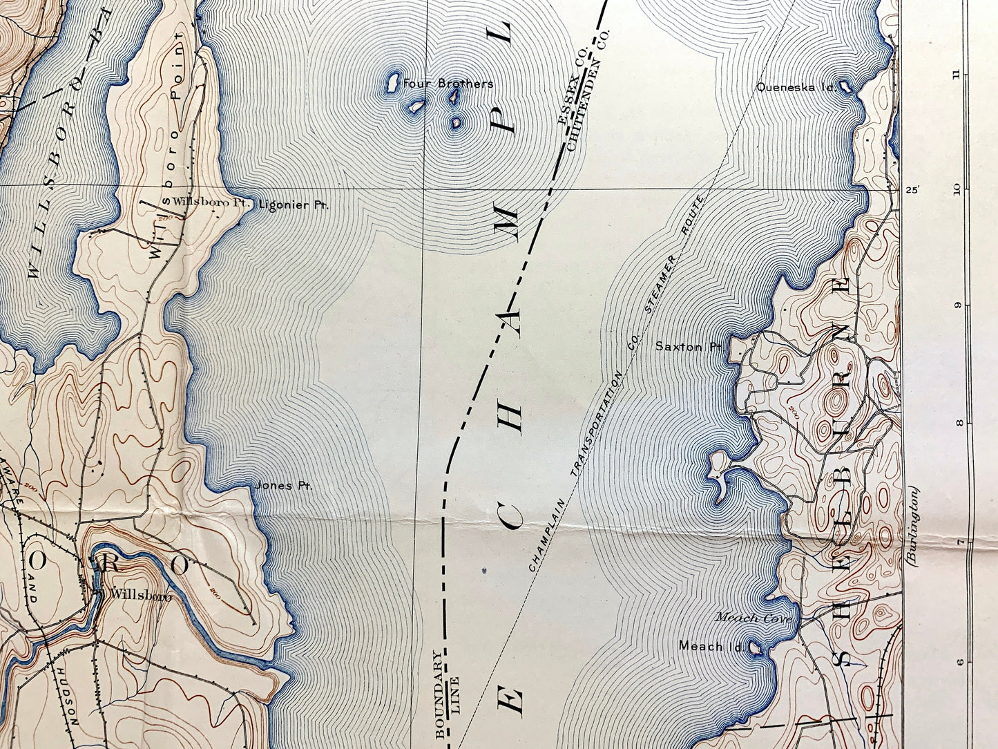
See what New York and Vermont looked like 120 years ago. Lots of intricate details and geological contours. Map even has little squares for every house that existed at the time. The USGS cartographers were very thorough back then! On the back is a description of topographic symbols and map guide.
Perfect for the historian, map-lover, the curious or just as a conversation starter. Wonderful and rare. Vintage maps such as these make great gifts.
Edition of 1895, printed 1924
Dimensions: 16 1/2" width x 20" height
----
Features
Cities & Towns: NEW YORK: Chesterfield, Willsboro, Lewis, Essex, Westport, Keeseville, Port Douglass, Willsboro Point, Reber, Craterclub, Whallonsburg.
VERMONT: Burlington, Shelburne, Charlotte, Ferrisburg, Cedar Beach.
Points of Interest: Clinton County, Essex County, Chittenden County, Addison County, Lake Champlain, Adirondack State Park, Willsboro Bay, Whallon Bay, Appletree Bay, Corlear Bay, Town Farm Bay, The Four Brothers, Juniper Island, Garden Island, Schuyler Island, Willsboro Point, Thompson Point, Quaker Smith Point, Orchard Point, Queneska Island, Appletree Point, Augur Lake, Butternut Pond, Long Pond, Highlands Forge Lake, Bouquet River, Drake Mountain, Rattlesnake Mountain, Sugarloaf Mountain, North Bouquet Mountain, Split Rock Mountain, Payne Mountain, Whipple Mountain and many more islands, brooks, coves, towns, houses, schools, ponds, hills and mountains.
Condition: Good Vintage condition, commensurate with age. This map is in great shape for being about 100 years old. Map has light edge-wear, toning, stamp in margin, and folds as-issued, but these will flatten easily, and all of which will read as vintage character when framed.
----
We will happily adjust shipping price for multiple purchases. Maps are rolled up and shipped in sturdy mailing tubes, never folded.
Couldn't load pickup availability
Share