My Store
Antique Wilmington, Delaware 1920 US Geological Survey Topographic Map – Newcastle County, Delaware City, Christiana, Brandywine, Newport DE
Antique Wilmington, Delaware 1920 US Geological Survey Topographic Map – Newcastle County, Delaware City, Christiana, Brandywine, Newport DE
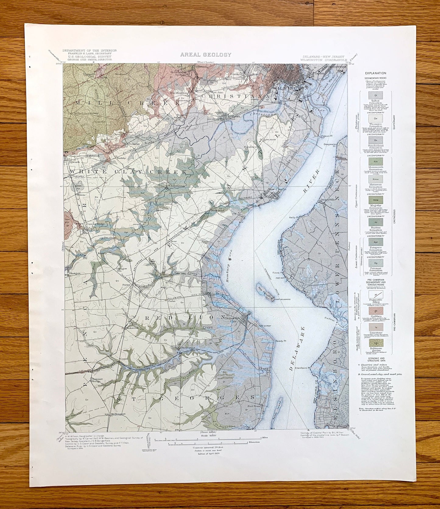
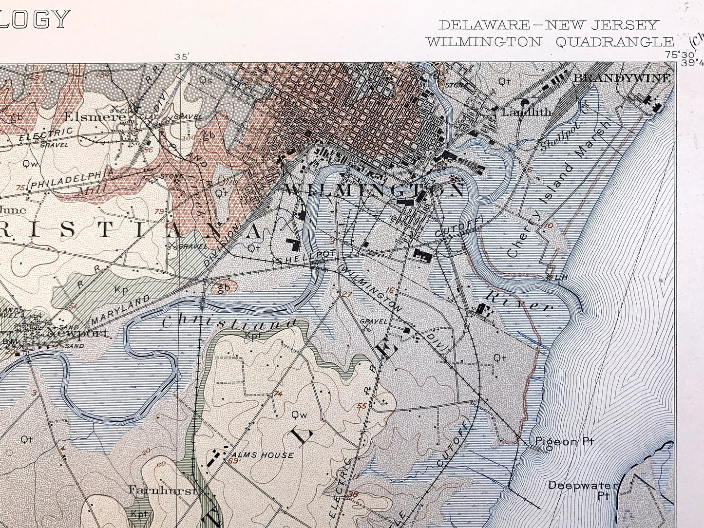
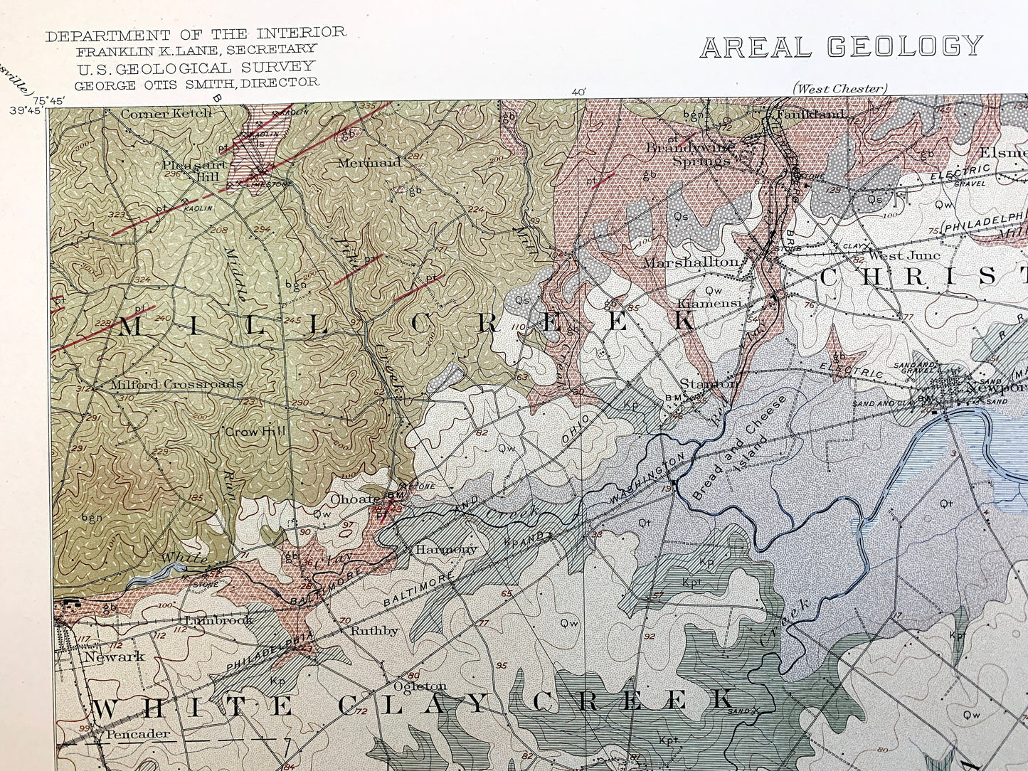
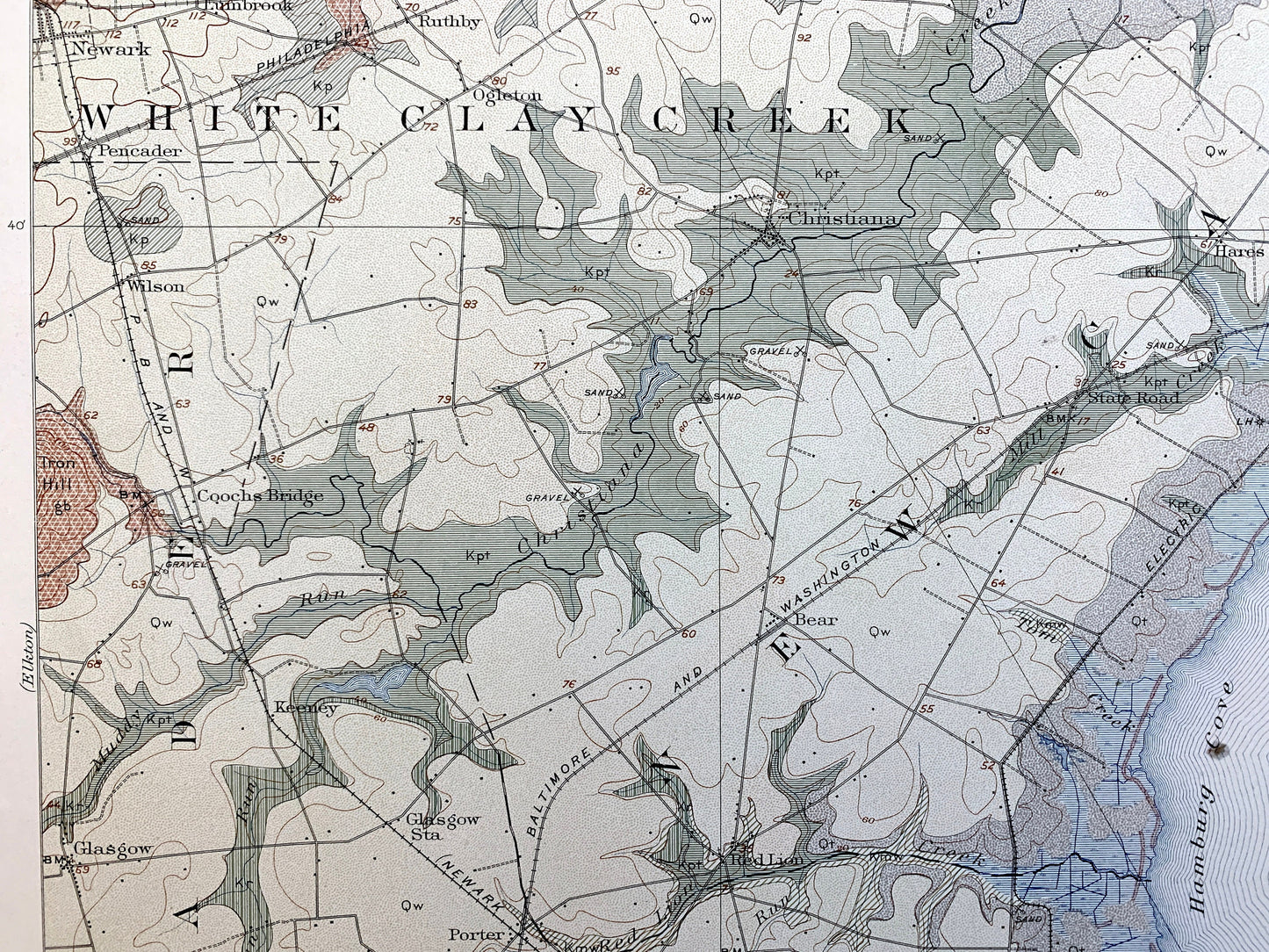
Beautiful, antique map of Wilmington, Delaware and Newcastle County. This is an authentic 1920 edition, 1920 print from the U.S. Geological Survey and NOT a computer reproduction. It is from a Geologic Atlas folio.
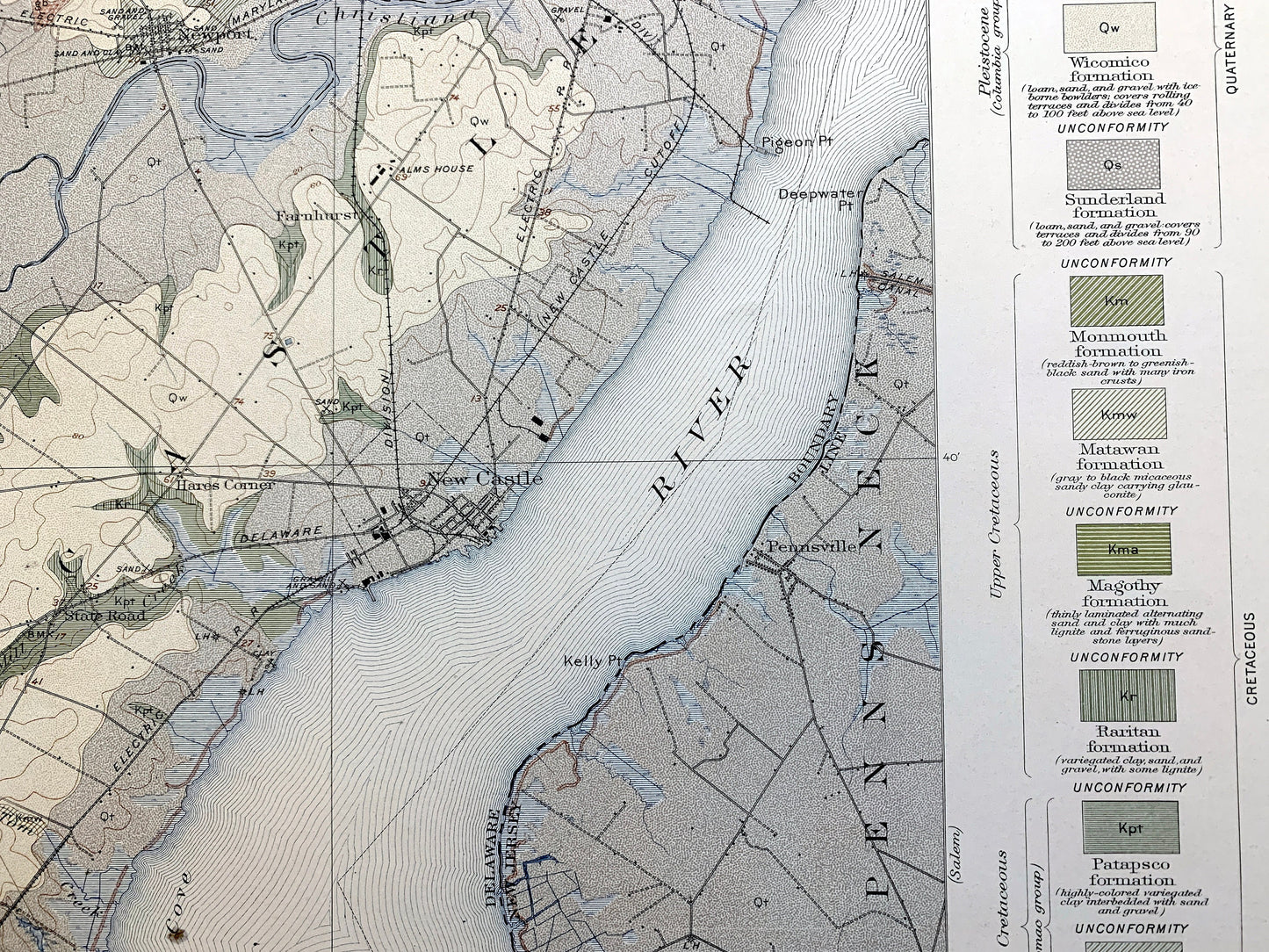
See what coastal Newcastle County and the Delaware River looked like more than 100 years ago. Lots of intricate details and geological contours. Map even has little squares for every house that existed at the time. The USGS cartographers were very thorough back then! This is one of the rare maps where the topographic symbols and map guide are on the front.
Perfect for the historian, map-lover, the curious or just as a conversation starter. Wonderful and rare. Vintage maps such as this make great gifts.
Edition of 1920, printed 1920
Dimensions: 18 1/2" width x 22" height
----
Cities & Towns: DELAWARE: Wilmington, Mill Creek, White Clay Creek, Christiana, Pencader, Corner Ketch, Pleasant Hill, Mermaid, Brandywine Springs, Faulkland, Elsmere, Milford Crossraods, Choate, Newark, Lumbrook, Marshallton, Kiamensi, West June, Harmony, Ruthby, Stanton, Newport, Landlith, Brandywine, Farnhurst, Wilson, Coochs Bridge, Christiana, Hares Corner, Newcastle, State Road, Keeney, Glasgow, Red Lion, State Road, Porter, Corbit, Delaware City, Kirkwood, Canal, St. Georges, Summit Bridge, Mt. Pleasant, Port Penn, Bear.
NEW JERSEY: Lower Penns Neck, Elsinboro, Pennsville, Reybold.
Points of Interest: Delaware River, Christiana River, Chesapeake and Delaware Canal, Cherry Island Marsh, Bread and Cheese Island, Red Lion Creek, Clay Creek, Pigeon Point, Hamburg Cove, Pea Patch Island, Reedy Island, Fort Dupont, Reedy Point, Philadelphia Baltimore and Washington Railroad, Iron Hill, Crow Hill, Salem Creek, Kelly Point, Scott Run, Dragon Creek, and many more roads, creeks, rivers, train tracks, schools, churches and hills.
Condition: Very Good Vintage condition, commensurate with age. This map is in incredible shape for being more 100 years old. Has some light wear and staple holes in the margin, but this will add to the real vintage character when framed.
----
We will happily adjust shipping price for multiple purchases. Maps are rolled up and shipped in sturdy mailing tubes, never folded.
Couldn't load pickup availability
Share