My Store
Antique Windsor Locks, Connecticut 1946 US Geological Survey Topographic Map – East Granby, Bloomfield, Suffield, Hayden, Hartford County CT
Antique Windsor Locks, Connecticut 1946 US Geological Survey Topographic Map – East Granby, Bloomfield, Suffield, Hayden, Hartford County CT
Beautiful, antique map of Windsor, Windsor Locks, Connecticut and surrounding area. This is an authentic 1946 print of 1946 data from the U.S. Geological Survey and NOT a computer reproduction.
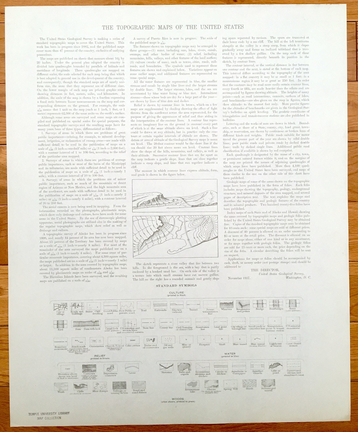
See what Windsor Locks and surrounding area looked like over 75 years ago. Lots of intricate details and geological contours. Map even has little squares for every house that existed at the time. The USGS cartographers were very thorough back then! On the back is a description of topographic symbols and map guide.
Perfect for the historian, map-lover, the curious or just as a conversation starter. Wonderful and rare. Vintage maps such as these make great gifts.
Edition of 1946, printed 1946
Dimensions: 17" width x 21" height
----
Features
Cities & Towns: Suffield, West Suffield, Windsor Locks, Windsor, East Granby, Hayden, North Bloomfield, Poquonock, Rainbow.
Points of Interest: West Suffield Mountain, Suffield High School, Buffalo Academy, Boston Neck School, Bradley Field U.S. Military Reservation, Hatchett Hill, Farmington River, Elm Grove School, Silver Birch Lake, New York New Haven and Hartford Railroad, Old Newgate Prison, and lots more hills, mountains, creeks, towns, schools, churches, valleys, roads and train tracks.
Condition: Very Good Vintage condition, commensurate with age. This map is in great shape for being over 75 years old.
----
We will happily adjust shipping price for multiple purchases. Maps are rolled up and shipped in sturdy mailing tubes, never folded.
Couldn't load pickup availability
Share