My Store
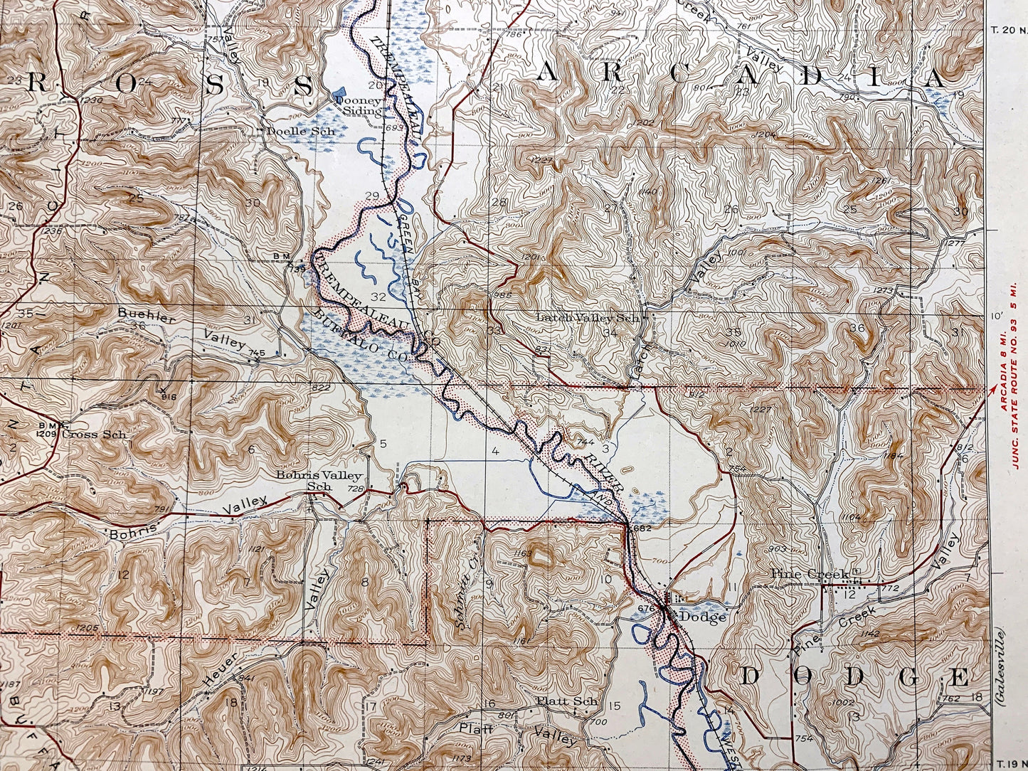
Antique Winona, Minnesota, Wisconsin 1937 US Geological Survey Topographic Map – Trempealeau, Buffalo, Dodge County, Arcadia, Waumandee, WI
Antique Winona, Minnesota, Wisconsin 1937 US Geological Survey Topographic Map – Trempealeau, Buffalo, Dodge County, Arcadia, Waumandee, WI
Beautiful, antique map of Winona, Minnesota and surrounding Winona County and Buffalo County, Trempealeau County, Wisconsin areas. This is an authentic 1937 edition, 1944 edition from the U.S. Geological Survey and NOT a computer reproduction.
See what Minnesota and Wisconsin looked like more than 85 years ago. Lots of intricate details and geological contours. Map even has little squares for every house that existed at the time. The USGS cartographers were very thorough back then! On the back is a description of topographic symbols and map guide.
Perfect for the historian, map-lover, the curious or just as a conversation starter. Wonderful and rare. Maps such as these make great gifts.
Edition of 1937, printed 1944
Dimensions: 16 1/2" width x 20" height
----
Features
Cities & Towns: Winona, East Winona, Milton, Cross, Eagle, West Prairie, Trempealeau, Buffalo, Dodge, Arcadia, Glencoe, Waumandee, Marshland, Warren, Wilson, Homer, Minnesota City, Bluff Siding, Pine Creek, West Prairie, Fountain City.
Points of Interest: Winona County, Buffalo County, Trempealeau County, Mississippi River, Trempealeu River, Buffalo Ridge, Fountain City Ridge, Glencoe Ridge, Buehler Valley, Trout Valley, and lots more hills, creeks, towns, schools, churches, roads and train tracks.
Condition: Good Vintage condition, commensurate with age. This map is in great shape for being 70 years old. Has light wear, foxing and toning, but this will add to vintage character when framed.
----
We will happily adjust shipping price for multiple purchases. Map will be shipped folded to preserve integrity.
Couldn't load pickup availability
Share