My Store
Antique Wolcott, New York 1953 US Geological Survey Topographic Map – Wayne County, Huron, Rose, Butler, Galen, Savannah, Furnace Village NY
Antique Wolcott, New York 1953 US Geological Survey Topographic Map – Wayne County, Huron, Rose, Butler, Galen, Savannah, Furnace Village NY
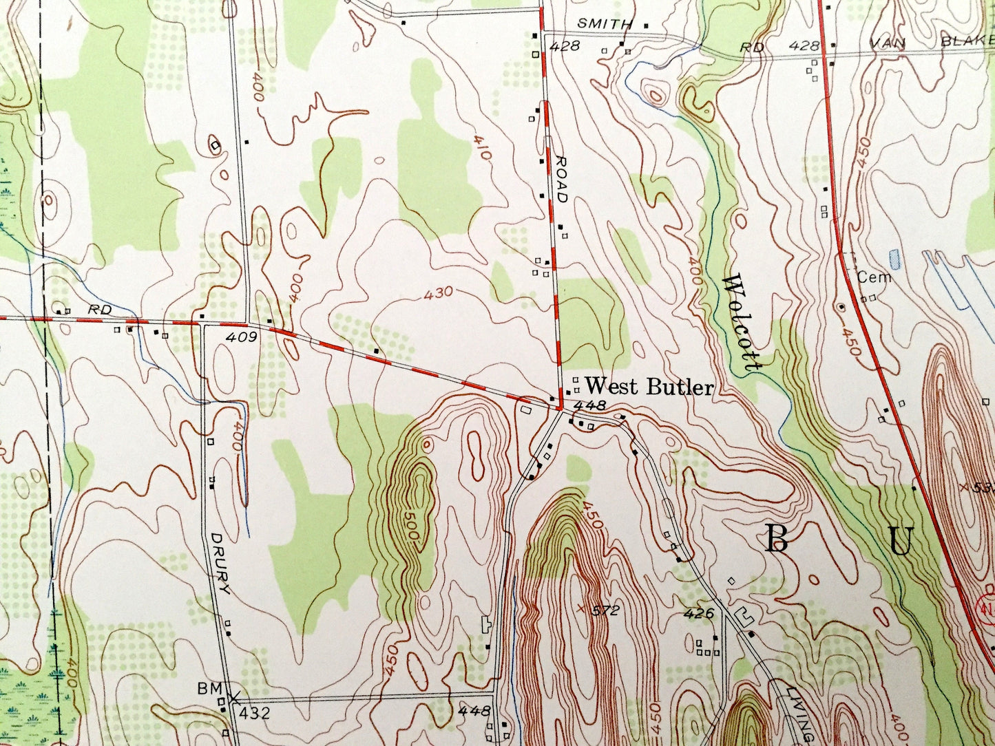
Beautiful, antique map of North Wolcott, New York and surrounding Wayne County area. This is an authentic 1953 edition, 1955 print from the U.S. Geological Survey and NOT a computer reproduction.
See what New York looked like over 65 years ago. Lots of intricate details and geological contours. Map even has little squares for every house that existed at the time. The USGS cartographers were very thorough back then! On the back is a description of topographic symbols and map guide.
Perfect for the historian, map-lover, the curious or just as a conversation starter. Wonderful and rare. Vintage maps such as these make great gifts.
Edition of 1953, printed 1955
Dimensions: 22" width x 27" height
----
Features
Cities & Towns: Rice Mill, Stewart Corners, Sunnyside Mission, Lockwood Corners, Maunders Corners, Pangburn Corners, South Butler, Butler Center, West Butler.
Points of Interest: Pinkney Hill, Tamarack Swamp, Millpond, Mudge Creek, Beaver Creek, Wolcott Creek, Sodus Creek, Black Creek, Butler Creek, and many more hills, streams, ponds, houses, schools, railroads, churches and roads.
Condition: Very Good Vintage condition, commensurate with age. This map is in great shape for being 65 years old. Has light edge-wear and some small tears on the edges, all of which will read as character when framed.
----
We will happily adjust shipping price for multiple purchases. Maps are rolled up and shipped in sturdy mailing tubes, never folded.
Couldn't load pickup availability
Share