My Store
Antique Wolf Point, Montana 1954 US Geological Survey Topographic Map – Poplar, Culbertson, Scobey, Plentywood, Froid Fort Kipp, Peerless MT
Antique Wolf Point, Montana 1954 US Geological Survey Topographic Map – Poplar, Culbertson, Scobey, Plentywood, Froid Fort Kipp, Peerless MT
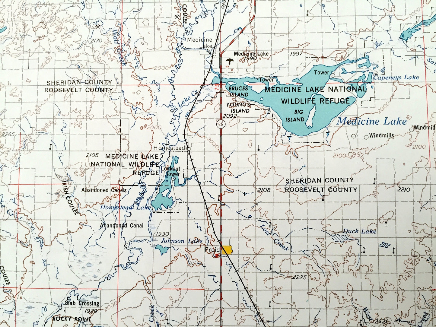
Beautiful, antique map of Wolf Point, Montana and surrounding North Dakota areas. This is an authentic 1954 edition, 1967 print from the U.S. Geological Survey and NOT a computer reproduction.
See what Montana and North Dakota looked like over 65 years ago. Lots of intricate details and geological contours. Map is incredibly large and in the grand 1:250,000 scale. The USGS cartographers were very thorough back then!
Perfect for the historian, map-lover, the curious or just as a conversation starter. Wonderful and rare. Vintage maps such as these make great gifts.
Edition of 1954, printed 1967
Dimensions: 32" width x 22 1/2" height
----
Features
Cities & Towns: MONTANA - Wolf Point, Oswego, Monson, Hanson, Four Buttes, Flaxville, Bredette, Brockton, McCabe, Westby, Poplar, Culbertson, Scobey, Plentywood, Froid, Fort Kipp, Peerless.
NORTH DAKOTA - Stiehl.
Points of Interest: Missouri River, Medicine Lake, Homestead Lake, Capeneys Lake, Goose Lake, Fort Peck Indian Reservation, Medicine Lake National Wildlife Refuge, Bruce Islands, Youngs Island, and lots more hills, mountains, lakes, rivers, creeks, roads, highways and railroads.
Condition: Very Good Vintage condition, commensurate with age. This map is in great shape for being over 50 years old. Has light edge-wear, all of which will read as vintage character when framed.
----
We will happily adjust shipping price for multiple purchases. Maps are rolled up and shipped in sturdy mailing tubes, never folded.
Couldn't load pickup availability
Share