My Store
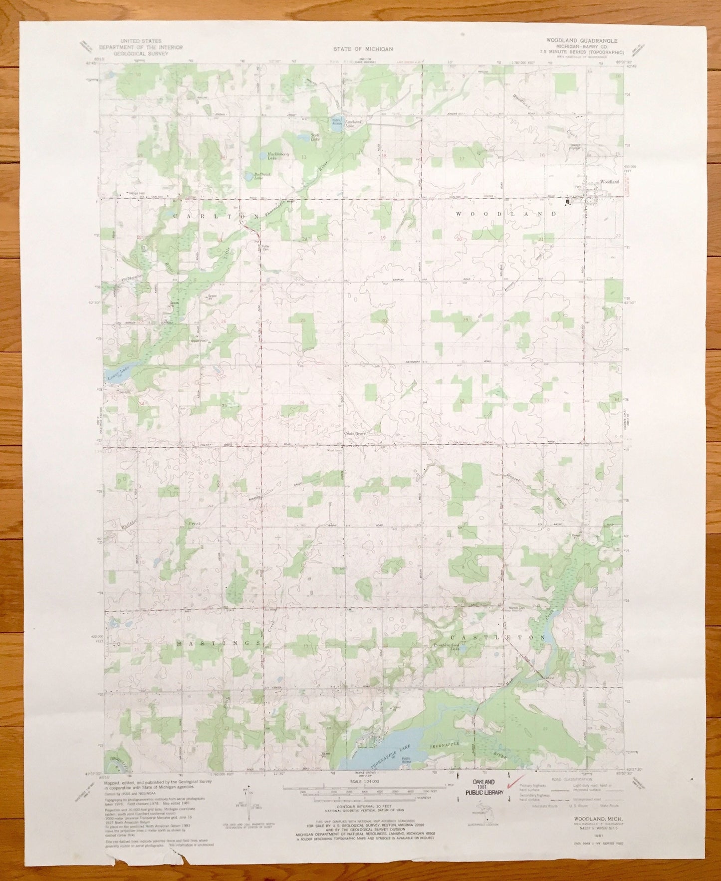
Antique Woodland, Michigan, 1981 US Geological Survey Topographic Map – Barry County, Castleton, Hastings, Carlton, Thornapple Lake, MI
Antique Woodland, Michigan, 1981 US Geological Survey Topographic Map – Barry County, Castleton, Hastings, Carlton, Thornapple Lake, MI
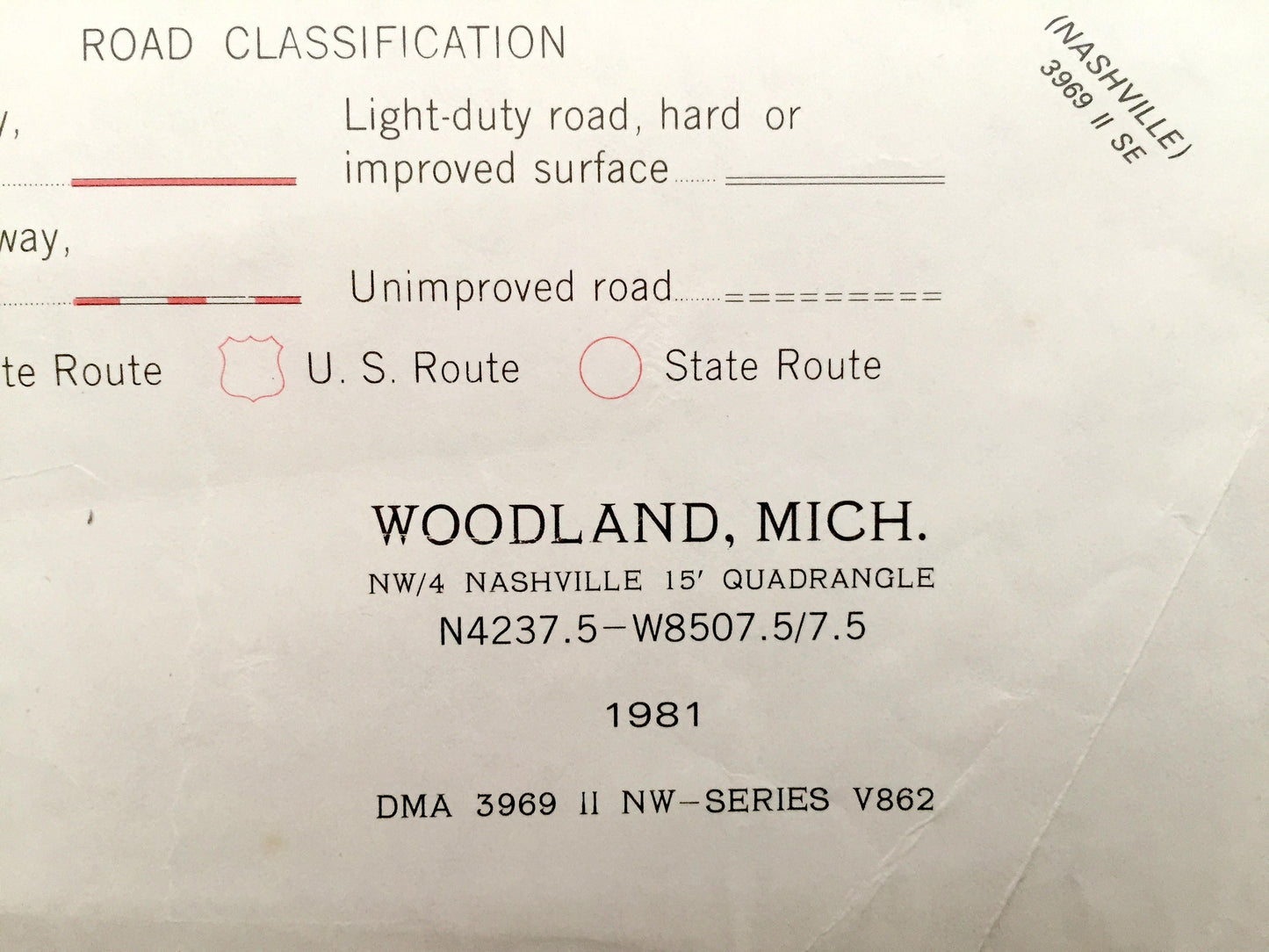
Beautiful, antique map of Woodland, Thornapple Lake, Carlton, Coats Grove and Hastings, Michigan. This is an authentic 1981 print from the U.S. Geological Survey and NOT a computer reproduction.
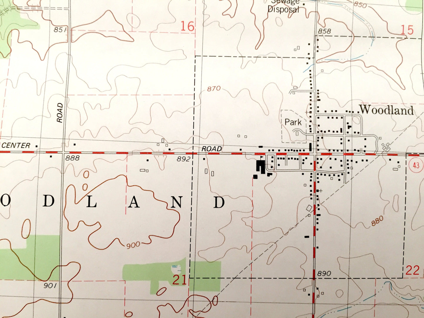
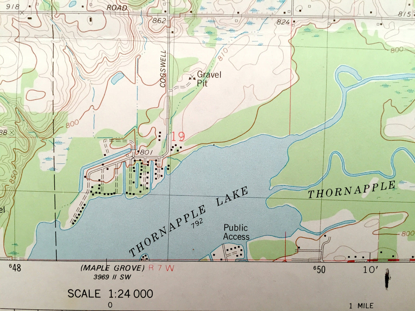
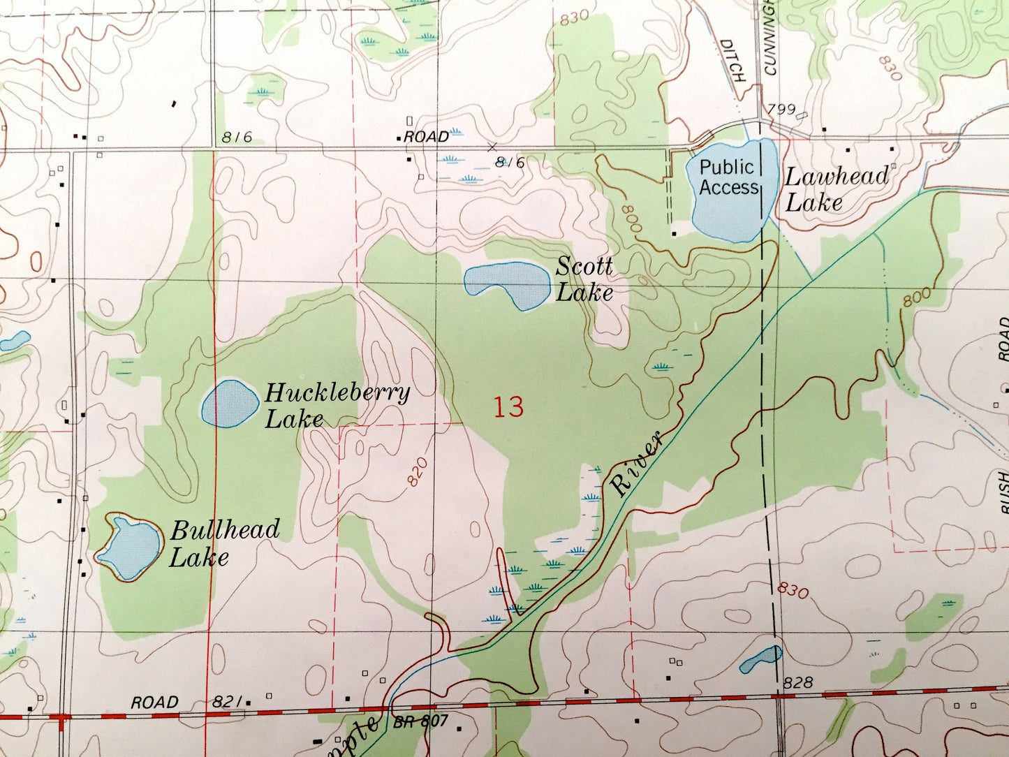
See what Barry County looked like over 40 years ago. Lots of intricate details and geological contours. Map even has little squares for every house that existed at the time. The USGS cartographers were very thorough back then!
Perfect for the historian, map-lover, the curious or just as a conversation starter. Wonderful and rare. Vintage maps such as this make great gifts.
Edition of 1981, printed 1981
Dimensions: 22" width x 27" height
----
Features
Cities & Towns: Castleton, Hastings, Woodland, Carlton, Coats Grove.
Points of Interest: Stony Point Church, Thornapple Lake, Lower Lake, Pumpkin Seed Lake, Wood Grove Church, old abandoned railroad and many more lakes, roads, towns and rivers.
Condition: Very Good Vintage condition, commensurate with age. This map is in great shape for being over 40 years old.
----
We will happily adjust shipping price for multiple purchases. Maps are rolled up and shipped in sturdy mailing tubes, never folded.
Couldn't load pickup availability
Share