My Store
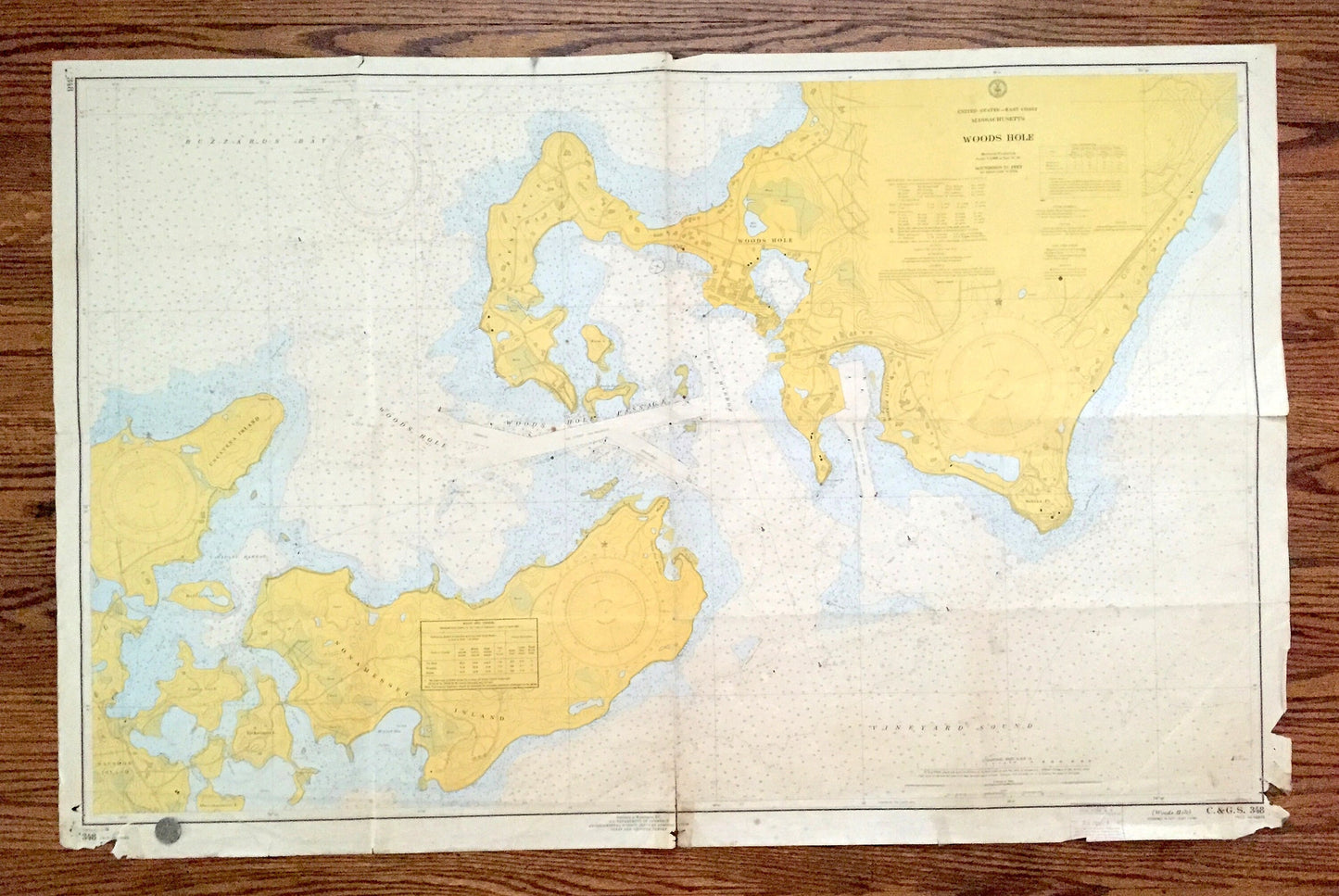
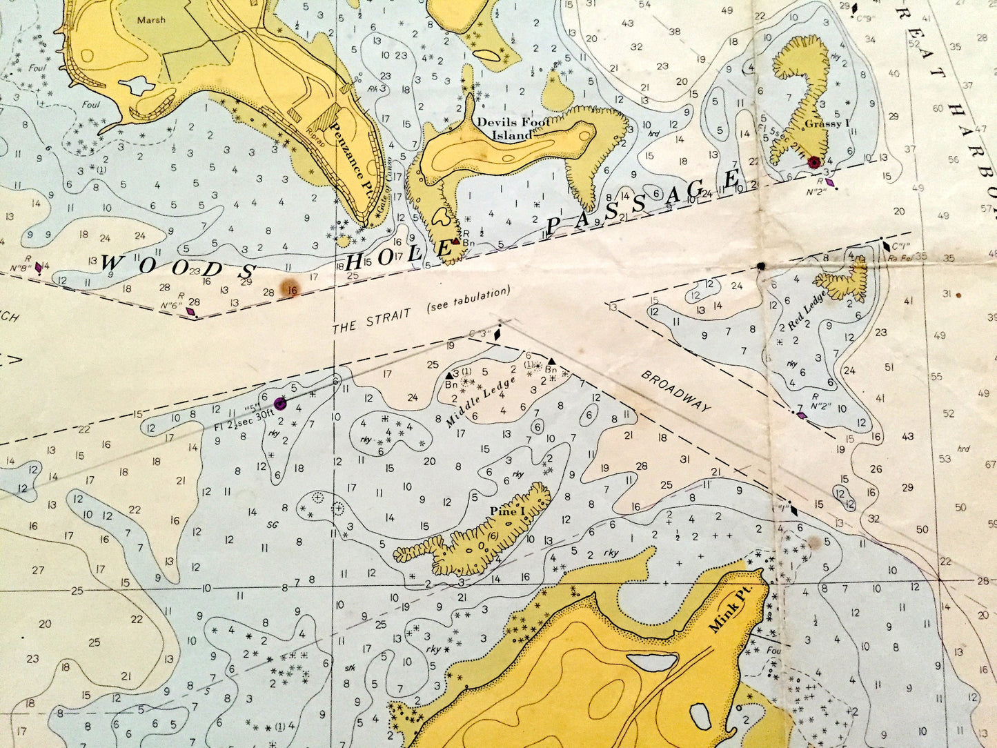
Antique Woods Hole, Massachusetts 1966 US Coast Guard Nautical Map – Falmouth, Cape Cod, Barnstable County, Nobska, Nonamesset Island, MA
Antique Woods Hole, Massachusetts 1966 US Coast Guard Nautical Map – Falmouth, Cape Cod, Barnstable County, Nobska, Nonamesset Island, MA
Beautiful, antique nautical chart of Woods Hole, Massachusetts and surrounding Barnstable County. This is an authentic map from the United States Coast Guard & Geodetic Survey, published in 1966 and is NOT a computer reproduction. Verso is blank.
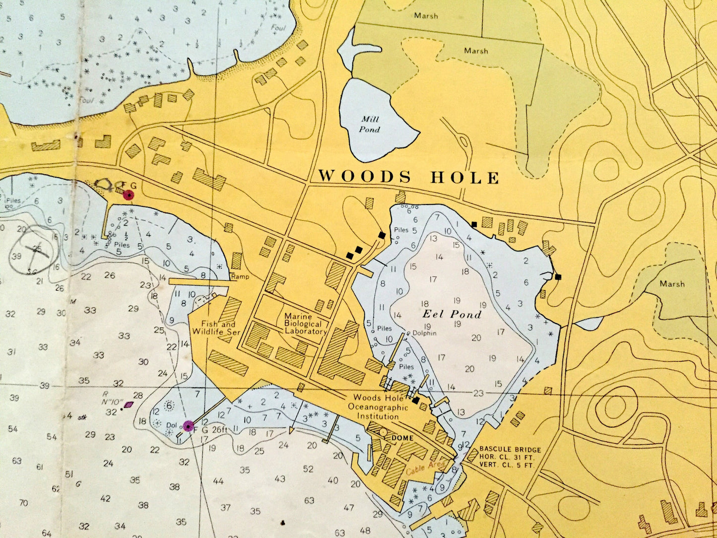
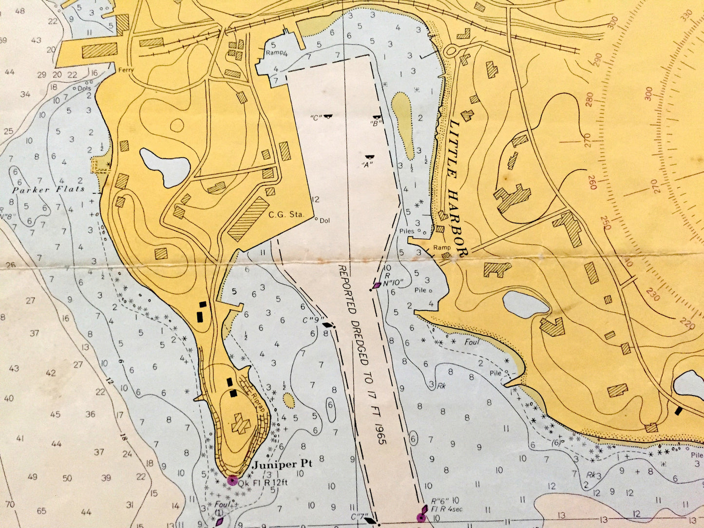
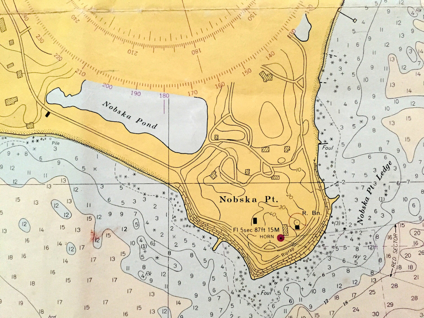
See what Massachusetts looked like more than 55 years ago. Lots of charming, intricate details and contours, including depth soundings, cities, streets, rivers, anchorages, magnetic anomaly areas and other points of nautical interest. Map is large and would be the focal point of wherever it is hung. (See coin in bottom left corner of first picture to get an idea of scale.)
Perfect for the historian, seaman, map-lover, the curious or just as a conversation starter. Wonderful and rare. Vintage maps such as these make great gifts.
Edition of 1966, printed 1966
Dimensions: 45 1/2" width x 29 1/2" height
----
Condition: Good or "Very Vintage" condition, commensurate with age. This map is in great shape for being over 55 years old. Has some obvious wear, stains, tape repair, toning, pin holes in corners, separations, as well as folds as-issued, but these will flatten easily and all will read as vintage character when framed. It looks like this map has seen many sea voyages!
----
We will happily adjust shipping price for multiple purchases. Maps are rolled up and shipped in sturdy mailing tubes, never folded.
Couldn't load pickup availability
Share