My Store
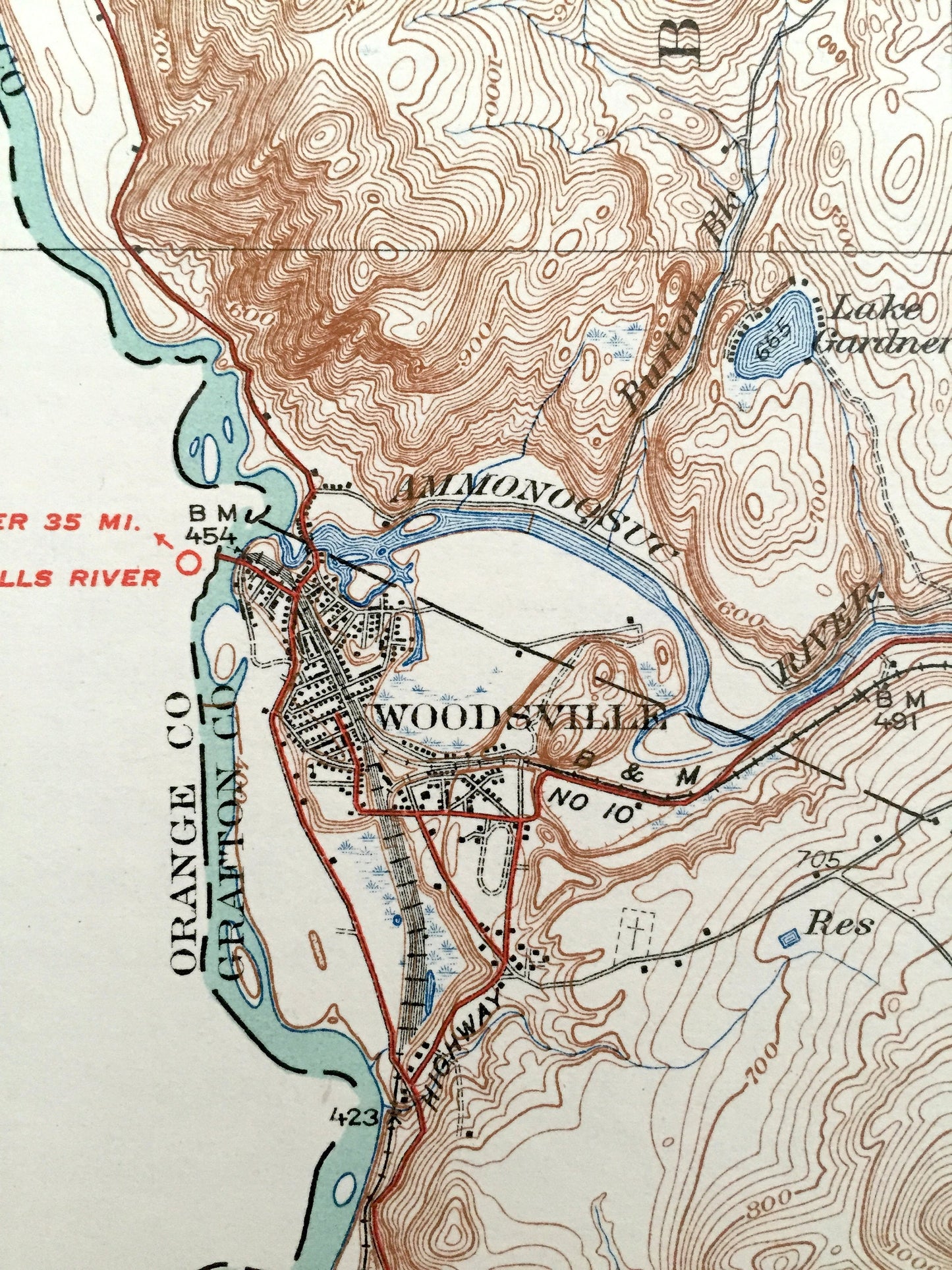
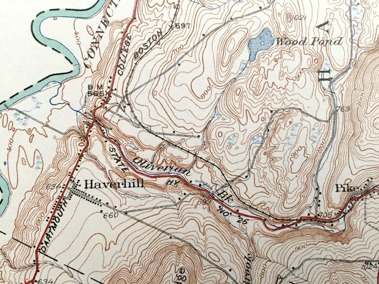
Antique Woodsville, New Hampshire 1935 US Geological Survey Topographic Map – Grafton County, Bath, Haverhill, Piermont, Monroe, Lyman, NH
Antique Woodsville, New Hampshire 1935 US Geological Survey Topographic Map – Grafton County, Bath, Haverhill, Piermont, Monroe, Lyman, NH
Beautiful, antique map of Woodsville, Piermont, Haverhill, North Haverhill, Bath and Monroe, New Hampshire. This is an authentic 1935 print from the U.S. Geological Survey and NOT a computer reproduction.
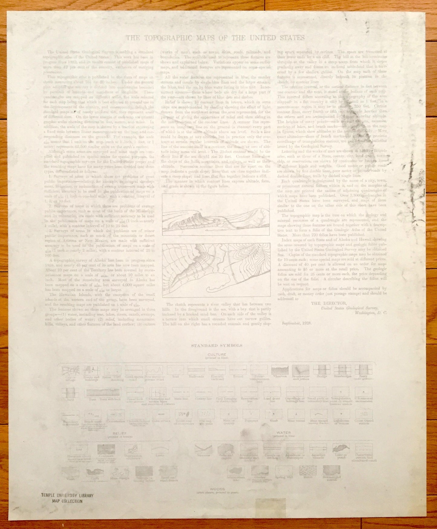
See what Grafton Countiy of New Hampshire looked like over 85 years ago. Lots of intricate details and geological contours. Map even has little squares for every house that existed at the time. The USGS cartographers were very thorough back then! On the back is a description of topographic symbols and map guide.
Perfect for the historian, map-lover, the curious or just as a conversation starter. Wonderful and rare. Vintage maps such as these make great gifts.
Edition of 1935, printed 1935
Dimensions: 16 1/2" width x 20" height
----
Features
Cities & Towns: Lyman, Monroe, Bath, Woodsville, North Haverhill, Haverhill, Piermont, Pike.
Points of Interest: Gardner Mountain, West Bath School, Carbee School, Connecticut River, Ammonousuc River, County Poor Farm, Horse Meadow, Blackmount Station, Black Hill, Wood Pond, Boston & Maine Railroad, and lots more hills, mountains, streams, ponds, houses, and roads.
Condition: Very Good Vintage condition, commensurate with age. This map is in incredible shape for being over 85 years old.
----
We will happily adjust shipping price for multiple purchases. Maps are rolled up and shipped in sturdy mailing tubes, never folded.
Couldn't load pickup availability
Share