My Store
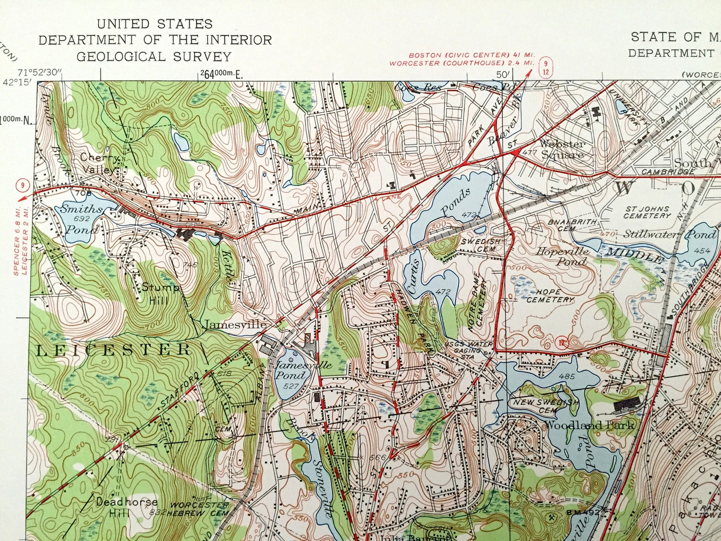
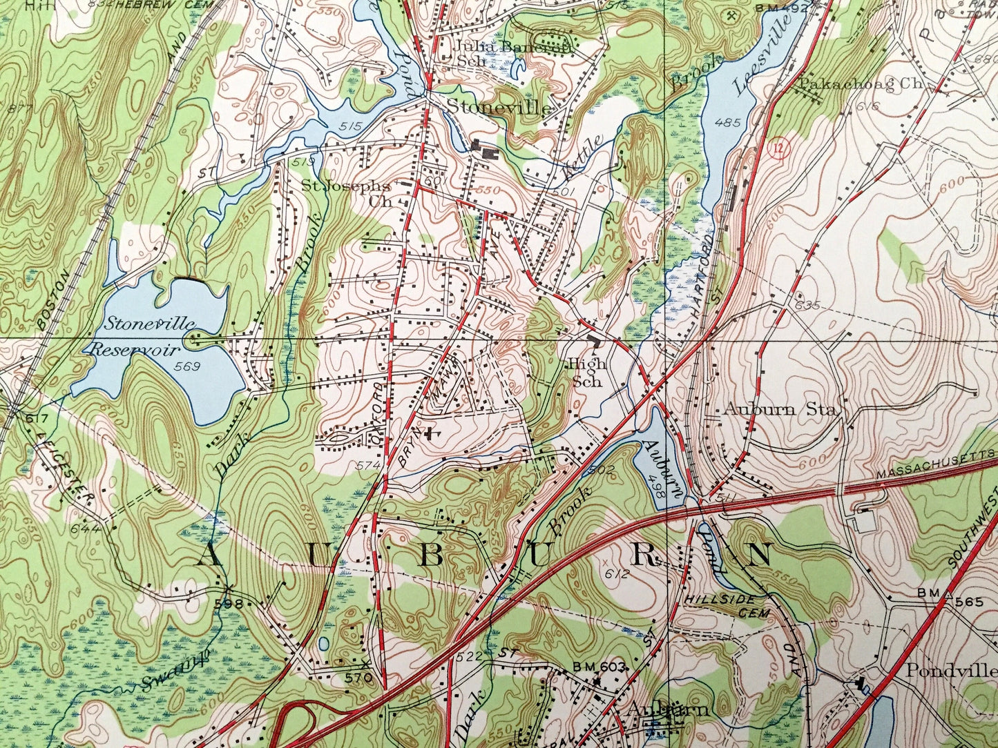
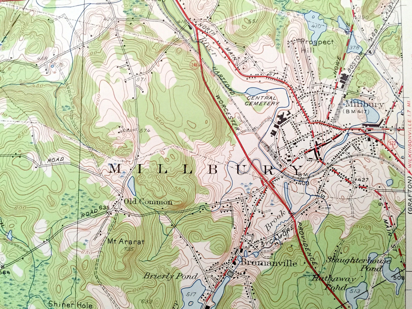
Antique Worcester South, Massachusetts 1948 US Geological Survey Topographic Map – Leichester, Auburn, Millbury, Oxford, Jamesville, MA
Antique Worcester South, Massachusetts 1948 US Geological Survey Topographic Map – Leichester, Auburn, Millbury, Oxford, Jamesville, MA
Beautiful, antique map of Worcester South, Massachusetts and surrounding Worcester County area. This is an authentic 1948 edition, 1959 print from the U.S. Geological Survey and NOT a computer reproduction.
See what Massachusetts looked like over 70 years ago. Lots of intricate details and geological contours. Map even has little squares for every house that existed at the time. The USGS cartographers were very thorough back then!
Perfect for the historian, map-lover, the curious or just as a conversation starter. Wonderful and rare. Vintage maps such as these make great gifts.
Edition of 1948, printed 1959
Dimensions: 22" width x 27" height
----
Cities & Towns: Leichester, Auburn, Millbury, Oxford, Jamesville, Sutton, Stoneville, Webster Square, Woodland Park, Quinsigamond, Dorothy Manor, West Auburn, Pondville, West Millbury, Bramanville, North Oxford, Old Common.
Points of Interest: Holy Cross College, Auburn Airport, Windless Airport, Greenwood Park, Pakachoag Hill, Crompton Park, Park Hill, Mt Ararat, Federal Hill, Grass Hill, Gaskill Field, Deadhorse Hill, Curtis Ponds, Eddy Pond, Ramshorn Pond, Singletary Pond, Carbuncle Pond, Stumpy Pond, Smiths Pond, Middle River, Wellington Brook, Ramshorn Brook, and many more hills, streams, ponds, houses, schools, railroads, churches and roads.
Condition: Very Good Vintage condition, commensurate with age. This map is in great shape for being over 60 years old. Has some edge-wear and large areas of discoloration and staining on the back, all of which will read as character when framed.
----
We will happily adjust shipping price for multiple purchases. Maps are rolled up and shipped fully-insured in sturdy mailing tubes, never folded.
Couldn't load pickup availability
Share