My Store
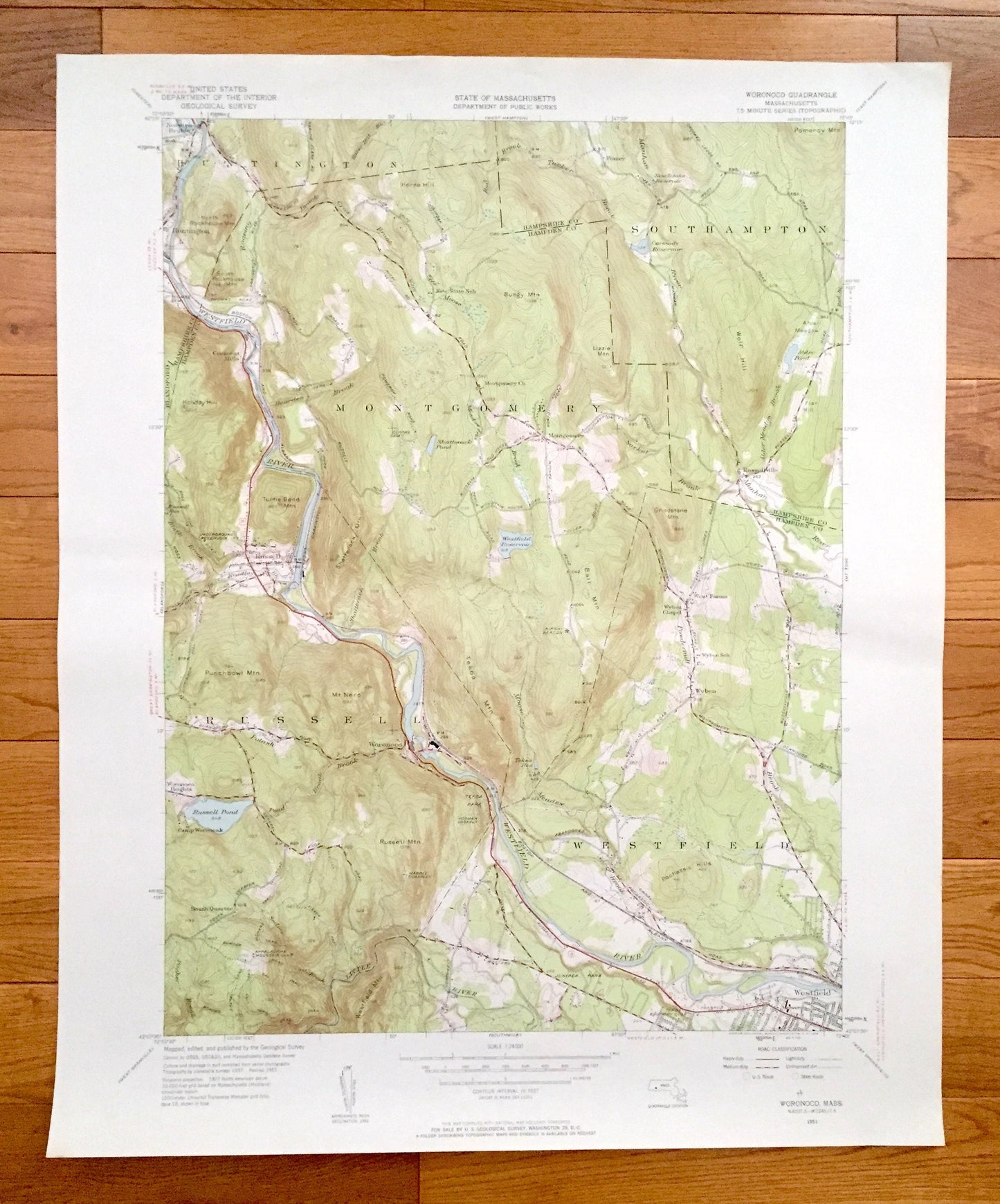
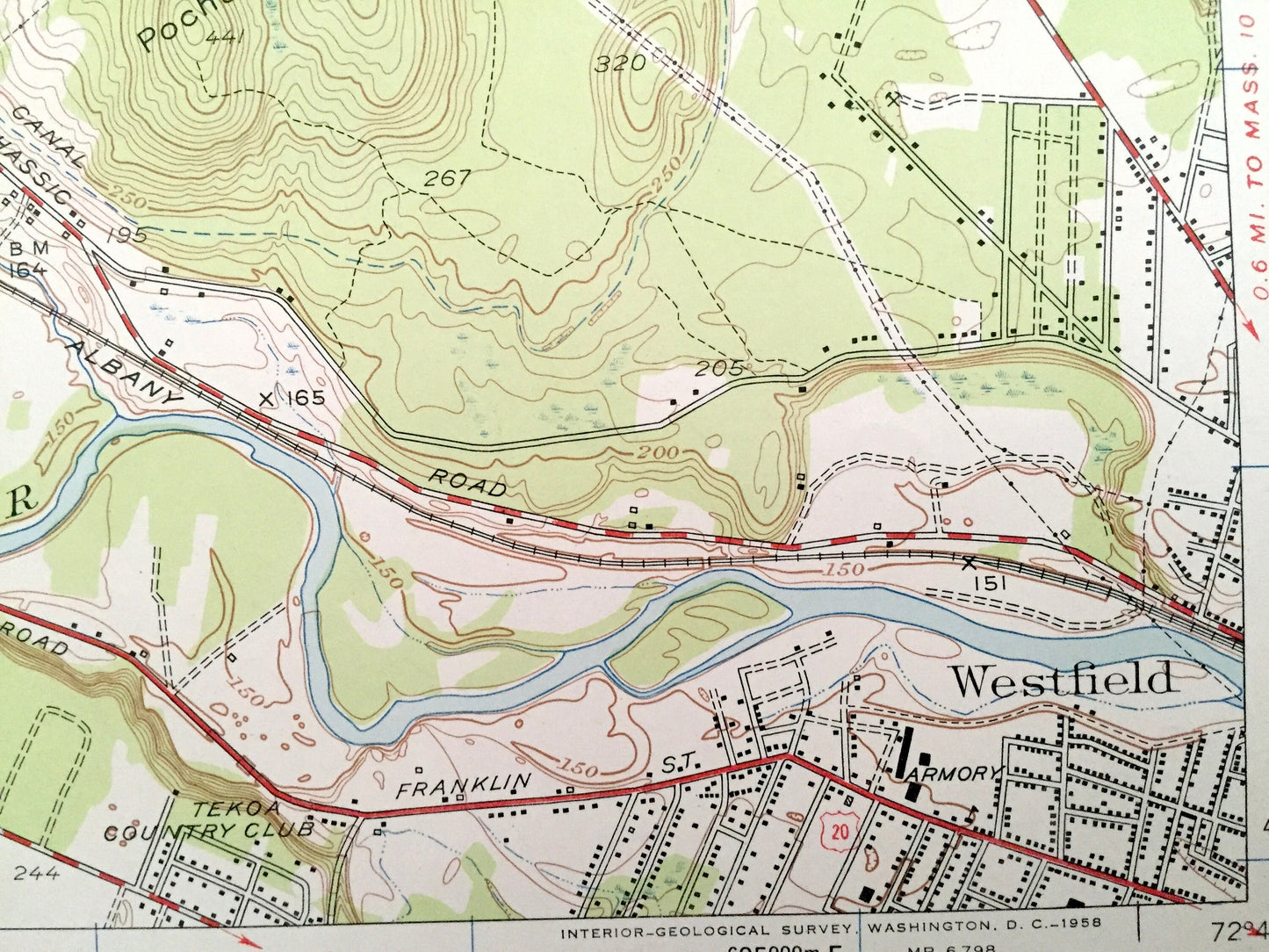
Antique Woronoco, Massachusetts 1951 US Geological Survey Topographic Map – Hampden County, Montgomery, Russell, Westfield, Huntington
Antique Woronoco, Massachusetts 1951 US Geological Survey Topographic Map – Hampden County, Montgomery, Russell, Westfield, Huntington
Beautiful, antique map of Woronoco, Massachusetts and surrounding Hampden County and Hampshire County areas. This is an authentic 1951 edition, 1958 print from the U.S. Geological Survey and NOT a computer reproduction.
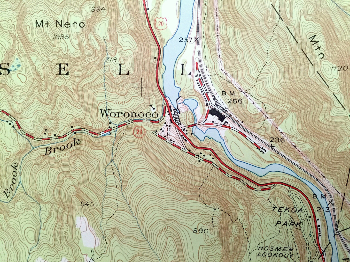
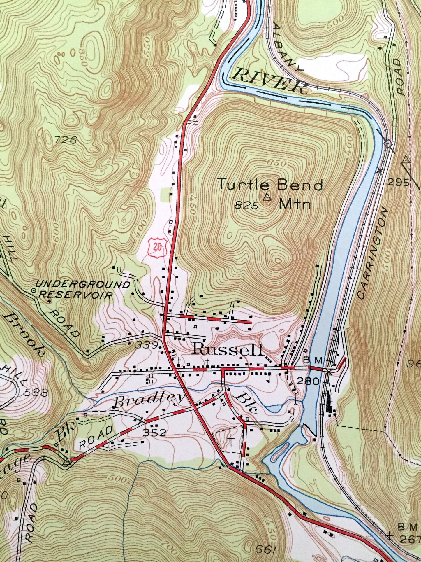
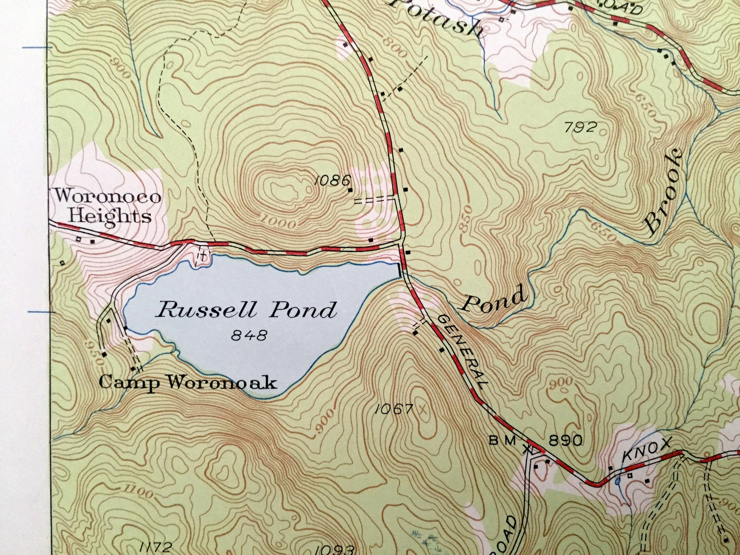
See what Massachusetts looked like over 65 years ago. Lots of intricate details and geological contours. Map even has little squares for every house that existed at the time. The USGS cartographers were very thorough back then!
Perfect for the historian, map-lover, the curious or just as a conversation starter. Wonderful and rare. Vintage maps such as these make great gifts.
Edition of 1951, printed 1958
Dimensions: 22" width x 27" height
----
Features
Cities & Towns: Woronoco, Norwich Bridge, Crescent Mills, Wyben, West Farms, Fomer, Southampton, Russellville, Montgomery, Russell, Westfield, Huntington.
Points of Interest: Hampden County, Hampshire County, Westfield River, Little River, Russell Pond, Alder Pond, Horse Hill, Wolf Hill, Pochassic Hills, Holiday Hill, Punchbowl Mountain, Russell Mountain, Bungy Mountains, Turtle Bend Mountain, Westfield Reservoir, Carmody Reservoir and lots more hills, mountains, streams, ponds, lakes, rivers, schools, churches, houses, and roads.
Condition: Very Good condition, commensurate with age. This map is in incredible shape for being 60 years old. Has some light edge-wear and some pencil markings, all of which will read as vintage character when framed.
----
We will happily adjust shipping price for multiple purchases. Maps are rolled up and shipped in sturdy mailing tubes, never folded.
Couldn't load pickup availability
Share