My Store
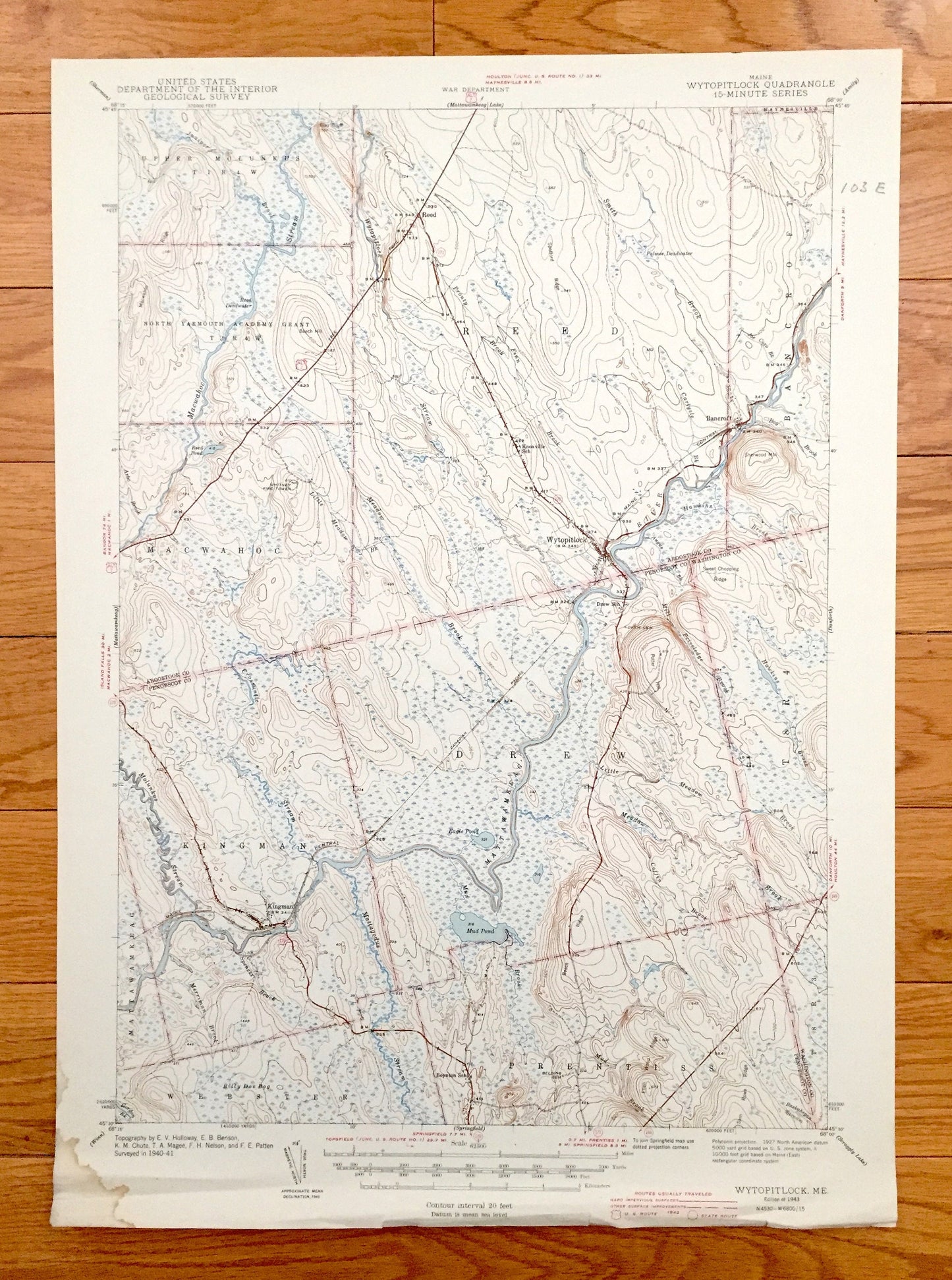
Antique Wytopitlock, Maine 1941 US Geological Survey Topographic Map – Kingman, Reed, Bancroft, Webster, Prentiss, Aroostook, Penobscot
Antique Wytopitlock, Maine 1941 US Geological Survey Topographic Map – Kingman, Reed, Bancroft, Webster, Prentiss, Aroostook, Penobscot
Beautiful, antique map of Wytopitlock, Maine and surrounding Aroostook, Penobscot & Washington Counties. This is an authentic 1943 edition, 1943 print from the U.S. Geological Survey and NOT a computer reproduction.
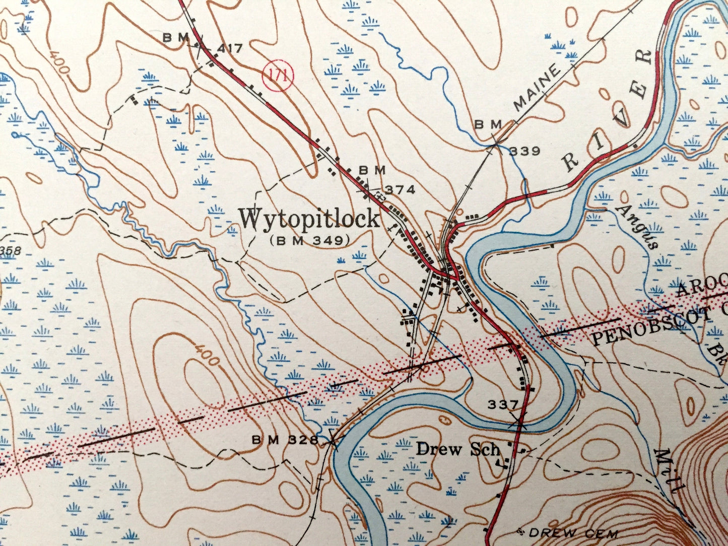
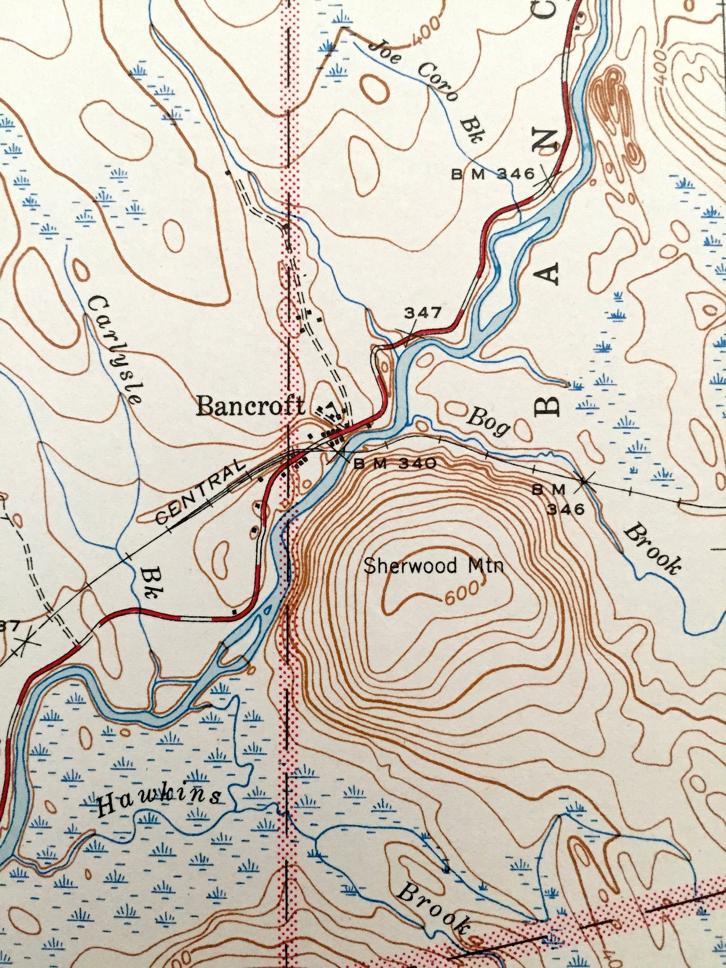
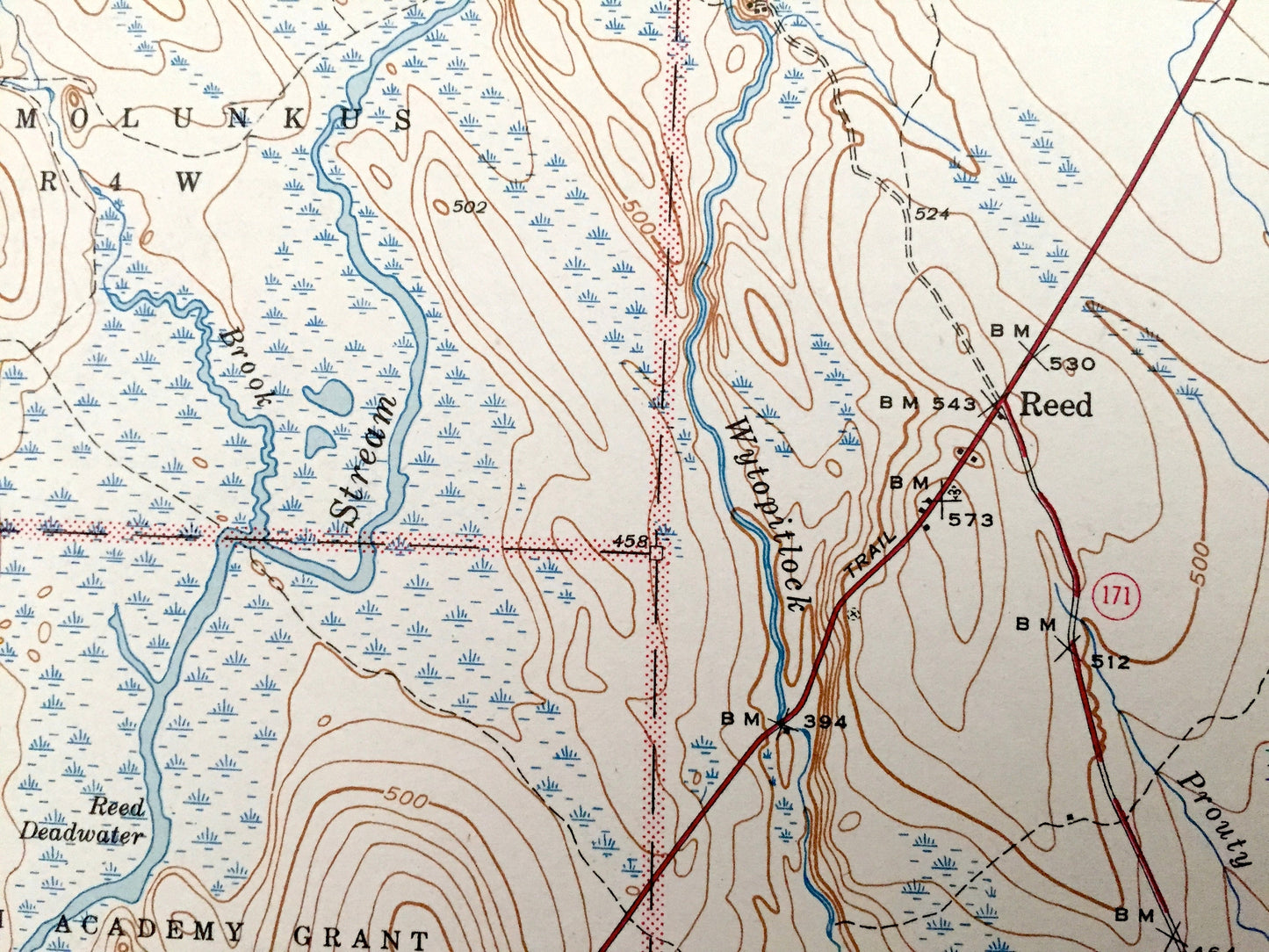
See what Wytopitlock, Kingman, Reed, Bancroft, Webster & Prentiss, Maine looked like 75 years ago. Lots of intricate details and geological contours. Map even has little squares for every house that existed at the time. The USGS cartographers were very thorough back then! On the back is a description of topographic symbols and map guide.
Perfect for the historian, map-lover, the curious or just as a conversation starter. Wonderful and rare. Vintage maps such as these make great gifts.
Edition of 1943, printed 1943
Dimensions: 14 1/2" width x 20" height
----
Features
Cities & Towns: Upper Molunkus, North Yarmouth Academy Grant, Macwahoc, Reed, Bancroft, Mattawamkeag, Kingman, Drew, Webster, Prentiss, Wytopitlock, Haynesville.
Points of Interest: Aroostook County, Penobscot County, Washington County, Mattawamkeag River, Macwahoc Stream, Sherwood Mountain, Sweet Chopping Ridge, Mud Pond, Molunkus Stream, Sam Rowe Ridge, Central Maine Railroad, and lots more hills, mountains, streams, ponds, houses, camps and roads.
Condition: Good Vintage condition, commensurate with age. This map is in great shape for being over 75 years old. Has some edge-wear and corner stain and pencil in margin, but this will add to vintage character when framed.
----
We will happily adjust shipping price for multiple purchases. Maps are rolled up and shipped in sturdy mailing tubes, never folded.
Couldn't load pickup availability
Share