My Store
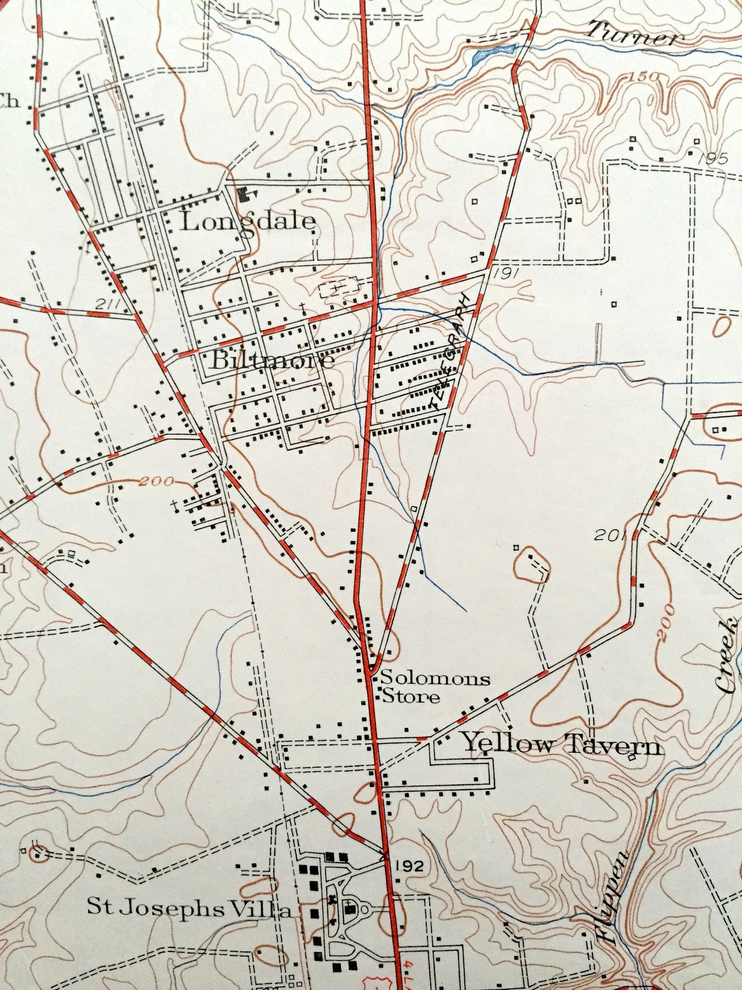
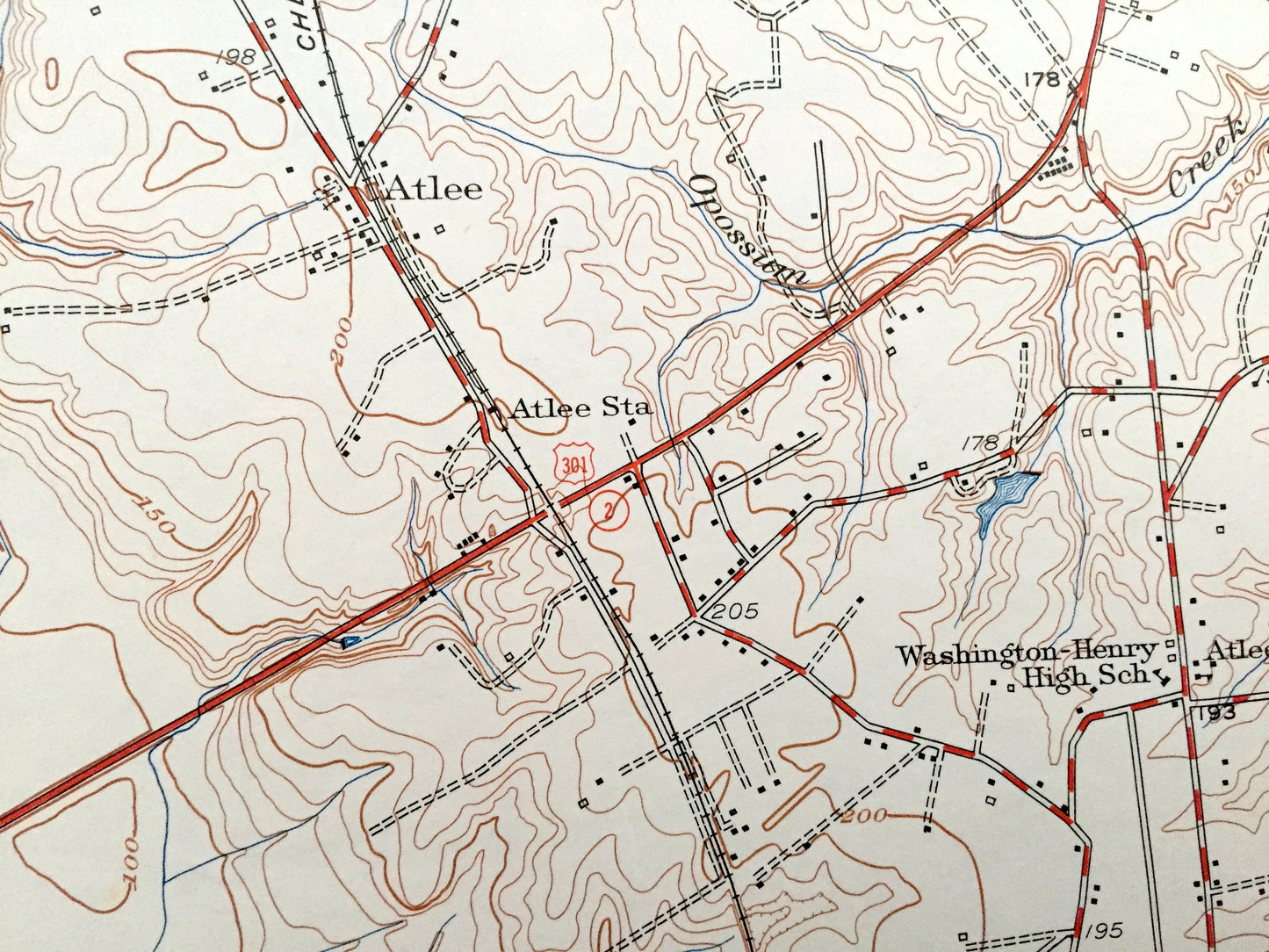
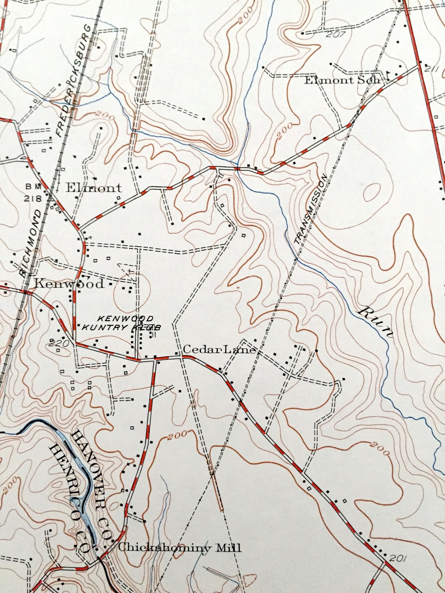
Antique Yellow Tavern, Virginia 1951 US Geological Survey Topographic Map –Henrico County, Longdale, Biltmore, Boudar, Greenwood, French Hay
Antique Yellow Tavern, Virginia 1951 US Geological Survey Topographic Map –Henrico County, Longdale, Biltmore, Boudar, Greenwood, French Hay
Beautiful, antique map of Yellow Tavern, Virginia and surrounding Henrico and Hanover County area. This is an authentic 1951 print from the U.S. Geological Survey and NOT a computer reproduction.
See what Virginia looked like almost 70 years ago. Lots of intricate details and geological contours. Map even has little squares for every house that existed at the time. The USGS cartographers were very thorough back then!
Perfect for the historian, map-lover, the curious or just as a conversation starter. Wonderful and rare. Vintage maps such as these make great gifts.
Edition of 1951, printed 1951
Dimensions: 22" width x 27" height
----
Features
Cities & Towns: Yellow Tavern, St Josephs Villa, Boudar, Biltmore, Longdale, Greenwood, Kenwood, Elmont, Ashland, Heaths Store, Lewistown, Jenkins Store, Ashcake, French Hay, Atlee, Henry Clay Heights, Chamberlayne Heights.
Points of Interest: Chickahominy River, Richmond Fredericksburg & Potomac Railroad, Totopotomoy Creek, Campbell Creek, Henry Clay Birthplace, Chesapeake & Ohio Railway, Sliding Hill, and many more hills, streams, ponds, houses, schools, churches and roads.
Condition: Very Good condition, commensurate with age. This map is in incredible shape for being almost 70 years old. Has some light-edge wear, but this will read as vintage character when framed.
----
We will happily adjust shipping price for multiple purchases. Maps are rolled up and shipped in sturdy mailing tubes, never folded.
Couldn't load pickup availability
Share