My Store
Antique Yonkers, New York 1956 US Geological Survey Topographic Map – Westchester, Bronx County, Bergen County, Bronx, Upstate, New Jersey
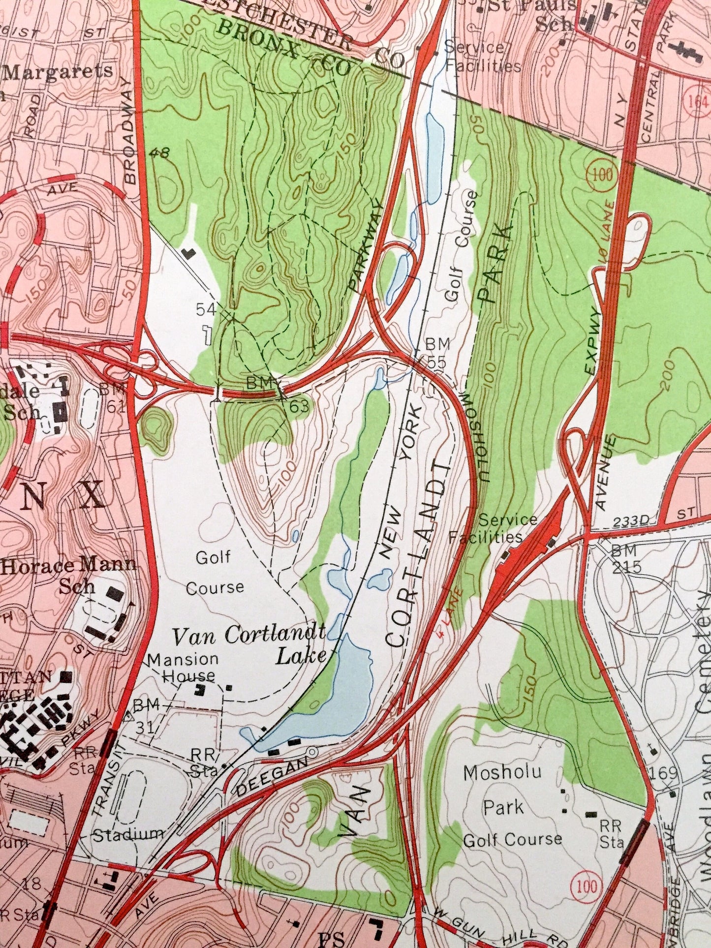
Antique Yonkers, New York 1956 US Geological Survey Topographic Map – Westchester, Bronx County, Bergen County, Bronx, Upstate, New Jersey
Beautiful, antique map of Yonkers, New York - New Jersey and surrounding Bronx County, Westchester County, New York County, Rockland County NY and Bergen County, NJ areas. This is an authentic 1956 edition, 1956 print from the U.S. Geological Survey and NOT a computer reproduction.
See what New York and New Jersey looked like over 60 years ago. Lots of intricate details and geological contours. Map even has little squares for every house that existed at the time. The USGS cartographers were very thorough back then!
Perfect for the historian, map-lover, the curious or just as a conversation starter. Wonderful and rare. Vintage maps such as these make great gifts.
Edition of 1956, printed 1956
Dimensions: 22" width x 27" height
----
Features
Cities & Towns: New York - Yonkers, Bronx, Greenburgh, Manhattan, Riverdale, Lincoln, Lowerre, Park Hill, Ludlow, Glenwood, King Bridge, Spuyten Duyvil, Orangetown, Hastings on Hudson.
New Jersey - Englewood, Englewood Cliffs, Tenafly, Bergenfield, Cresskill, Alpine, Demarest, Dumont, Haworth, Emerson, Closter, Norwood, Northvale, River Vale, Harrington Park, Old Tapan, Rockleigh.
Points of Interest: New York - Bronx County, Westchester County, New York County, Rockland County, Hudson River, Van Cortlandt Park, Tibbetts Brook Park, Manhattan College, Van Cortlandt Lake, Williamsbridge Playground, Jerome Park Reservoir and many more hills, streams, ponds, houses, schools, churches and roads.
New Jersey - Bergen County, Hudson River, Hackensack River, Palisades Interstate Park, Forest View Forest, Huyler Landing, Oradell Reservoir, Dwars Kill, Tenakill Brook and many more hills, streams, ponds, houses, schools, churches and roads.
Condition: Very Good condition, commensurate with age. This map is in incredible shape for being over 60 years old. Has some light edge-wear, all of which will read as vintage character when framed.
----
We will happily adjust shipping price for multiple purchases. Maps are rolled up and shipped in sturdy mailing tubes, never folded.
Couldn't load pickup availability
Share